MyTopo
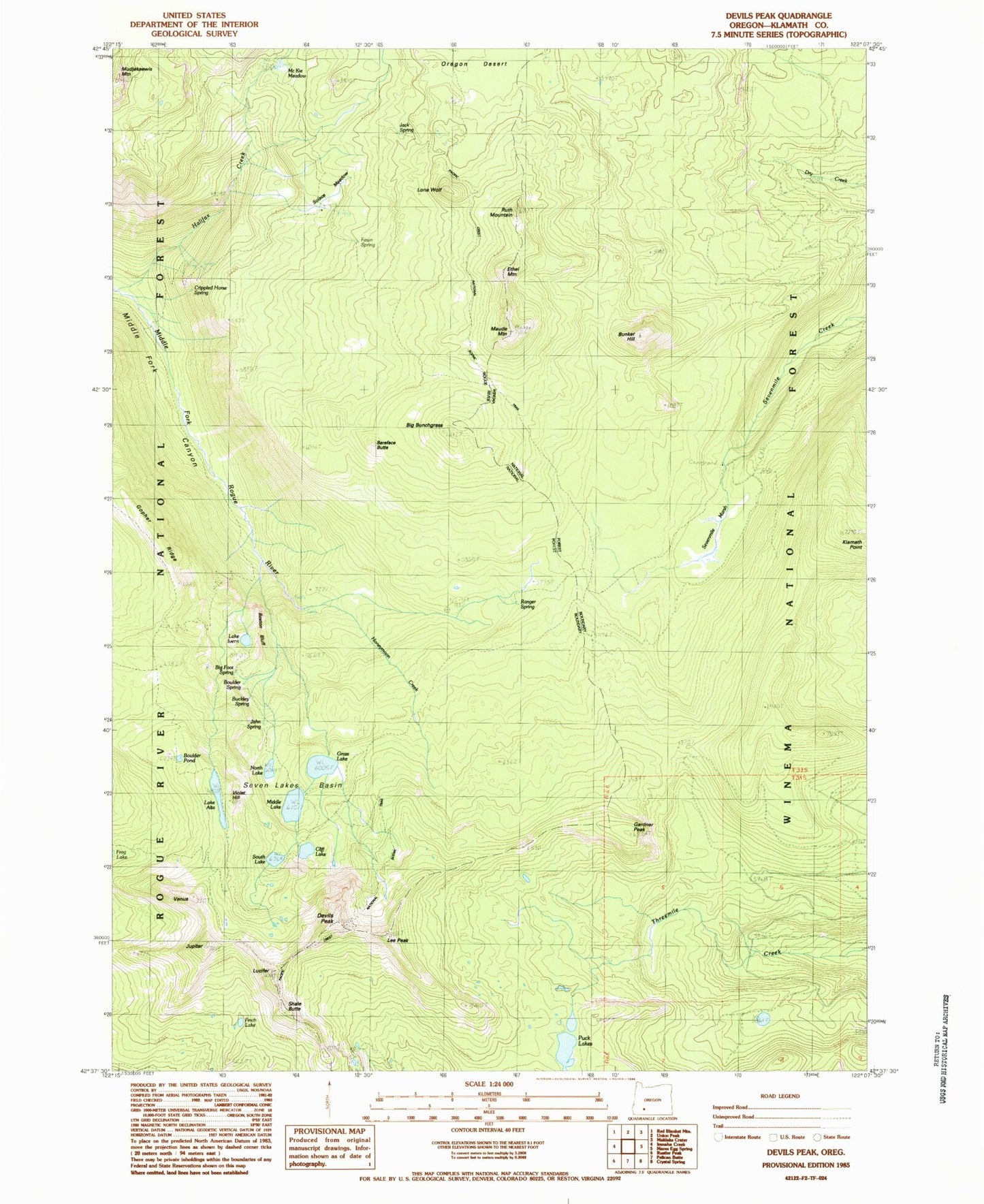
Classic USGS Devils Peak Oregon 7.5'x7.5' Topo Map
Couldn't load pickup availability
Historical USGS topographic quad map of Devils Peak in the state of Oregon. Typical map scale is 1:24,000, but may vary for certain years, if available. Print size: 24" x 27"
This quadrangle is in the following counties: Klamath.
The map contains contour lines, roads, rivers, towns, and lakes. Printed on high-quality waterproof paper with UV fade-resistant inks, and shipped rolled.
Contains the following named places: Alta Lake Trail, Lake Alta, Bareface Butte, Big Bunchgrass, Boston Bluff, Boulder Pond, Bunker Hill, Cliff Lake, Devils Peak, Dry Creek Trail, Ethel Mountain, Finch Lake, Gardner Peak, Gopher Ridge, Grass Lake, Halifax Trail, Honeymoon Creek, Lake Ivern, Jupiter, Lee Peak, Lone Wolf, Lucifer, Maude Mountain, McKie Camp, Middle Lake, Moude Mountain Trail, North Lake, Oregon Desert, Puck Lakes, Ranger Spring, Ruth Mountain, Seven Lakes Basin, Sevenmile Marsh, Shale Butte, Solace Camp, South Lake, Venus, Violet Hill, Sevenmile Marsh Campground, Crippled Horse Spring, Sevenmile Marsh Trailhead, Sevenmile Trail, Snow Lakes, South Lake Campground (historical), Cliff Lake Campground (historical), Grass Lake Campground (historical), Grass Lake Campground Number 2 (historical), Alta Campground (historical)