
MyTopo
Classic USGS Devils Teeth Rapids Idaho 7.5'x7.5' Topo Map
Couldn't load pickup availability
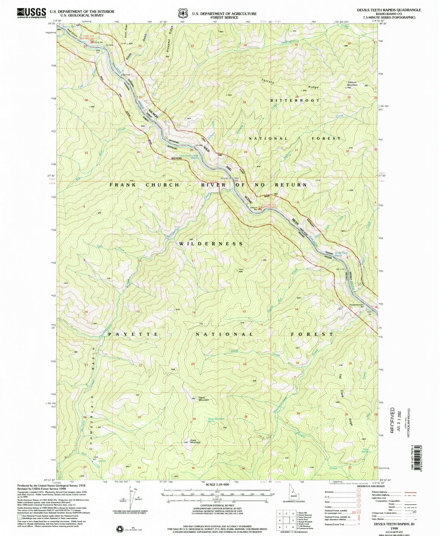
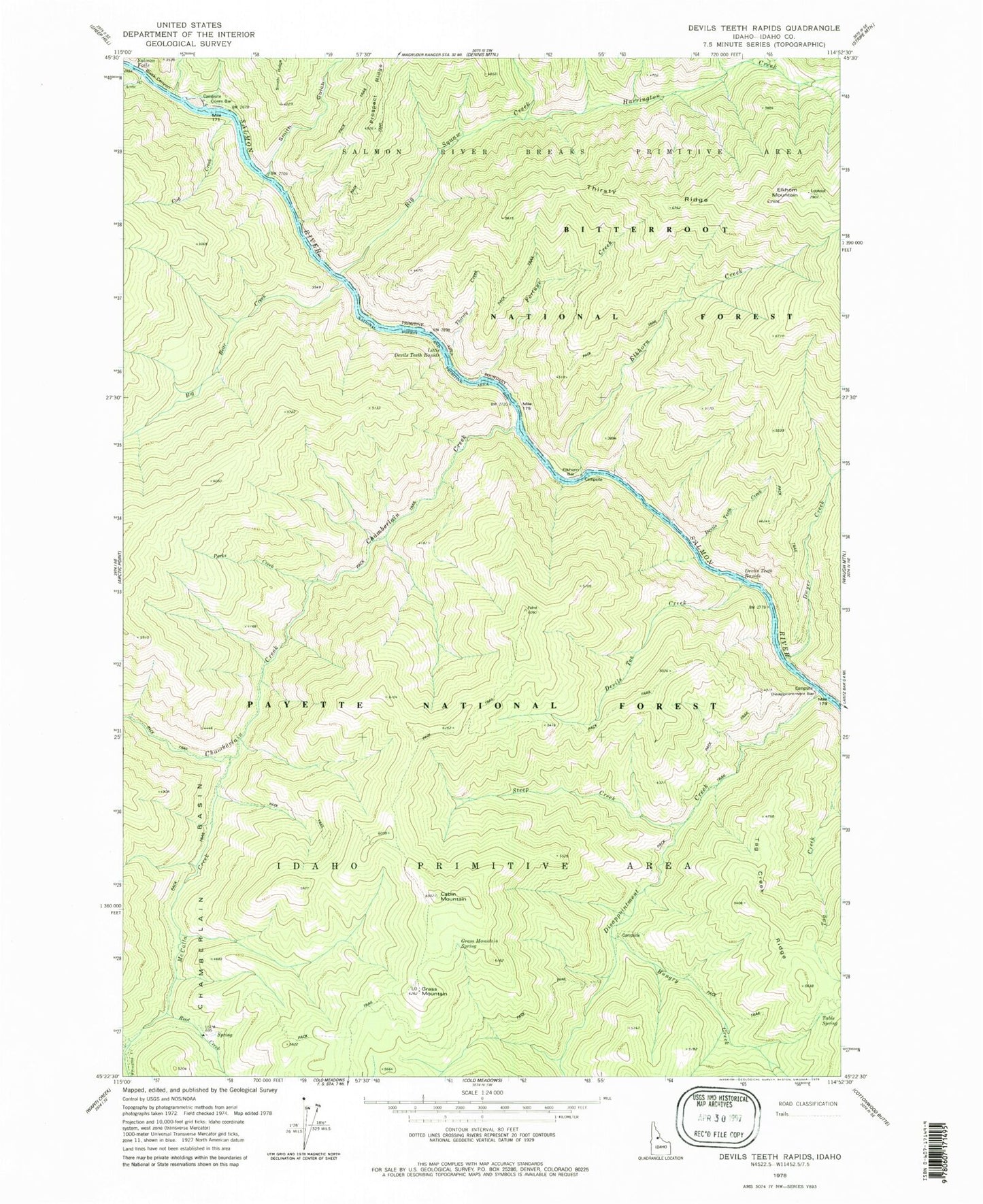
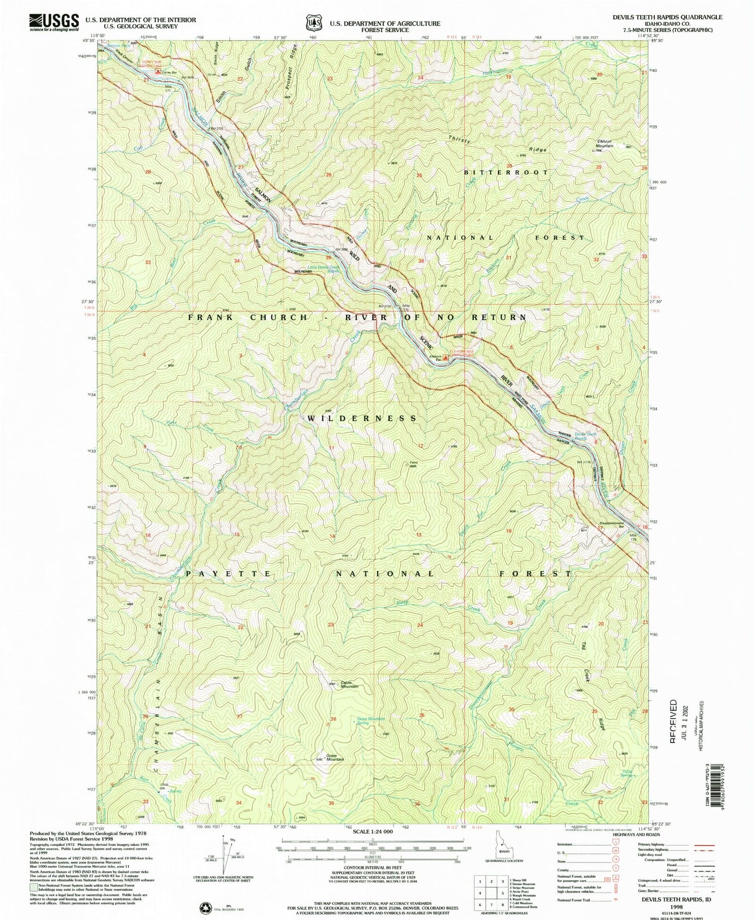
Historical USGS topographic quad map of Devils Teeth Rapids in the state of Idaho. Typical map scale is 1:24,000, but may vary for certain years, if available. Print size: 24" x 27"
This quadrangle is in the following counties: Idaho.
The map contains contour lines, roads, rivers, towns, and lakes. Printed on high-quality waterproof paper with UV fade-resistant inks, and shipped rolled.
Contains the following named places: Arctic Creek, Big Bear Creek, Big Squaw Creek, Cabin Mountain, Chamberlain Creek, Corey Bar, Cub Creek, Devils Teeth Creek, Devils Teeth Rapids, Devils Toe Creek, Disappointment Bar, Disappointment Creek, Dwyer Creek, Elkhorn Bar, Elkhorn Creek, Fortune Creek, Grass Mountain, Grass Mountain Spring, Harrington Creek, Hungry Creek, Little Devils Teeth Rapids, McCalla Creek, Parks Creek, Patrol Point, Root Creek, Salmon Falls, Smith Gulch, Steep Creek, Table Spring, Tag Creek Ridge, Thirst Creek, Whimstick Creek, Corey Bar Campground, Elkhorn Lookout, Elkhorn Bar Campground, Salmon Wild and Scenic River