MyTopo
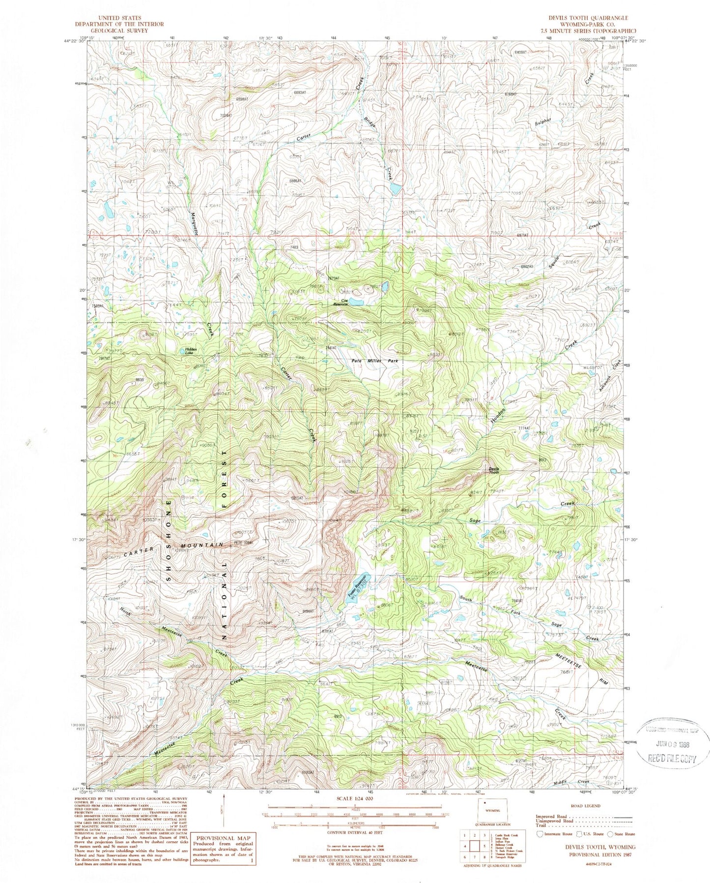
Classic USGS Devils Tooth Wyoming 7.5'x7.5' Topo Map
Couldn't load pickup availability
Historical USGS topographic quad map of Devils Tooth in the state of Wyoming. Map scale may vary for some years, but is generally around 1:24,000. Print size is approximately 24" x 27"
This quadrangle is in the following counties: Park.
The map contains contour lines, roads, rivers, towns, and lakes. Printed on high-quality waterproof paper with UV fade-resistant inks, and shipped rolled.
Contains the following named places: Bridge Creek, Coe Reservoir, Darrah Dam, Darrah Number 1 Dam, Darrah Number 1 Reservoir, Darrah Number 2 Dam, Darrah Number 2 Reservoir, Darrah Number 3 Reservoir, Devils Tooth, Eagle Lake, Eagle Lake Dam, Foster Number 3 Dam, Foster Number 3 Reservoir, Foster Reservoir, Grabbert Cabin, Hidden Lake, Nina Dam, Nina Reservoir, North Meeteetse Creek, Pete Miller Park, Shoshone Number 1 Dam, Shoshone Number 1 Reservoir, Shoshone Ranch, Sylvan Dam, Sylvan Reservoir