MyTopo
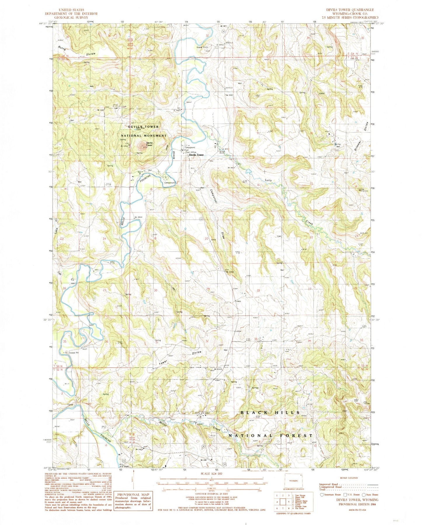
Classic USGS Devils Tower Wyoming 7.5'x7.5' Topo Map
Couldn't load pickup availability
Historical USGS topographic quad map of Devils Tower in the state of Wyoming. Typical map scale is 1:24,000, but may vary for certain years, if available. Print size: 24" x 27"
This quadrangle is in the following counties: Crook.
The map contains contour lines, roads, rivers, towns, and lakes. Printed on high-quality waterproof paper with UV fade-resistant inks, and shipped rolled.
Contains the following named places: Bitter Springs School, Brimmer School, Campstool Draw, Campstool Ranch, Campstool School, Left Creek, PIC Ranch, PIC School, Tower Divide, Tower Divide School, Butte Divide, Carlile Junction, Brimmer Divide, Lytle Creek, Miller Creek, Devils Tower, Claudie Dam, Claudie Reservoir, Devils Tower Post Office, Devils Tower, Belle Fourche River Number Two Mine, Nubeth Joint Venture Mine, Campstool Nine Mine, Campstool Eleven Mine, Devils Tower National Monument, Tower Divide Cemetery