MyTopo
Classic USGS Devine Ridge North Oregon 7.5'x7.5' Topo Map
Couldn't load pickup availability
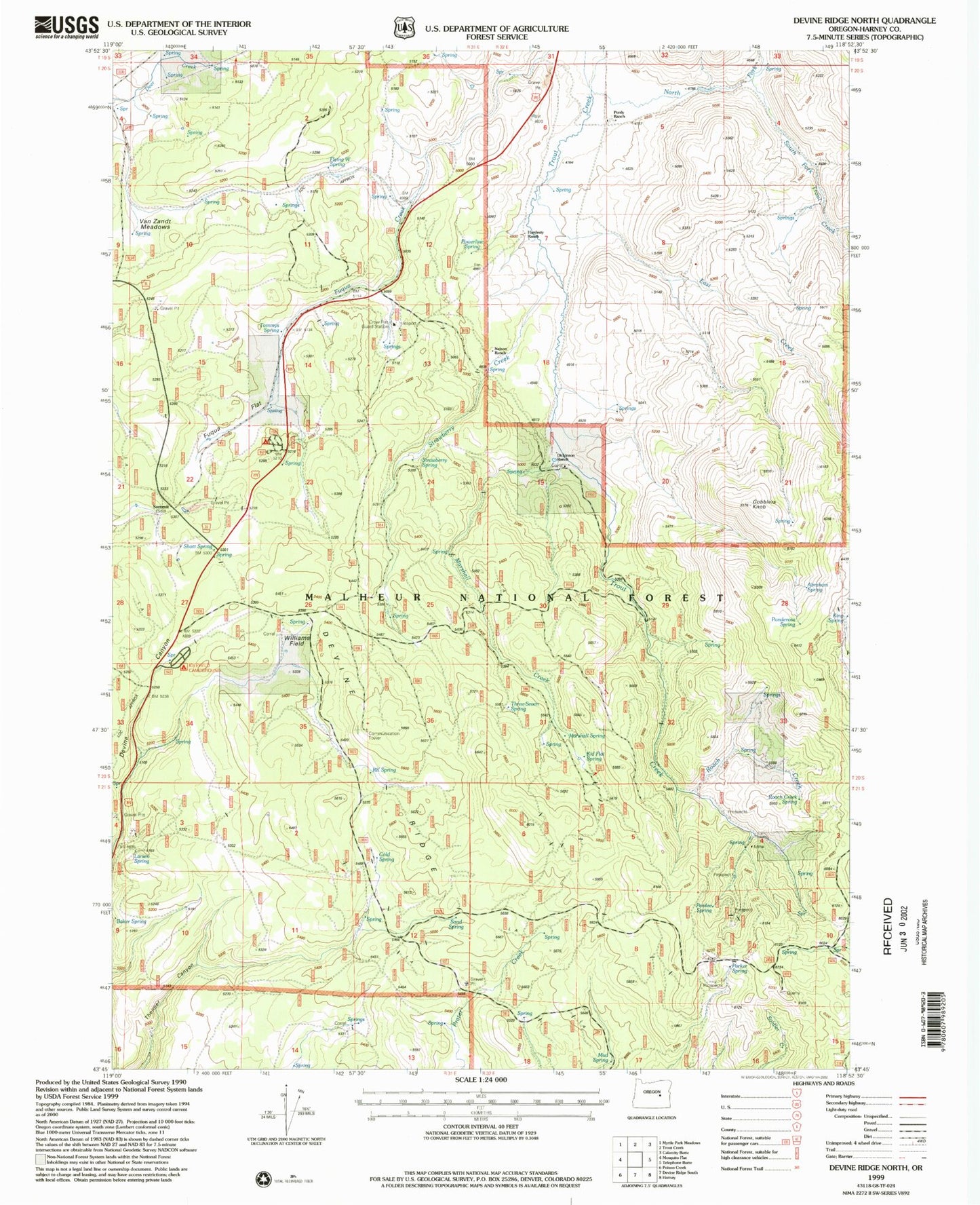
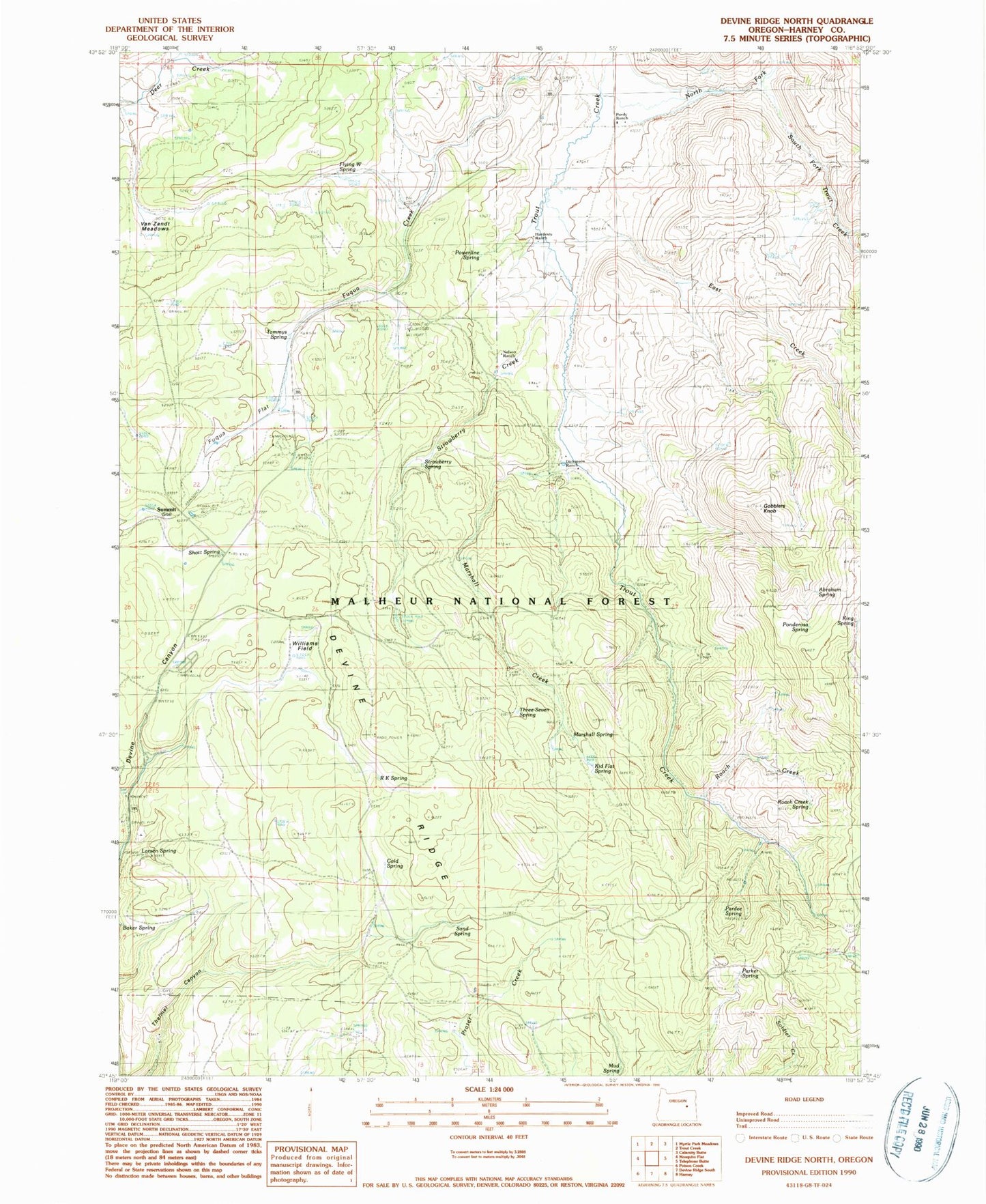
Historical USGS topographic quad map of Devine Ridge North in the state of Oregon. Map scale may vary for some years, but is generally around 1:24,000. Print size is approximately 24" x 27"
This quadrangle is in the following counties: Harney.
The map contains contour lines, roads, rivers, towns, and lakes. Printed on high-quality waterproof paper with UV fade-resistant inks, and shipped rolled.
Contains the following named places: Abraham Spring, Baker Corral, Boy Scout Cabin, Cold Spring, Cross Ranch, Crow Flat, Crow Flat Guard Station, Devine Ridge, Dickenson Ranch, East Creek, Flying W Spring, Gobblers Knob, Hardesty Ranch, Hi Desert Ski Area, Idlewild Recreation Site, Idol City Mines, Idol Post Office, Kid Flat Spring, King Spring, Larsen Spring, Lonesomehurst Post Office, Marshall Creek, Marshall Spring, Mud Spring, Nelson Ranch, North Fork Trout Creek, Pardee Spring, Parker Spring, Ponderosa Spring, Powerline Spring, Purdy Ranch, R K Spring, RIL Spring, Roach Creek, Roach Creek Spring, Rock Spring, Sand Spring, Shott Spring, South Fork Trout Creek, Strawberry Creek, Strawberry Spring, Summit, Temple Ranch, Three-Seven Spring, Tommys Spring, Van Zandt Meadows, Williams Field