MyTopo
Classic USGS Devine Ridge South Oregon 7.5'x7.5' Topo Map
Regular price
$16.95
Regular price
Sale price
$16.95
Unit price
per
Couldn't load pickup availability
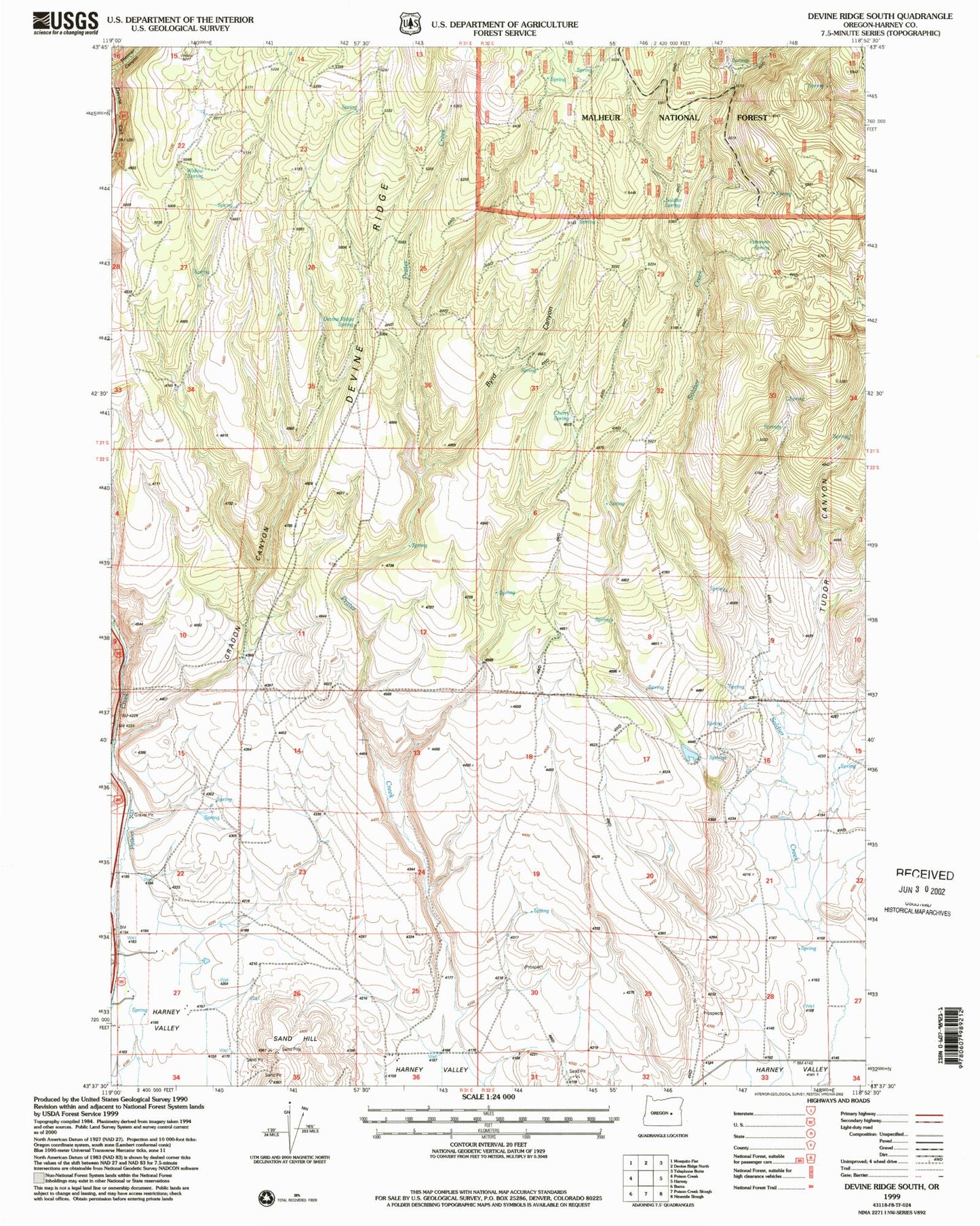
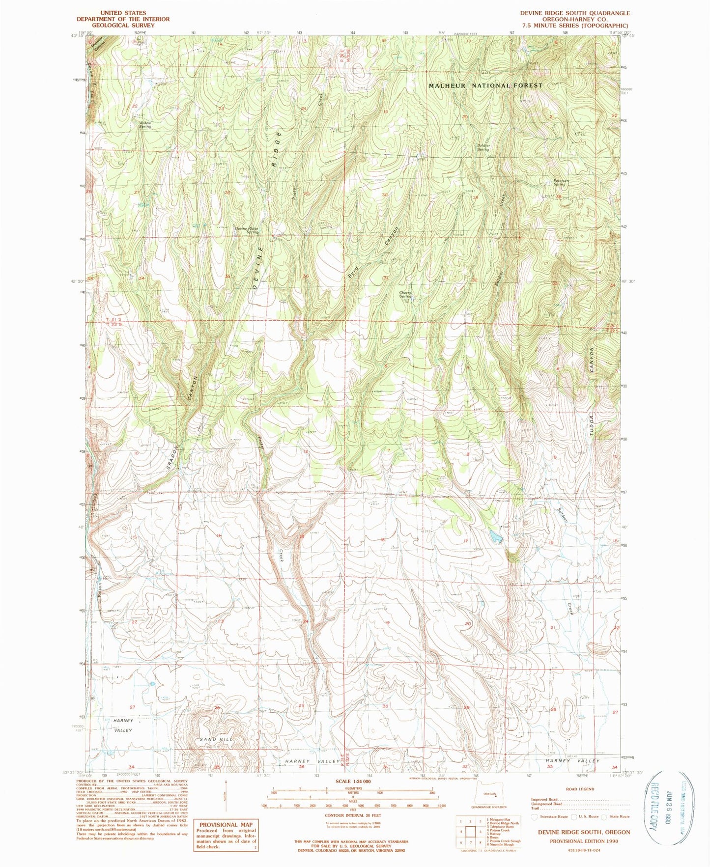
Historical USGS topographic quad map of Devine Ridge South in the state of Oregon. Map scale may vary for some years, but is generally around 1:24,000. Print size is approximately 24" x 27"
This quadrangle is in the following counties: Harney.
The map contains contour lines, roads, rivers, towns, and lakes. Printed on high-quality waterproof paper with UV fade-resistant inks, and shipped rolled.
Contains the following named places: Armstrong Canyon, Armstrong Canyon Reservoir, Byrd Canyon, Cherry Spring, Danforth Ditch, Devine Ridge Spring, Jameson Ranch, Old Graham Homestead, Petersen Spring, Pon Well, Sand Hill, Soldier Creek, Soldier Spring, Tudor Canyon, Uncle Tom Well, Widow Spring, Williams Ranch