MyTopo
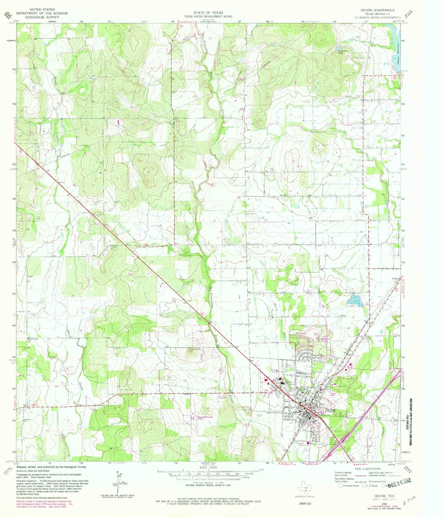
Classic USGS Devine Texas 7.5'x7.5' Topo Map
Couldn't load pickup availability
Historical USGS topographic quad map of Devine in the state of Texas. Map scale may vary for some years, but is generally around 1:24,000. Print size is approximately 24" x 27"
This quadrangle is in the following counties: Medina.
The map contains contour lines, roads, rivers, towns, and lakes. Printed on high-quality waterproof paper with UV fade-resistant inks, and shipped rolled.
Contains the following named places: Betania Baptist Mission Church, Bethel Assembly of God Church, Black Creek Church, Chacon Reservoir, Chicon Lake, Chicon Lake Dam, City of Devine, Colonial Oaks Park, Devine, Devine City Hall, Devine City Park, Devine Emergency Medical Service, Devine High School, Devine Intermediate School, Devine Middle School, Devine Municipal Airport, Devine Opera House, Devine Police Department, Devine Post Office, Devine Volunteer Fire Department, Devine-Natalia Division, Evergreen Cemetery, John J Ciavarra Elementary School, Jungman Lake, KTXX-FM (Devine), Medina County Constable's Office Precinct 4, Medina Lake State Fish Hatchery, Primitive Church, Roberson Cemetery, Rose Hill Church of Christ, Saint Josephs Cemetery, ZIP Code: 78016