MyTopo
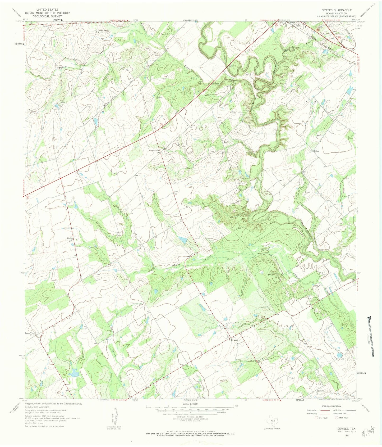
Classic USGS Dewees Texas 7.5'x7.5' Topo Map
Couldn't load pickup availability
Historical USGS topographic quad map of Dewees in the state of Texas. Map scale may vary for some years, but is generally around 1:24,000. Print size is approximately 24" x 27"
This quadrangle is in the following counties: Wilson.
The map contains contour lines, roads, rivers, towns, and lakes. Printed on high-quality waterproof paper with UV fade-resistant inks, and shipped rolled.
Contains the following named places: Camp Ranch, Circle P Ranch Airport, Connally Lake Dam 2, Connally Lake Dam Number 1, Connally Ranch, Darilek, Dewees, Dewees Ranch, Kilgore Lake, Kilgore Lake Dam, Loma Vista, Mariana Creek, Mission of Las Cabreras, Pajarito Creek, Picosa Creek, Ridout, Sacred Heart Cemetery, Seale Ranch Lake, Seale Ranch Lake Dam, Three Oaks Volunteer Fire Department, Wall Flying Service Airport, ZIP Code: 78114