
MyTopo
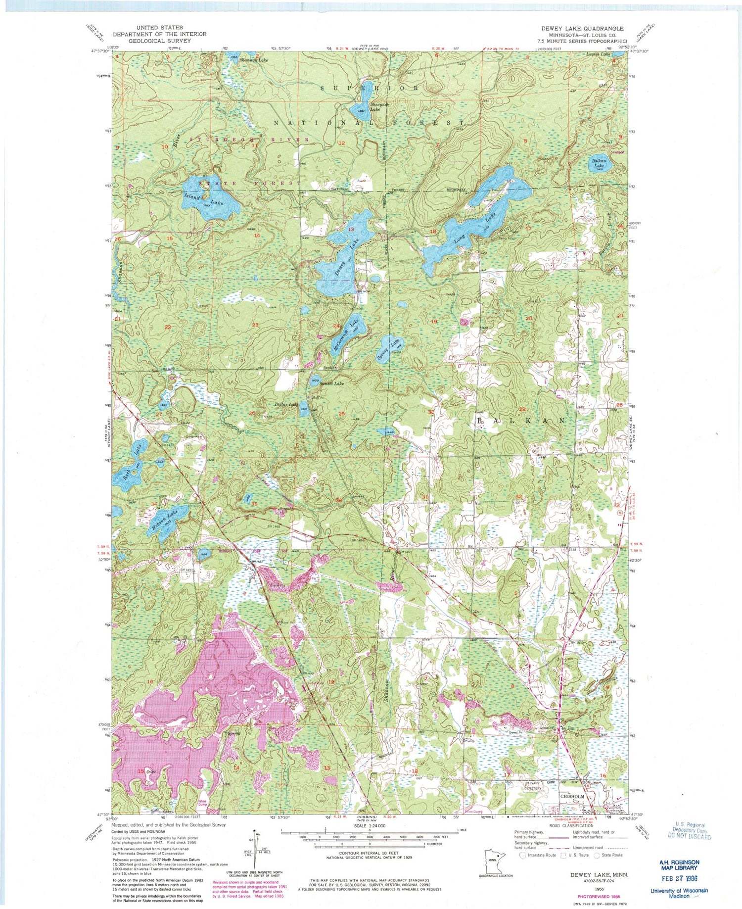
Classic USGS Dewey Lake Minnesota 7.5'x7.5' Topo Map
Couldn't load pickup availability
Historical USGS topographic quad map of Dewey Lake in the state of Minnesota. Map scale may vary for some years, but is generally around 1:24,000. Print size is approximately 24" x 27"
This quadrangle is in the following counties: St. Louis.
The map contains contour lines, roads, rivers, towns, and lakes. Printed on high-quality waterproof paper with UV fade-resistant inks, and shipped rolled.
Contains the following named places: Balkan Lake, Calvary Cemetery, Camp Austin, Dewey Lake, Dollar Lake, Hibbing Taconite Starter Dam Three, Hibbing Taconite Tailings Basin, Hobson Lake, Island Lake, Long Lake, Louise Lake, McCormack Lake, Rock Lake, Shoepack Lake, Spring Lake, Sunset Lake, Unorganized Territory of McCormack


