MyTopo
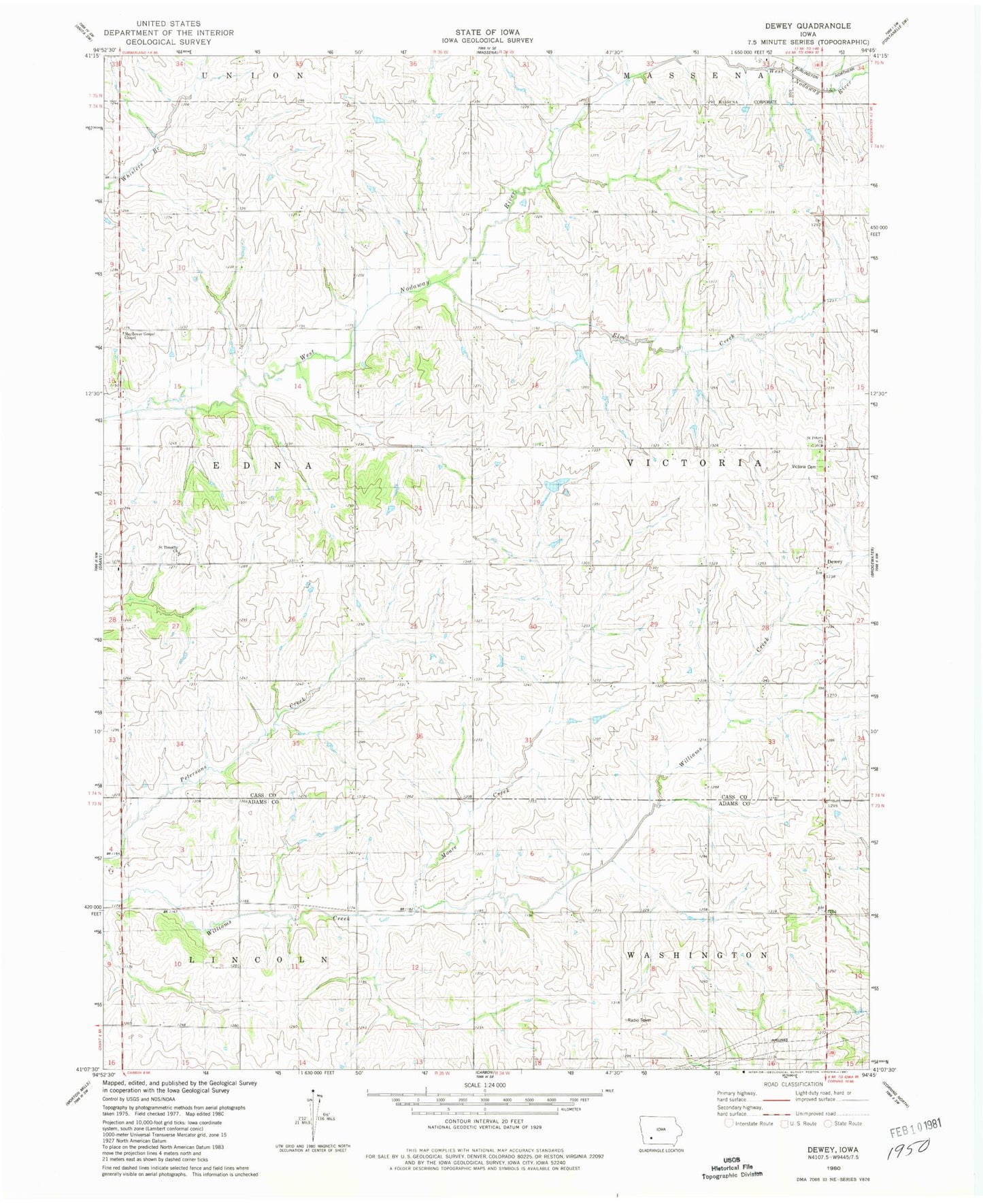
Classic USGS Dewey Iowa 7.5'x7.5' Topo Map
Couldn't load pickup availability
Historical USGS topographic quad map of Dewey in the state of Iowa. Map scale may vary for some years, but is generally around 1:24,000. Print size is approximately 24" x 27"
This quadrangle is in the following counties: Adams, Cass.
The map contains contour lines, roads, rivers, towns, and lakes. Printed on high-quality waterproof paper with UV fade-resistant inks, and shipped rolled.
Contains the following named places: Briscoe Post Office, Dewey, Dewey Post Office, Elm Creek, Mayflower Gospel Chapel, Moore Creek, Nodaway Wildlife Area, Prosser Creek, Saint Peters Church, Saint Timothy Cemetery, Saint Timothy Church, Township of Edna, Township of Victoria, Victoria Cemetery, West Nodaway Wildlife Area, ZIP Code: 50853