MyTopo
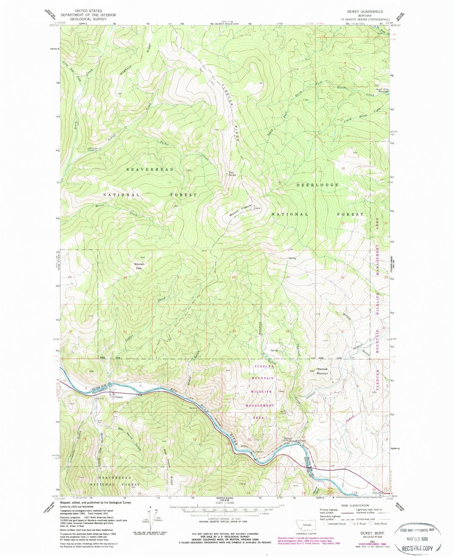
Classic USGS Dewey Montana 7.5'x7.5' Topo Map
Couldn't load pickup availability
Historical USGS topographic quad map of Dewey in the state of Montana. Map scale may vary for some years, but is generally around 1:24,000. Print size is approximately 24" x 27"
This quadrangle is in the following counties: Beaverhead, Silver Bow.
The map contains contour lines, roads, rivers, towns, and lakes. Printed on high-quality waterproof paper with UV fade-resistant inks, and shipped rolled.
Contains the following named places: Big Hole Copper Mine, Big Hole Dam, Big Hole Pumping Station, Cayuga Mine, Charcoal Creek, Charcoal Gulch, Charcoal Mountain, Dewey, Dewey Cemetery, Dewey Census Designated Place, Dewey Fishing Access Site, Dewey Post Office, Dewey School, Divide Bridge Campground, Divide Post Office, Divide School, Fleecer Ridge, Grafton Mine, Greenwood Bottoms Fishing Access Site, Hogback Ridge, Indian Creek, Jerry Creek Cow Camp, Leffler Creek, Limekiln Gulch, Long Tom Creek, Mitchell Park, Mount Fleecer, NE NW Section 22 Mine, Nez Perce Gulch, NW NW Section 9 Mine, NW SE Section 15 Mine, NW SW Section 9 Mine, Old Tom Horn Mine, Parker Creek, Powerhouse Fishing Access Site, Quartz Hill Gulch, Sawmill Gulch, Sheep Gulch, South Fork Reservoir, Tub Spring, ZIP Code: 59727