MyTopo
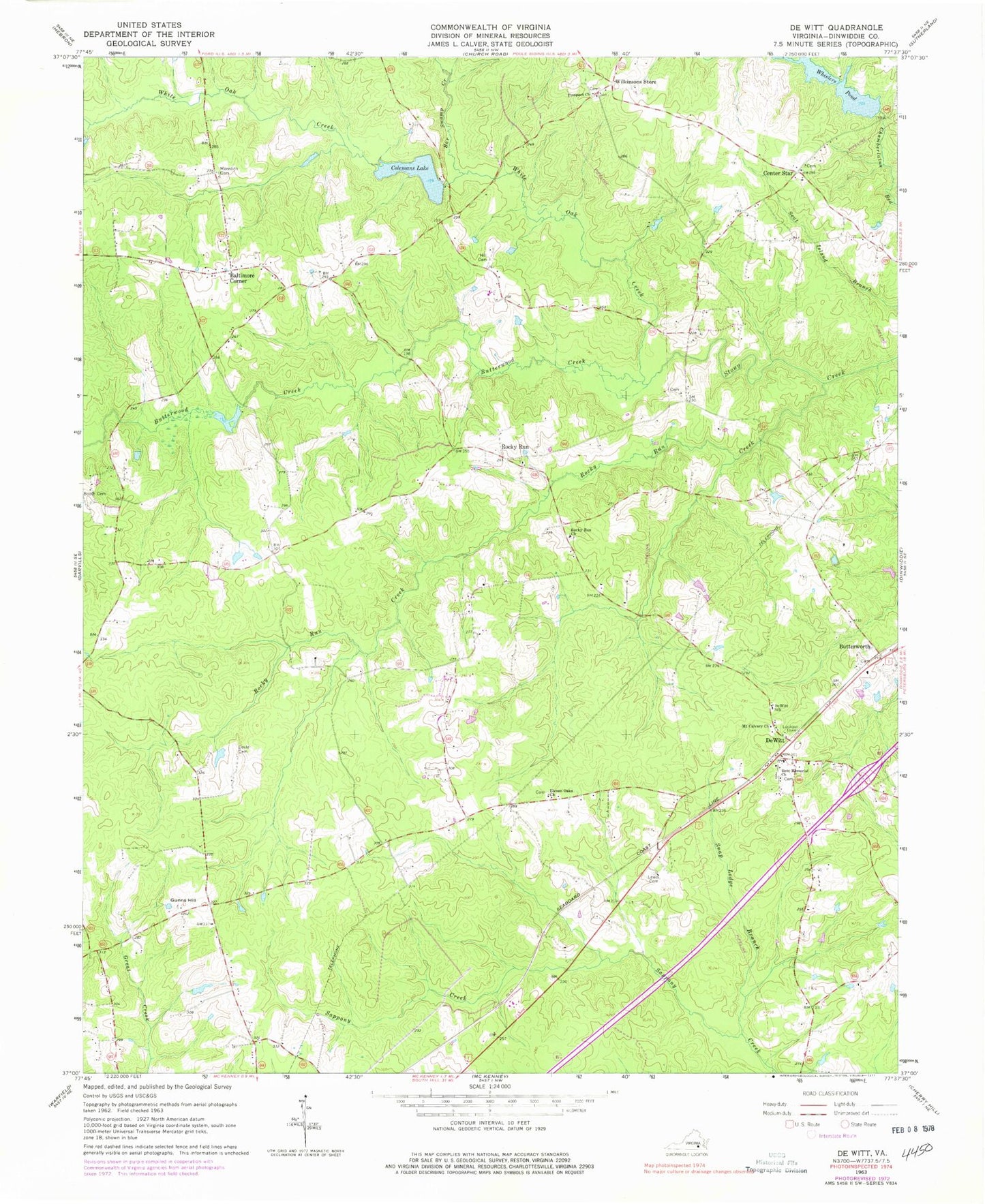
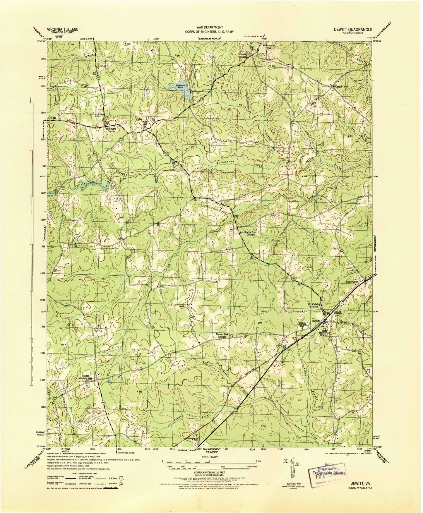
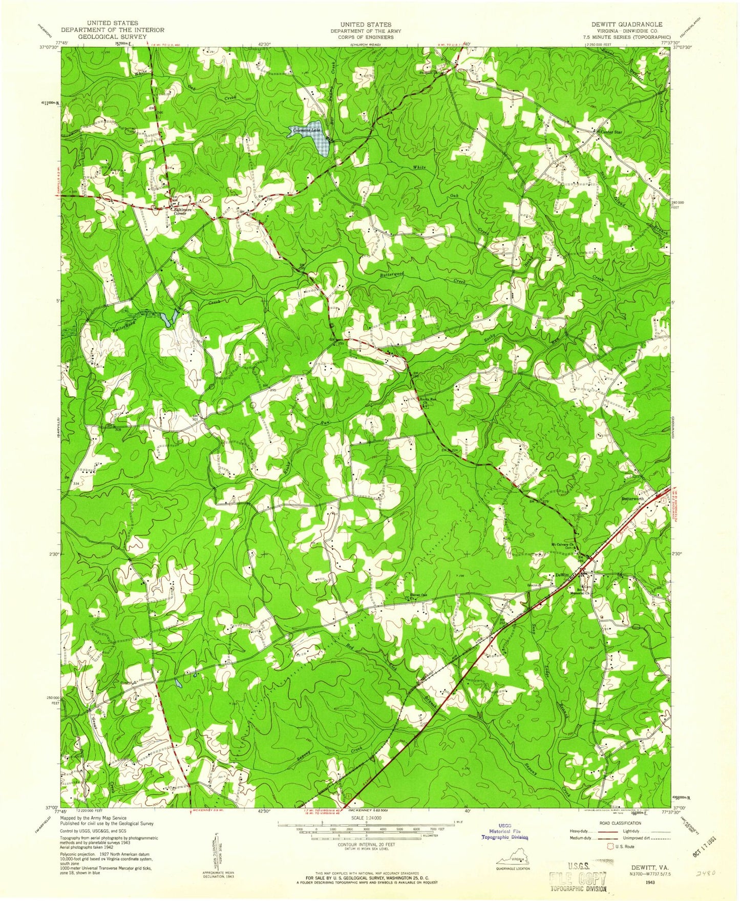
Classic USGS DeWitt Virginia 7.5'x7.5' Topo Map
Couldn't load pickup availability
Historical USGS topographic quad map of DeWitt in the state of Virginia. Map scale may vary for some years, but is generally around 1:24,000. Print size is approximately 24" x 27"
This quadrangle is in the following counties: Dinwiddie.
The map contains contour lines, roads, rivers, towns, and lakes. Printed on high-quality waterproof paper with UV fade-resistant inks, and shipped rolled.
Contains the following named places: Baltimore Corner, Bar Swamp Creek, Booth Cemetery, Borthwick, Bott Memorial Cemetery, Bott Memorial Church, Butterwood Creek, Butterworth, Center Star, Coleman Dam, Colemans Lake, DeWitt, DeWitt Post Office, DeWitt School, Dinwiddie County, District 5, Doyle Cemetery, Eleven Oaks Baptist Church Cemetery, Eleven Oaks Church, Gunns Hill, Hill Cemetery, Hills Mill, Lewis Cemetery, LG and E Westmoreland, Meredith Cemetery, Mount Calvary Church, Prospect Church, Reade Store, Rocky Run, Rocky Run Church, Rocky Run Creek, Snap Lodge Branch, Wheelers Dam, Wheelers Pond, White Oak Creek, Wilkinsons Store, ZIP Code: 23840