MyTopo
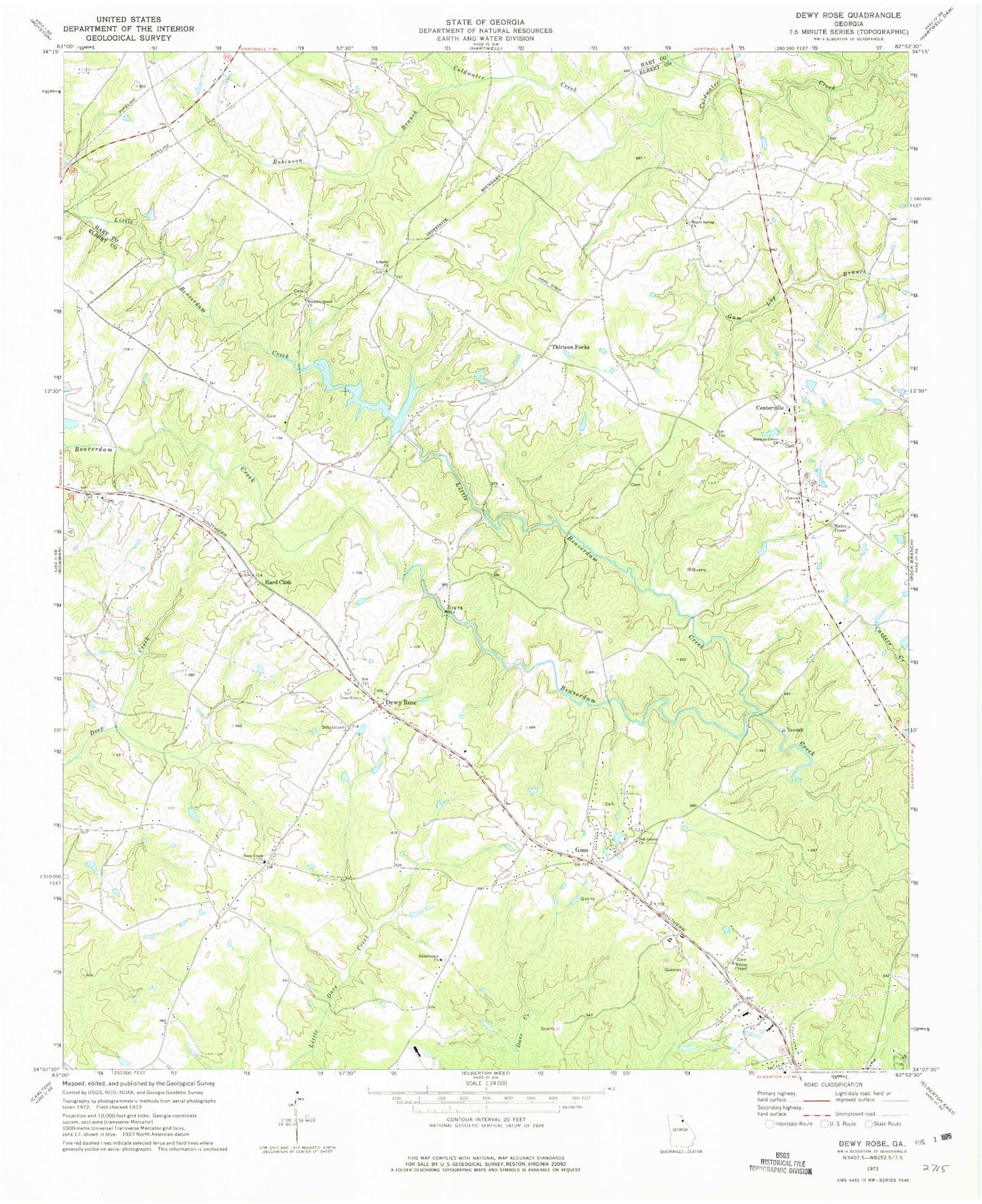
Classic USGS Dewy Rose Georgia 7.5'x7.5' Topo Map
Couldn't load pickup availability
Historical USGS topographic quad map of Dewy Rose in the state of Georgia. Map scale may vary for some years, but is generally around 1:24,000. Print size is approximately 24" x 27"
This quadrangle is in the following counties: Elbert, Hart.
The map contains contour lines, roads, rivers, towns, and lakes. Printed on high-quality waterproof paper with UV fade-resistant inks, and shipped rolled.
Contains the following named places: Amandaville, Beaverdam Creek Structure Number 30 Dam, Brewers Mill, Centerville, Centerville School, Church of Christ, Concord Cemetery, Concord Church, Deep Creek Cemetery, Deep Creek Church, Dewy Rose, Dewy Rose Baptist Church, Dewy Rose Cemetery, Dewy Rose Census Designated Place, Dewy Rose Post Office, Elbert County Fire Department Centerville Station, Elbert County Fire Department Deep Creek Station, Elberton Powerplant, Faith Baptist Church, Faith Cemetery, Goss, Hard Cash, Harper, Liberty Cemetery, Liberty Church, Little Beaverdam Creek, Maple Spring Cemetery, Maple Spring Church, Maple Spring School, Norman Grove Cemetery, Norman Grove Church, Oak Grove Baptist Church, Oak Grove Cemetery, Pulliam Mill, Reservoir 30, Robinson Branch, Ruckers Grove Cemetery, Ruckers Grove Church, Saint Philip's Parish, Stinchcomb Church, Stinchcomb United Methodist Church Cemetery, Thirteen Forks, Victory Church, Wesley Chapel, Whites Chapel, Whites Chapel Cemetery, ZIP Code: 30634