MyTopo
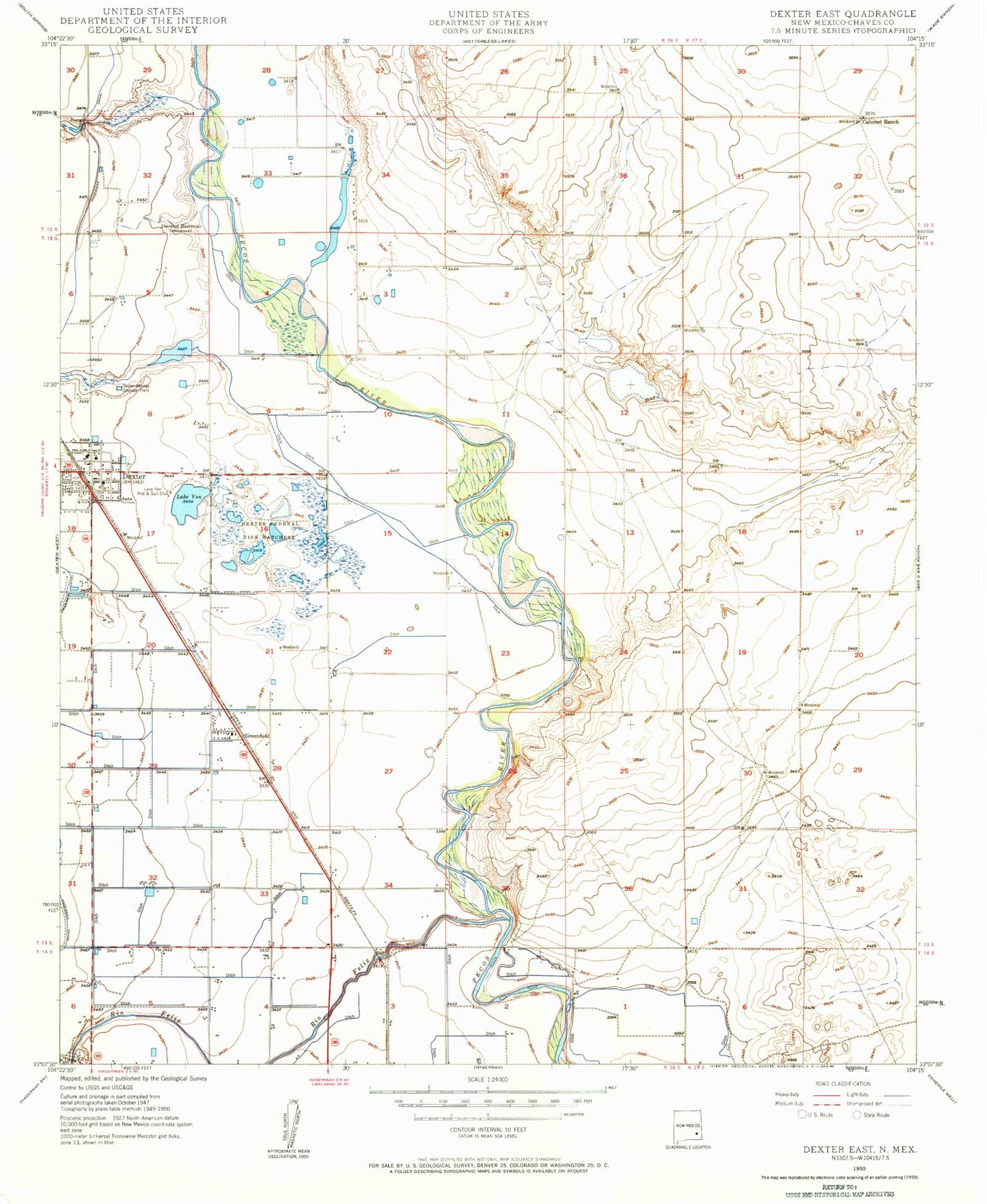
Classic USGS Dexter East New Mexico 7.5'x7.5' Topo Map
Couldn't load pickup availability
Historical USGS topographic quad map of Dexter East in the state of New Mexico. Map scale may vary for some years, but is generally around 1:24,000. Print size is approximately 24" x 27"
This quadrangle is in the following counties: Chaves.
The map contains contour lines, roads, rivers, towns, and lakes. Printed on high-quality waterproof paper with UV fade-resistant inks, and shipped rolled.
Contains the following named places: Calumet Ranch, Church of Christ, Dexter, Dexter Elementary School, Dexter Fire and Rescue Station 1, Dexter High School, Dexter Junior High School, Dexter National Fish Hatchery and Fish Technology Center, Dexter Police Department, Dexter Post Office, Dexter Public Library, Dexter Sewage Disposal Plant, Durand Reservoir, Eastside Church of Christ, First Baptist Church, First Methodist Church, First Presbyterian Church, Greenfield, Greenfield Post Office, Lake Van, Lake Van Rod Club, Midway Baptist Church, Pecos River Bridge, Primera Iglesia Bautista, Rio Felix, Spring Mound Valley Cemetery, Town of Dexter, Westside Church of Christ, Zuber Hollow Reservoir Dam