MyTopo
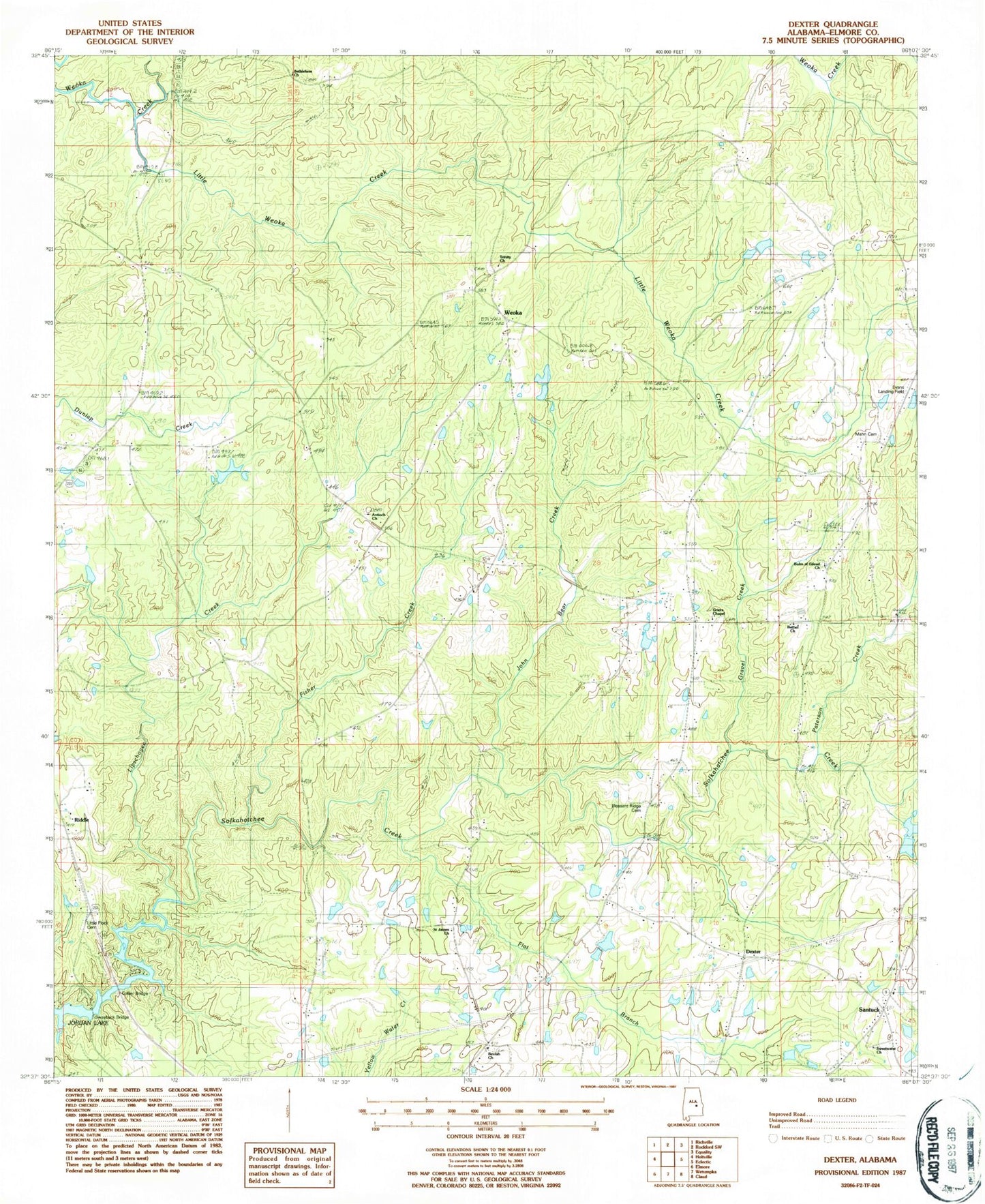
Classic USGS Dexter Alabama 7.5'x7.5' Topo Map
Couldn't load pickup availability
Historical USGS topographic quad map of Dexter in the state of Alabama. Map scale may vary for some years, but is generally around 1:24,000. Print size is approximately 24" x 27"
This quadrangle is in the following counties: Elmore.
The map contains contour lines, roads, rivers, towns, and lakes. Printed on high-quality waterproof paper with UV fade-resistant inks, and shipped rolled.
Contains the following named places: Antioch Baptist Church, B G Powell Lake, B G Powell Lake Dam, Balm of Gilead Church, Bethel Church, Bethlehem Church, Beulah Baptist Church, Collier Bridge, Danny Davis Lake, Danny Davis Lake Dam, Davis Dam, Davis Lake, Dexter, Evans Airport, Evergreen School, Faith Rescue Mission Farm, Fisher Creek, Gravel Creek, Greer, Griers Chapel, Hall Chapel School, John Bear Creek, Levins Store, Lipschogee Creek, Little Flock Cemetery, Little Weoka Creek, Mann Cemetery, Milam Lake, Milam Lake Dam, New Bethel Church, Paterson Creek, Pleasant Ridge Cemetery, Riddle, Saint James Church, Santuck, Santuck Baptist Church, Santuck Volunteer Fire Department Station 1, Sears Marina, Stewart Dam, Stewart Lakes, Swayback Bridge, Sweetwater Church, Sweetwater School, Ten Cedars Estates, Titus Division, Trinity United Methodist Church, Weoka, Weoka Junior High School, Whetstone Dam, Whits Lake