MyTopo
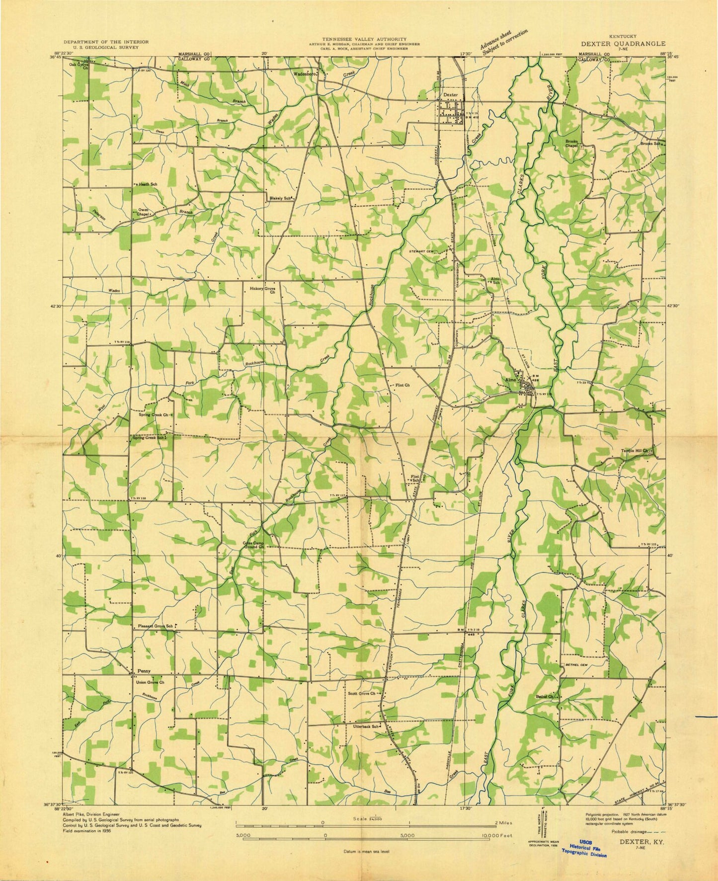
Classic USGS Dexter Kentucky 7.5'x7.5' Topo Map
Couldn't load pickup availability
Historical USGS topographic quad map of Dexter in the state of Kentucky. Map scale may vary for some years, but is generally around 1:24,000. Print size is approximately 24" x 27"
This quadrangle is in the following counties: Calloway, Marshall.
The map contains contour lines, roads, rivers, towns, and lakes. Printed on high-quality waterproof paper with UV fade-resistant inks, and shipped rolled.
Contains the following named places: Almo, Almo Cemetery, Almo Church, Almo Heights, Bee Creek, Bethel, Bethel Cemetery, Bethel Church, Blakely, Brooks Chapel, Brooks Chapel - Gordon Cemetery, Calloway County Fire and Rescue Station 4, Coles Campground Cemetery, Coles Campground Church, Dexter, Dexter Census Designated Place, Dexter Hardin Church, Dexter Post Office, East Fork Rockhouse Creek, Flint, Flint Church, Hickory Grove Church, Kyle-Oakley Field, Muck Branch, Murray Memorial Gardens, North Pleasant Grove Cemetery, North Pleasant Grove Church, Northside Church, Oak Grove Church, Owen Branch, Owen Chapel, Penny, Peterson Branch, Pleasant Hill, Rockhouse Creek, Scotts Grove Cemetery, Scotts Grove Church, Spring Creek, Spring Creek Cemetery, Spring Creek Church, Stewart Cemetery, Temple Hill, Temple Hill Cemetery, Temple Hill Church, Turner Field, Union Grove Church, Utterback, Wadesboro, West Fork Rockhouse Creek, WNBS-AM (Murray), WSJP-AM (Murray), WSPH-TV (Murray), ZIP Code: 42020