
MyTopo
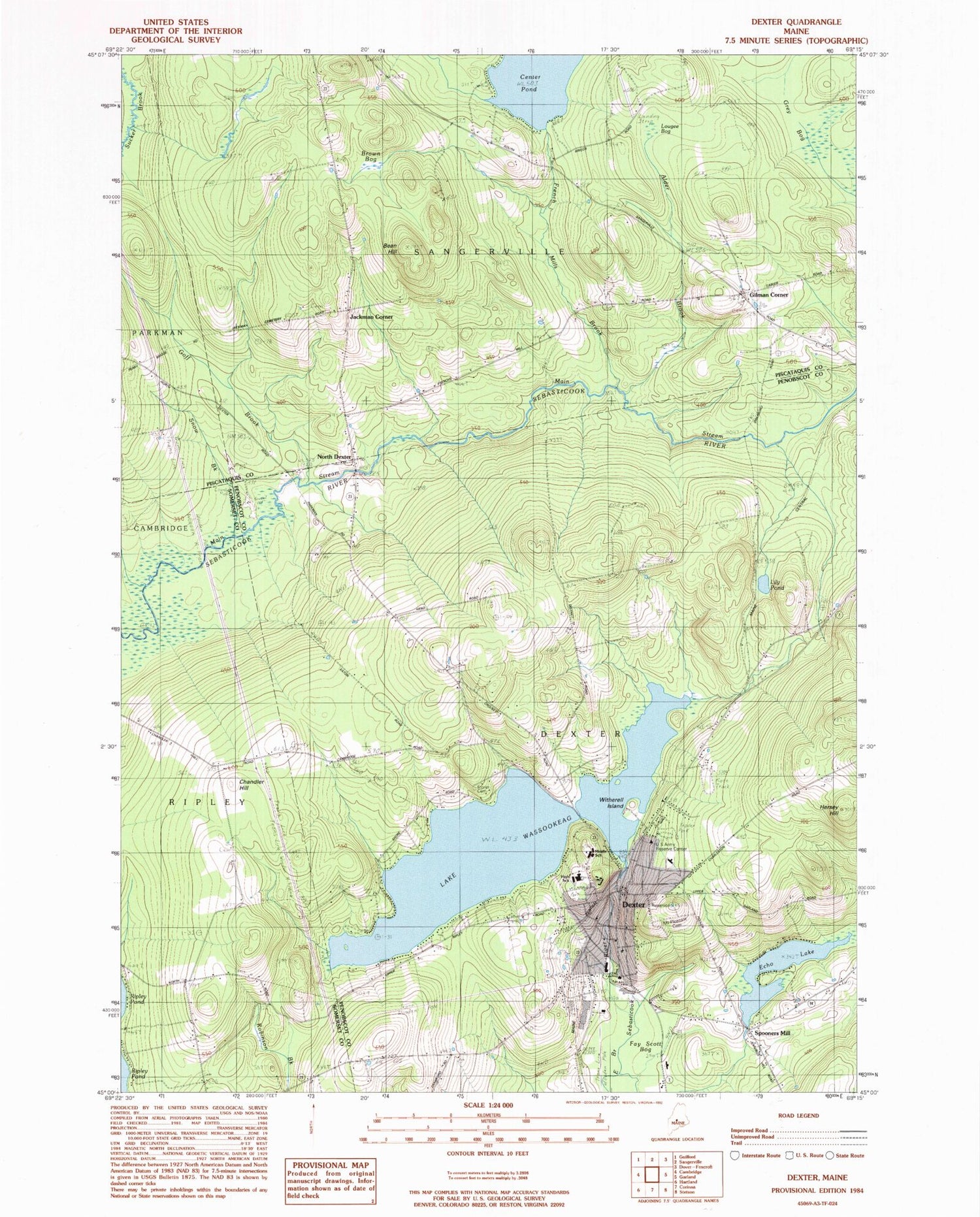
Classic USGS Dexter Maine 7.5'x7.5' Topo Map
Couldn't load pickup availability
Historical USGS topographic quad map of Dexter in the state of Maine. Typical map scale is 1:24,000, but may vary for certain years, if available. Print size: 24" x 27"
This quadrangle is in the following counties: Penobscot, Piscataquis, Somerset.
The map contains contour lines, roads, rivers, towns, and lakes. Printed on high-quality waterproof paper with UV fade-resistant inks, and shipped rolled.
Contains the following named places: Alder Brook, Bean Hill, Brown Bog, Center Pond, Chandler Hill, Dexter, Fay Scott Bog, French Mills Brook, Goff Brook, Grey Bog, Hersey Hill, Jackman Corner School, Lily Pond, Lougee Bog, Mount Pleasant Cemetery, North Dexter, Echo Lake, Snow Brook, Spooners Mill, Storer Cemetery, Wassookeag Camp, Lake Wassookeag, Witherell Island, Gilman Corner, Town of Dexter, Wassookeag Lake Dam, Puffers Pond Dam, Jackman Corner, Abbot Memorial Library, Dexter Historical Society Museum, Dexter Middle School (historical), Dexter Municipal Golf Course, Dexter Post Office, Dexter Primary School (historical), Dexter Regional High School, Dexter Universalist Church, Tri-County Regional Technical Center, Wilderness Community Church, Dexter Census Designated Place, Morrel Field, Dexter Fire Department, Dexter Ambulance Service, Gilman Cemetery, Jackman Corner Cemetery, Dexter Police Department, Bailey Cemetery, Frenchs Mills Cemetery, Tri County Technical Center School, Dexter Christian Academy, Ridge View Community School