MyTopo
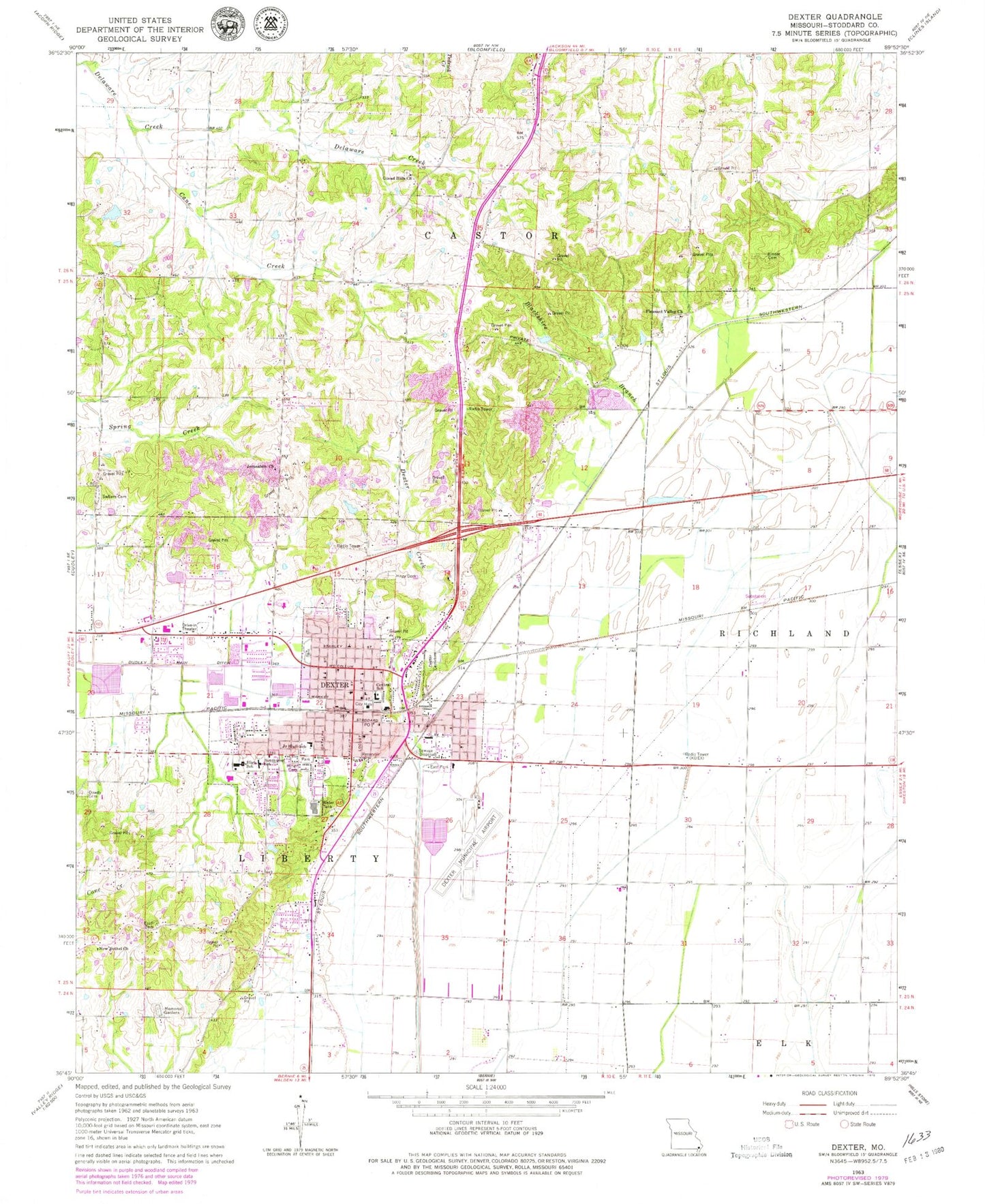
Classic USGS Dexter Missouri 7.5'x7.5' Topo Map
Couldn't load pickup availability
Historical USGS topographic quad map of Dexter in the state of Missouri. Map scale may vary for some years, but is generally around 1:24,000. Print size is approximately 24" x 27"
This quadrangle is in the following counties: Stoddard.
The map contains contour lines, roads, rivers, towns, and lakes. Printed on high-quality waterproof paper with UV fade-resistant inks, and shipped rolled.
Contains the following named places: Bartletts Fishing Lake Dam, Blackshire Branch, Cane Creek, Central School, Chalk Bluff Cemetery, City of Dexter, Dexter, Dexter Cemetery, Dexter Creek, Dexter Fire Department Station 2, Dexter Fire Department Station 3, Dexter Junction, Dexter Memorial Hospital Heliport, Dexter Municipal Airport, Dexter Police Department, Dexter Post Office, Dowdy Cemetery, East Park, Edwards School, Ezell Cemetery, Ezell School, Gilead Hills Church, Hagy Cemetery, Hill School, Jerusalem Church, KDEX-AM (Dexter), KDEX-FM (Dexter), Kinder Cemetery, Lambert School, Lost School, Miller - Carter Cemetery, Missouri State Veterans Cemetery - Bloomfield, New Bethel Church, Ott School, Panther Swamp, Pleasant Valley Church, Renner School, Sadler Chapel Cemetery, Southeast Health Medical Center Stoddard County, Southwest School, Stoddard County, Tatum School, Walnut Ridge School, ZIP Code: 63841