MyTopo
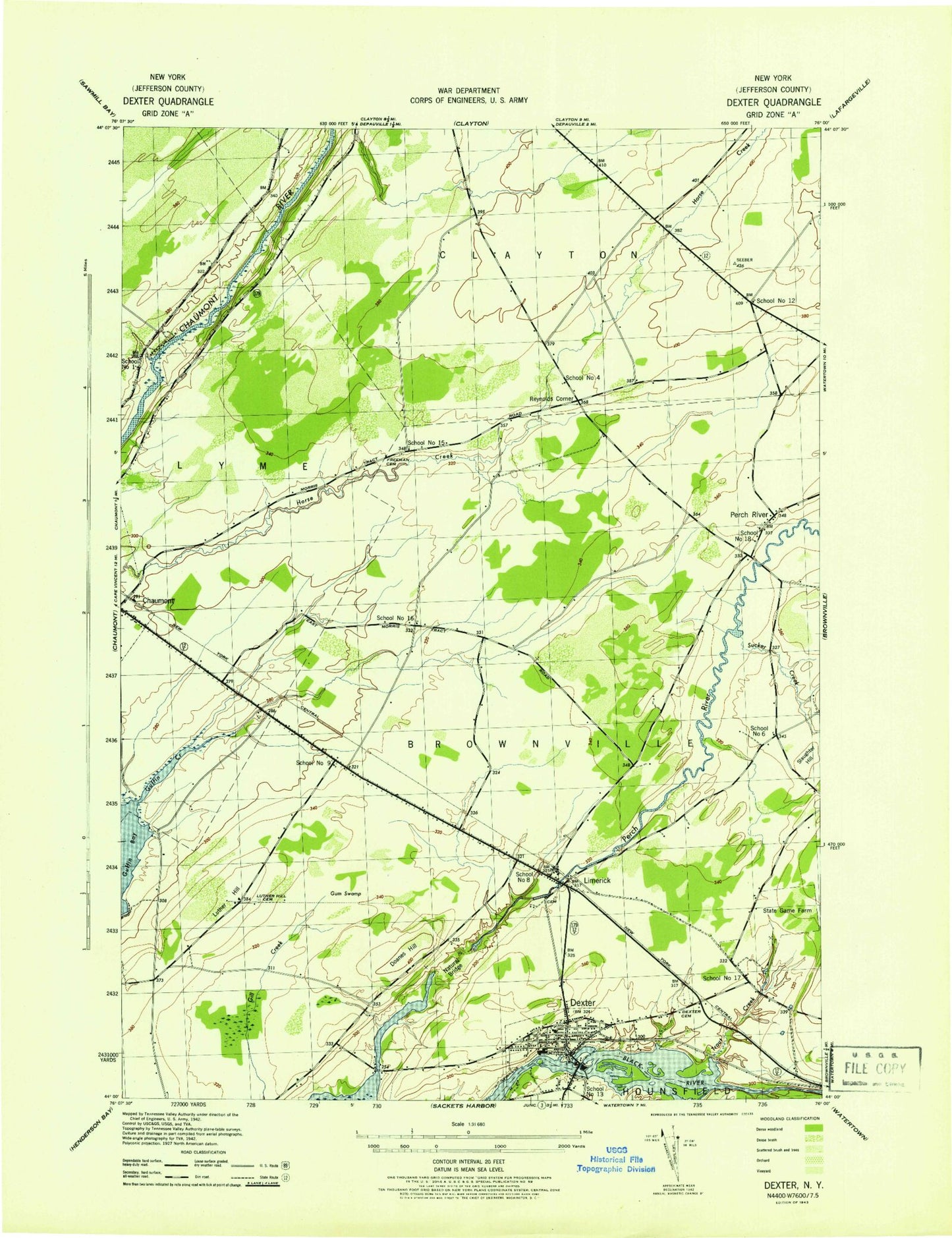
Classic USGS Dexter New York 7.5'x7.5' Topo Map
Couldn't load pickup availability
Historical USGS topographic quad map of Dexter in the state of New York. Map scale may vary for some years, but is generally around 1:24,000. Print size is approximately 24" x 27"
This quadrangle is in the following counties: Jefferson.
The map contains contour lines, roads, rivers, towns, and lakes. Printed on high-quality waterproof paper with UV fade-resistant inks, and shipped rolled.
Contains the following named places: Bar Z Farm, Breezy Knoll Mobile Home Park, Brownville State Game Farm, Dexter, Dexter Cemetery, Dexter Elementary School, Dexter Free Library, Dexter Police Department, Dexter Post Office, Dexter Presbyterian Church, Dexter Sewage Treatment Plant, Dexter United Methodist Church, Dexter Volunteer Fire Department Dexter Station 1, Doanes Hill, Freeman Cemetery, General Brown High School, Guffin Creek, Gum Swamp, Limerick, Luther Hill, Luther Hill Cemetery, Natural Bridge of New York, Parker Family Farms, Perch River, Reynolds Corner, School Number 1, School Number 12, School Number 13, School Number 15, School Number 16, School Number 17, School Number 18, School Number 4, School Number 6, School Number 8, School Number 9, Slaughter Hill, Sucker Creek, Town of Brownville, Trout Creek, Village of Dexter, WXIK-AM (Brownville), ZIP Codes: 13622, 13634