MyTopo
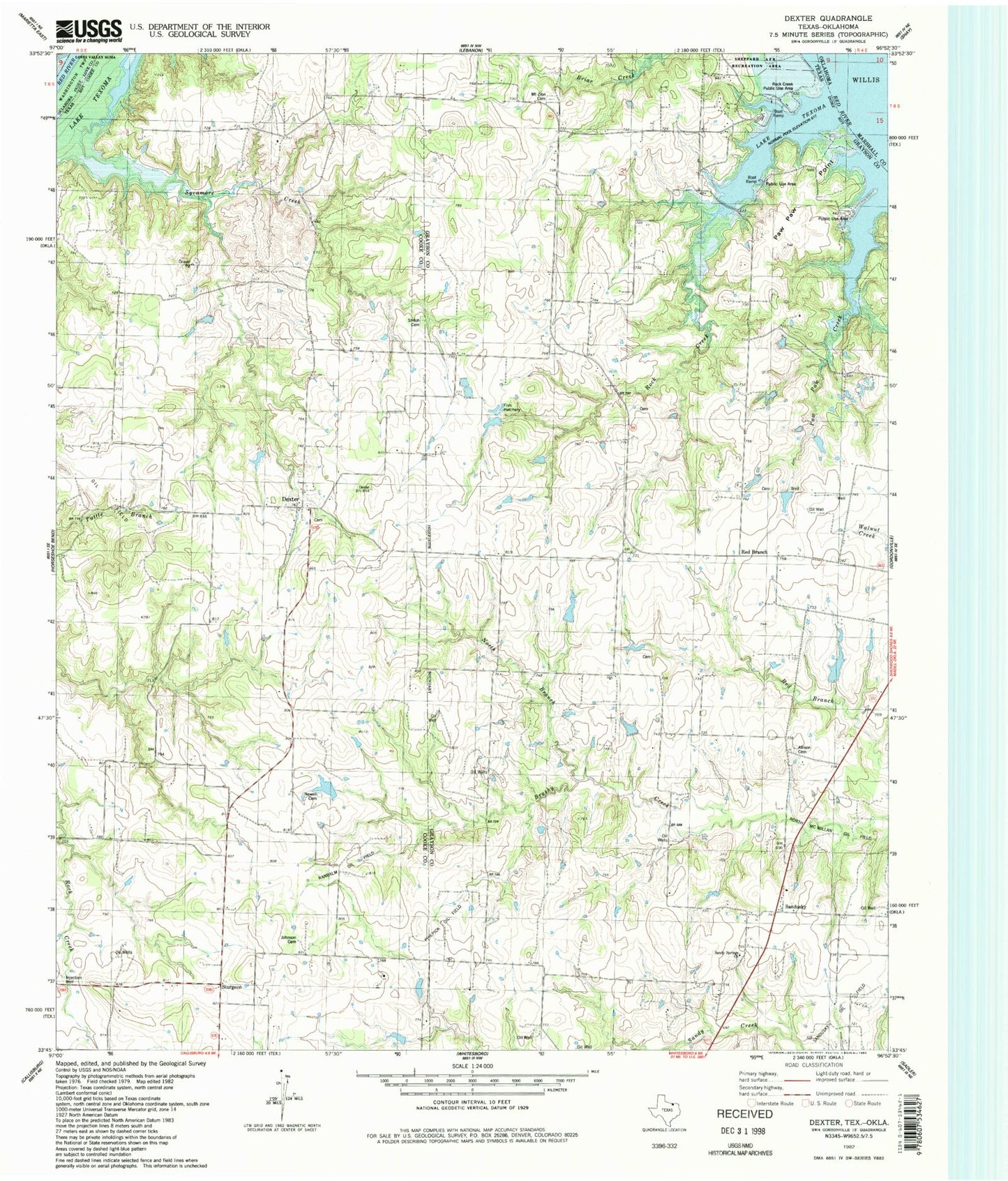
Classic USGS Dexter Texas 7.5'x7.5' Topo Map
Couldn't load pickup availability
Historical USGS topographic quad map of Dexter in the state of Texas. Typical map scale is 1:24,000, but may vary for certain years, if available. Print size: 24" x 27"
This quadrangle is in the following counties: Cooke, Grayson, Love, Marshall.
The map contains contour lines, roads, rivers, towns, and lakes. Printed on high-quality waterproof paper with UV fade-resistant inks, and shipped rolled.
Contains the following named places: Allison Cemetery, Bacon Cemetery, Dexter, Johnson Cemetery, Mount Zion Cemetery, Mount Zion Church, Pawpaw Creek, Rock Creek, Stillhouse Ferry, Hishway, Red Branch, Sandusky, Sturgeon, Rich Lake Dam, Rich Lake, Williams Lake Dam, Williams Lake, May Dam, May Lake, Collums Lake Dam, Collums Lake, Newell Cemetery, Ranbalm Oil Field, Shiloh Cemetery, Henry Cemetery, Blassingame Cemetery