MyTopo
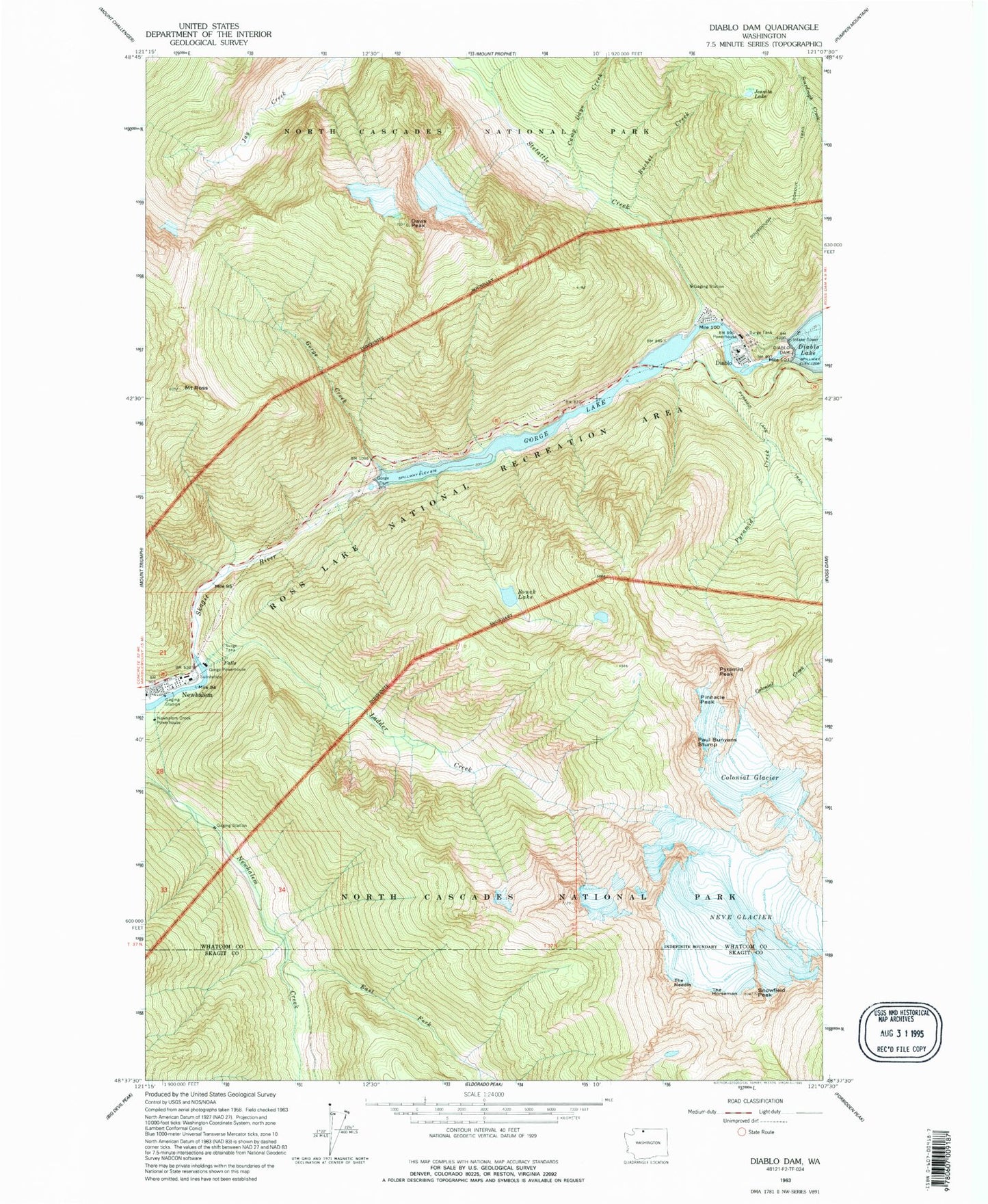
Classic USGS Diablo Dam Washington 7.5'x7.5' Topo Map
Couldn't load pickup availability
Historical USGS topographic quad map of Diablo Dam in the state of Washington. Typical map scale is 1:24,000, but may vary for certain years, if available. Print size: 24" x 27"
This quadrangle is in the following counties: Skagit, Whatcom.
The map contains contour lines, roads, rivers, towns, and lakes. Printed on high-quality waterproof paper with UV fade-resistant inks, and shipped rolled.
Contains the following named places: Bouck Lake, Bucket Creek, Camp Dayo Creek, Colonial Glacier, Davis Peak, Diablo, Diablo Dam, East Fork Newhalem Creek, Gorge Creek, Gorge Dam, Gorge Lake, Jeanita Lake, Ladder Creek, Neve Glacier, Newhalem, Paul Bunyans Stump, Pinnacle Peak, Pyramid Creek, Pyramid Lake Trail, Pyramid Peak, Mount Ross, Snowfield Peak, Sourdough Lookout Trail, Stetattle Creek, The Horseman, The Needle, Pyramid Lake Research Natural Area, Gorge Creek Falls Viewpoint, Gorge Creek Falls, Reflector Bar, Diablo Canyon, Ladder Creek Falls, Gorge Powerhouse, Newhalem Creek Powerhouse, Stephen Mather Wilderness, Gorge Creek Bridge, Newhalem / Diablo Volunteer Fire Department