MyTopo
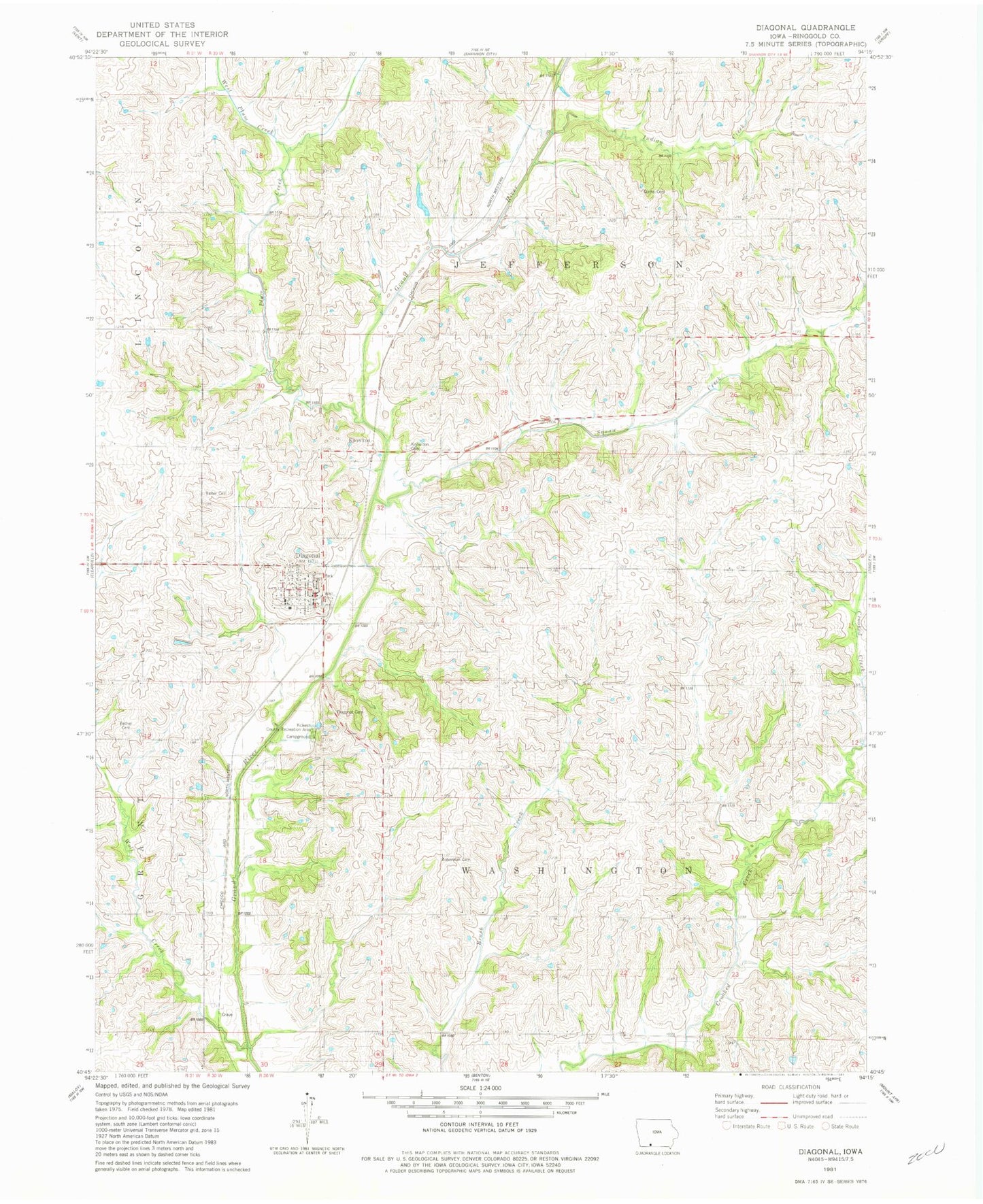
Classic USGS Diagonal Iowa 7.5'x7.5' Topo Map
Couldn't load pickup availability
Historical USGS topographic quad map of Diagonal in the state of Iowa. Map scale may vary for some years, but is generally around 1:24,000. Print size is approximately 24" x 27"
This quadrangle is in the following counties: Ringgold.
The map contains contour lines, roads, rivers, towns, and lakes. Printed on high-quality waterproof paper with UV fade-resistant inks, and shipped rolled.
Contains the following named places: Bethel Cemetery, Bohemian Cemetery, Centenary Cemetery, City of Diagonal, Dead Mans Cut Cemetery, Diagonal, Diagonal Cemetery, Diagonal City Hall, Diagonal Elementary School, Diagonal First Response Team, Diagonal Middle / High School, Diagonal Post Office, Diagonal Printing Museum, Diagonal United Church, Flushing Post Office, Goshen, Goshen Post Office, Indian Creek, Keller Cemetery, Kew, Kew Post Office, Knowlton, Knowlton Post Office, Kokesh County Recreation Area, Plum Creek, Quinn Cemetery, Squaw Creek, Sun Valley Lake, Sun Valley Lake Dam, Township of Jefferson, Township of Washington, West Plum Creek, Wolf Creek, ZIP Code: 50845