MyTopo
Classic USGS Diamond Bluff West Wisconsin 7.5'x7.5' Topo Map
Couldn't load pickup availability
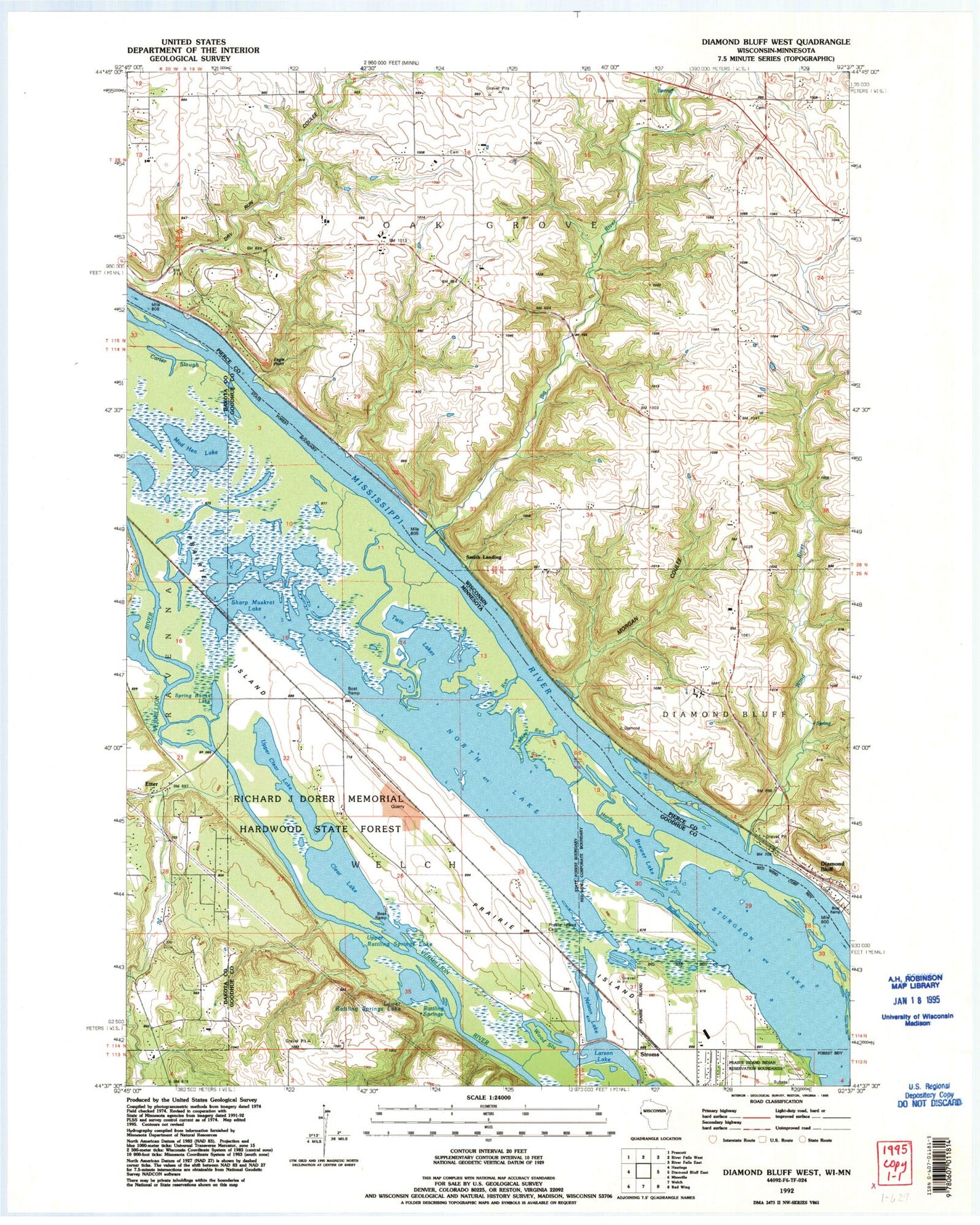
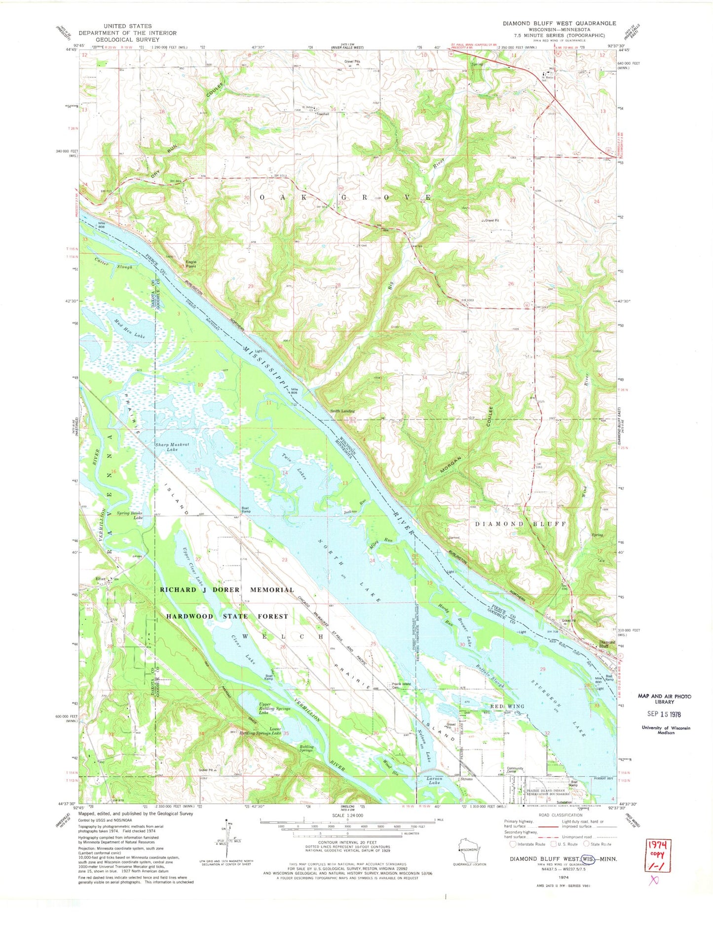
Historical USGS topographic quad map of Diamond Bluff West in the states of Wisconsin, Minnesota. Map scale may vary for some years, but is generally around 1:24,000. Print size is approximately 24" x 27"
This quadrangle is in the following counties: Dakota, Goodhue, Pierce.
The map contains contour lines, roads, rivers, towns, and lakes. Printed on high-quality waterproof paper with UV fade-resistant inks, and shipped rolled.
Contains the following named places: .20 Reservoir, 0.22 Reservoir, 54021, Big River, Brewer Lake, Buffalo Slough, Carter Slough, Clear Lake, Diamond Bluff, Eagle Point, Etter, Etter Post Office, Hardy Run, Huppert E 7689 Dam, Jackson Run, John G Hoikka G-9526 Dam, Larson Lake, Lower Rattling Springs Lake, Messiah Episcopal Church, Miley Run, Morgan Coulee, Mud Hen Lake, Nelson Lake, North Lake, Prairie Island, Prairie Island Cemetery, Prairie Island Indian Community, Prairie Island Tribal Police Department, Prairie Island-Schaller Airport, Rattling Springs, Saint Johns Church, Saint Marys School, Sharp Muskrat Lake, Smith Bar, Smith Landing, Spring Banks Lake, Stol Airport, Stroms, Sturgeon Lake, Town of Oak Grove, Twin Lakes, Upper Clear Lake, Upper Rattling Springs Lake, Wind River, Wood Slough