MyTopo
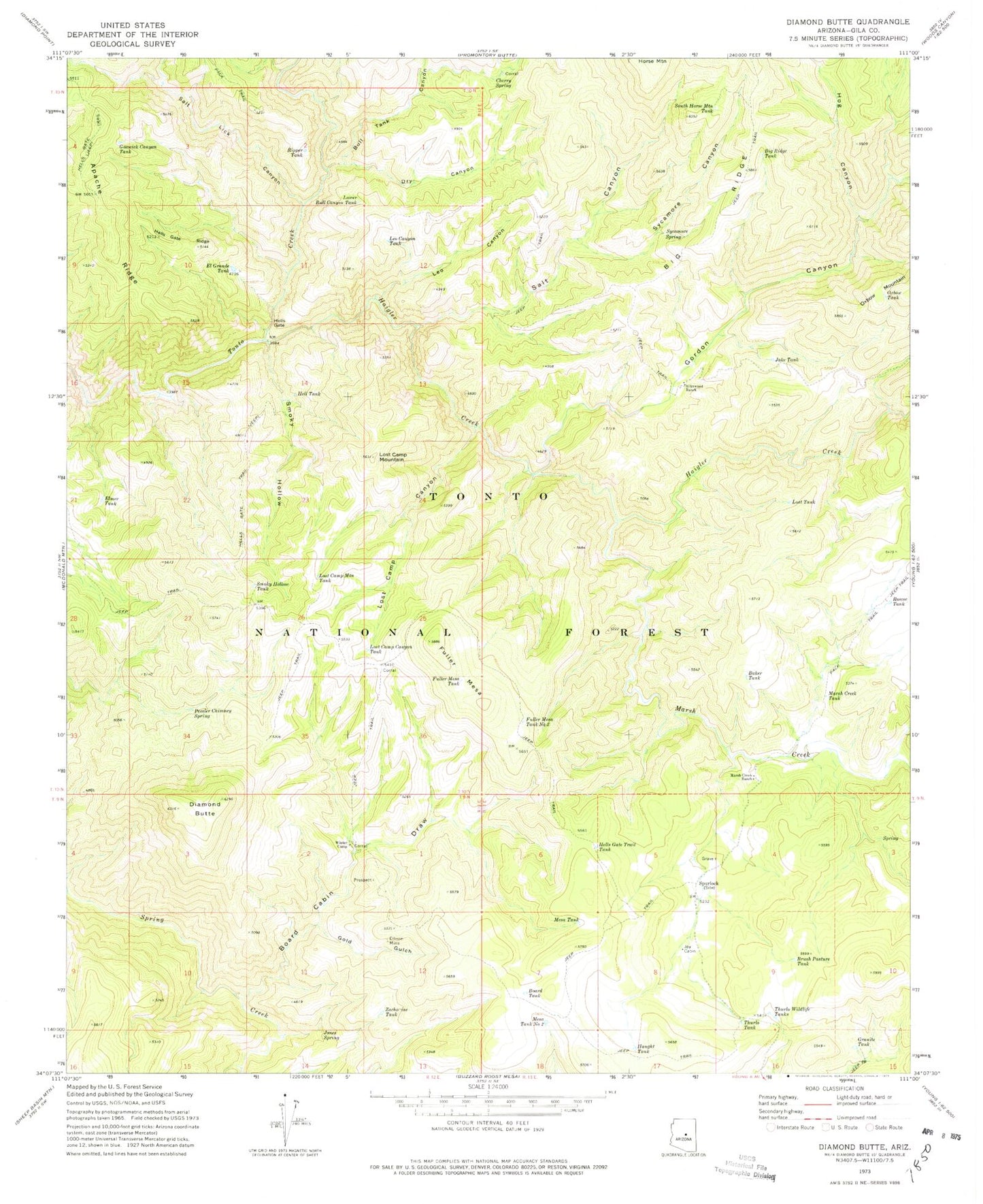
Classic USGS Diamond Butte Arizona 7.5'x7.5' Topo Map
Couldn't load pickup availability
Historical USGS topographic quad map of Diamond Butte in the state of Arizona. Map scale may vary for some years, but is generally around 1:24,000. Print size is approximately 24" x 27"
This quadrangle is in the following counties: Gila.
The map contains contour lines, roads, rivers, towns, and lakes. Printed on high-quality waterproof paper with UV fade-resistant inks, and shipped rolled.
Contains the following named places: Apache Ridge, Baker Tank, Big Ridge, Big Ridge Tank, Board Cabin Draw, Board Tank, Brush Pasture Tank, Bull Tank Canyon, Cherry Spring, Diamond Butte, Dry Canyon, El Grande Tank, Ellinwood Ranch, Ellison Mine, Elmer Tank, Fuller Mesa, Fuller Mesa Tank, Fuller Mesa Tank Number Two, Gold Gulch, Gordon Canyon, Goswick Canyon Tank, Granite Tank, Haigler Canyon, Haigler Creek, Haught Tank, Hell Tank, Hells Gate, Hells Gate Ridge, Hells Gate Trail Tank, Hog Canyon, Jake Tank, Jones Spring, Joy Cabin, Leo Canyon, Leo Canyon Tank, Lost Camp Canyon, Lost Camp Canyon Tank, Lost Camp Mountain, Lost Camp Mountain Tank, Lost Tank, Lower Bull Canyon Tank, Marsh Creek, Marsh Creek Ranch, Marsh Creek Tank, Mesa Tank Number Two, Oxbow Tank, Peveler Chimney Spring, Rascoe Tank, Ripper Tank, Salt Canyon, Salt Lick Canyon, Smoky Hollow, Smoky Hollow Tank, South Horse Mountain Tank, Spurlock, Sycamore Canyon, Sycamore Spring, Thurlo Tank, Thurlo Wildlife Tanks, Winter Camp, Winter Camp Well, Zachariae Tank