MyTopo
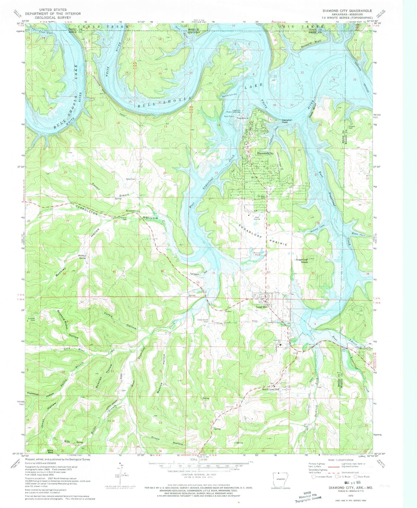
Classic USGS Diamond City Arkansas 7.5'x7.5' Topo Map
Couldn't load pickup availability
Historical USGS topographic quad map of Diamond City in the state of Arkansas. Map scale may vary for some years, but is generally around 1:24,000. Print size is approximately 24" x 27"
This quadrangle is in the following counties: Boone, Marion, Taney.
The map contains contour lines, roads, rivers, towns, and lakes. Printed on high-quality waterproof paper with UV fade-resistant inks, and shipped rolled.
Contains the following named places: Bailey Branch, Buckley Hollow, Buckley Spring, Bull Shoals Lake, Buzzard Bluff, Buzzard Roost Hollow, Campbell Point, Carrollton Hollow, Carrollton Hollow Cemetery, Cedar Grove Cemetery, Cedar Heights Bible Church, City of Diamond City, Coffman Cove, Curtis Hollow, Deer Cove, Deshield Fork, Diamond City, Diamond City Fire Station, Diamond City Police Department, Diamond City Post Office, Diamond City United Methodist Church, Dixon Hollow, Dubusque Landing, East Sugarloaf Creek, Enon Church, Fairview Cemetery, Foresee Cemetery, Four Spring Hollow, Goat Bluff, Grays Bend, Hog Thief Bend, Hunnicut Hollow, Jones Hollow, Lead Hill, Lead Hill Elementary School, Lead Hill High School, Lead Hill Post Office, Lead Hill Public Use Area, Lead Hill Volunteer Fire Department, Lead Mine Creek, Locust Creek, Longs Ferry, Lord of the Lake Lutheran Church, Monroe Hollow, Moon Cove, Nelson Cove, Northern Arkansas Regional Medical Center Emergency Medical Service - Diamond City, Pickard Cemetery, Raley Cemetery, Russian Hollow, Sheafers Ferry, South Lead Hill, State Line Cove, Sugarloaf Knob, Sugarloaf Prairie, Sycamore, Terrapin Hollow, Town of Lead Hill, Town of South Lead Hill, Township of Sugar Loaf, Trotter Branch, West Sugarloaf Creek, Willis, Willis Branch, ZIP Codes: 72630, 72644