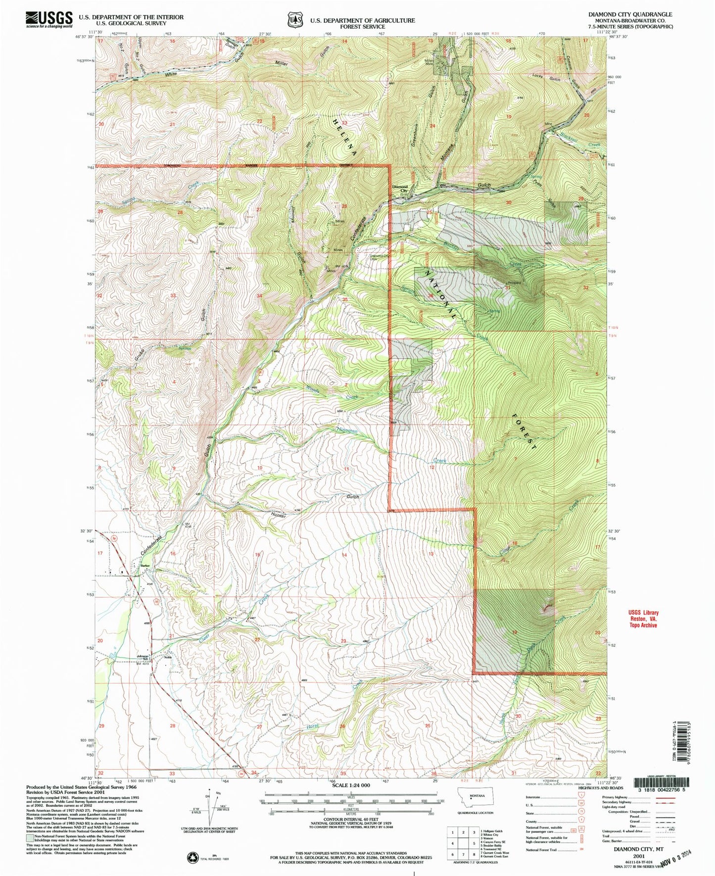
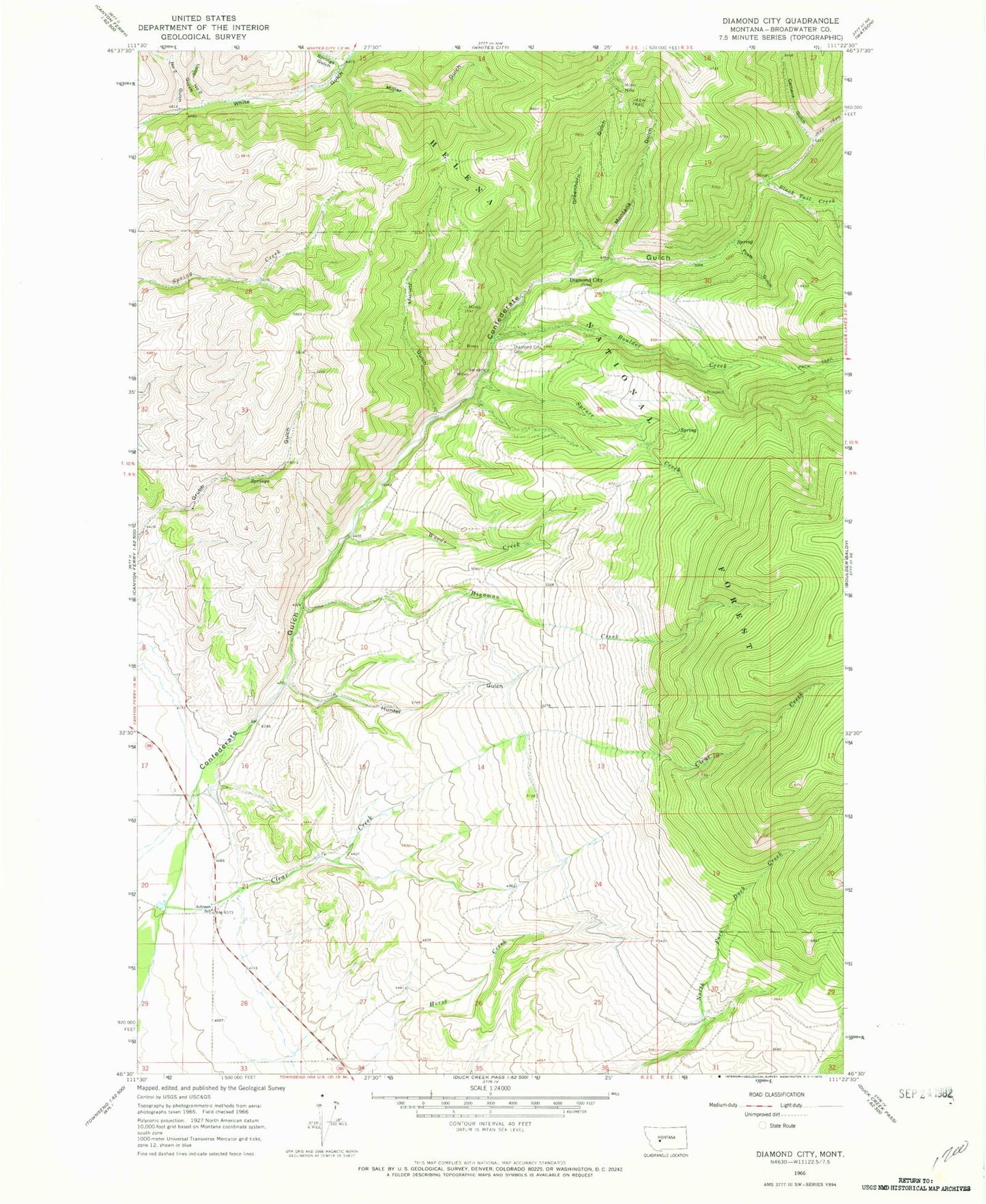
MyTopo
Classic USGS Diamond City Montana 7.5'x7.5' Topo Map
Couldn't load pickup availability
Historical USGS topographic quad map of Diamond City in the state of Montana. Map scale may vary for some years, but is generally around 1:24,000. Print size is approximately 24" x 27"
This quadrangle is in the following counties: Broadwater.
The map contains contour lines, roads, rivers, towns, and lakes. Printed on high-quality waterproof paper with UV fade-resistant inks, and shipped rolled.
Contains the following named places: 09N02E16CCCD01 Well, 09N02E16CDAD01 Well, Baker Mine, Barker, Blacktail Creek, Boom Mine, Boulder, Boulder Creek, Cement Gulch, Cement Gulch City, Clear Creek, Diamond City, Diamond City Cemetery, Diamond City Post Office, El Dorado, Elk Meadows Ranch Airport, Greenhorn Gulch, Hinaman Creek, Hunter Gulch, Jimmys Gulch, Johnson Post Office, Johnson School, Lucky Gulch, Miller Gulch, Miller Mine, Montana Gulch, Montana Regent Mine, NE NW Section 25 Mine, NE SW Section 26 Mine, Noble, Number Two Gulch, Pyatt Gulch, Silver Snowflake Mine, Springs Gulch, Springs Gulch Creek, Spruce Creek, Upper Number 2 Gulch Mine, Upper Number Two Gulch, Woods Creek