MyTopo
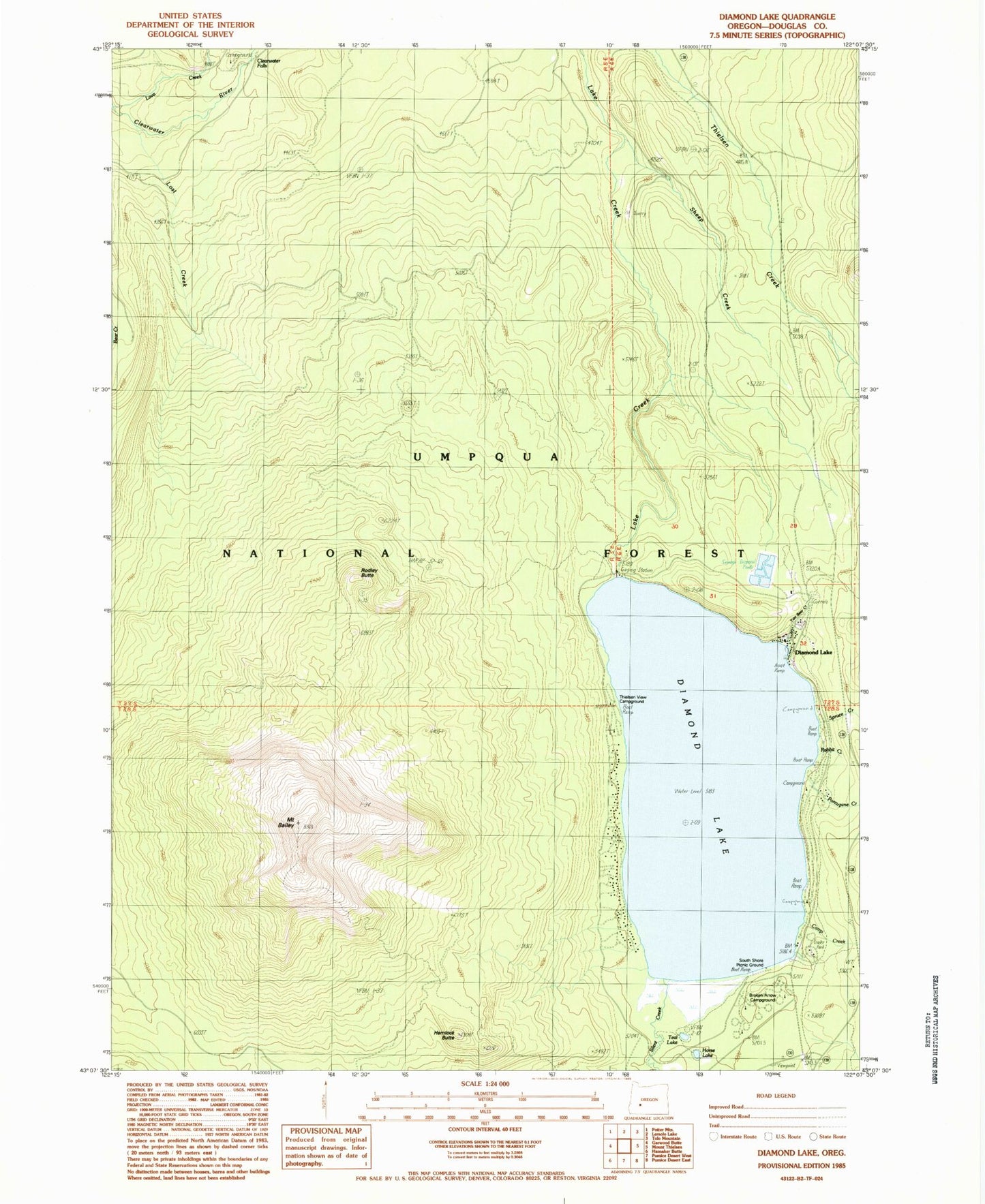
Classic USGS Diamond Lake Oregon 7.5'x7.5' Topo Map
Couldn't load pickup availability
Historical USGS topographic quad map of Diamond Lake in the state of Oregon. Typical map scale is 1:24,000, but may vary for certain years, if available. Print size: 24" x 27"
This quadrangle is in the following counties: Douglas.
The map contains contour lines, roads, rivers, towns, and lakes. Printed on high-quality waterproof paper with UV fade-resistant inks, and shipped rolled.
Contains the following named places: Beartrap Trail, Camp Creek, Camp Creek Forest Camp, Clearwater Falls, Diamond Lake, Diamond Lake, Hemlock Butte, Horse Lake, Lost Creek, Mount Bailey Trail, Porcupine Creek, Rabbit and Porcupine Creek Forest Camp, Rodley Butte, Rodley Butte Trail, Sheep Creek, Short Creek, Silent Creek, Spruce Creek, Teal Lake, Two Bear Creek, White Fir Forest Camp, Rabbit Creek, Broken Arrow Recreation Site, South Shore Recreation Site, Dry Creek, Pumice Beach (historical), Thielsen View Recreation Site, Clearwater Falls Recreation Site, Oregon Cascades Recreation Area, Diamond Lake Guard Station, Mount Bailey, Diamond Lake Recreation Site, Diamond Lake Information Center, Diamond Lake Trailer Camp Area, Diamond Lake Post Office, Howlock Mountain Horse Camp, North End Boat Ramp, Diamond Lake Volunteer Fire Department, Diamond Lake South Shore Boat Ramp, Diamond Lake Campground Boat Ramp