MyTopo
Classic USGS Diamond Mound New Mexico 7.5'x7.5' Topo Map
Regular price
$16.95
Regular price
Sale price
$16.95
Unit price
per
Couldn't load pickup availability
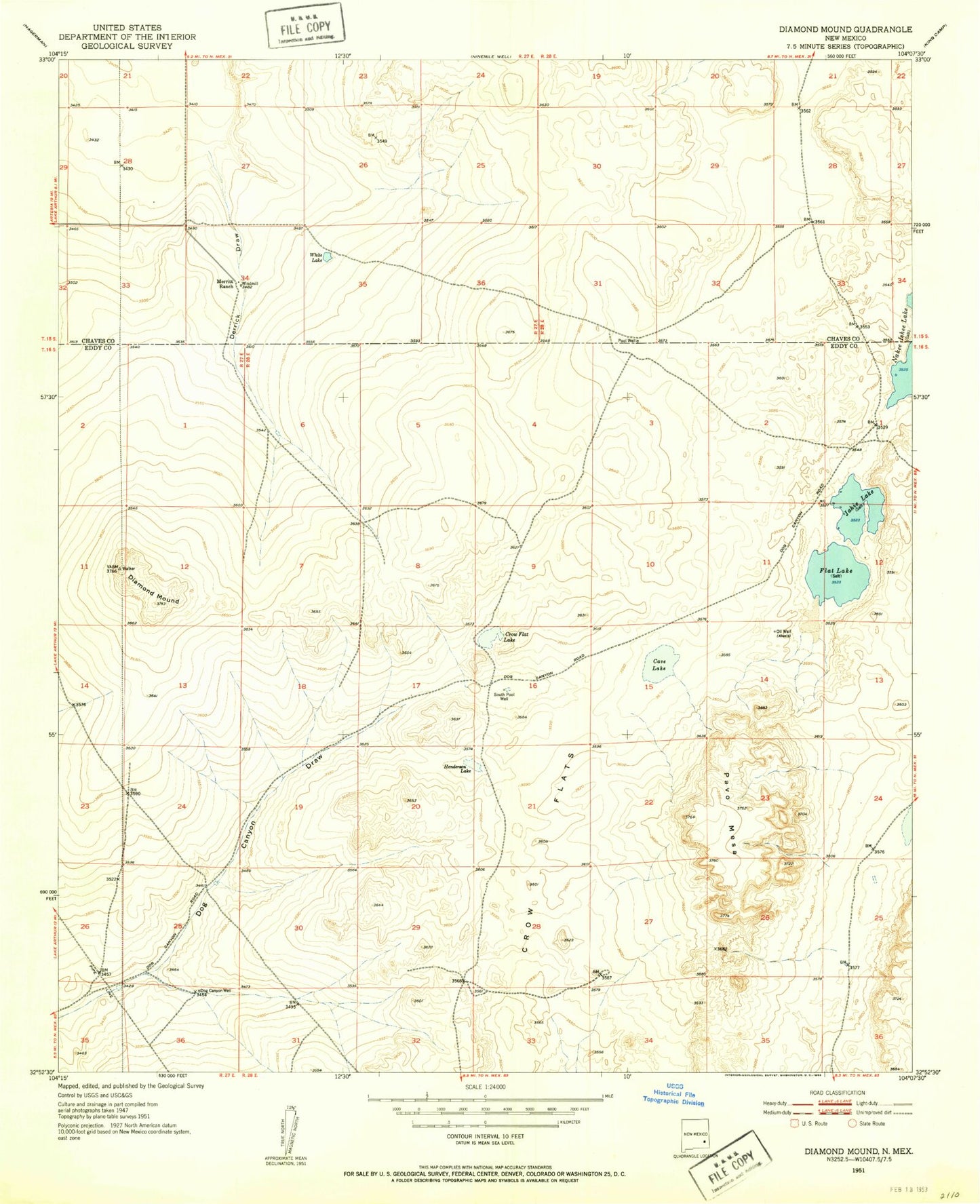
Historical USGS topographic quad map of Diamond Mound in the state of New Mexico. Map scale may vary for some years, but is generally around 1:24,000. Print size is approximately 24" x 27"
This quadrangle is in the following counties: Chaves, Eddy.
The map contains contour lines, roads, rivers, towns, and lakes. Printed on high-quality waterproof paper with UV fade-resistant inks, and shipped rolled.
Contains the following named places: Cave Lake, Crow Flat Lake, Crow Flats, Derrick Draw, Diamond Mound, Dog Canyon Well, Flat Lake, Henderson Lake, Jahie Lake, Merritt Ranch, Pavo Mesa, South Pool Well, White Lake