MyTopo
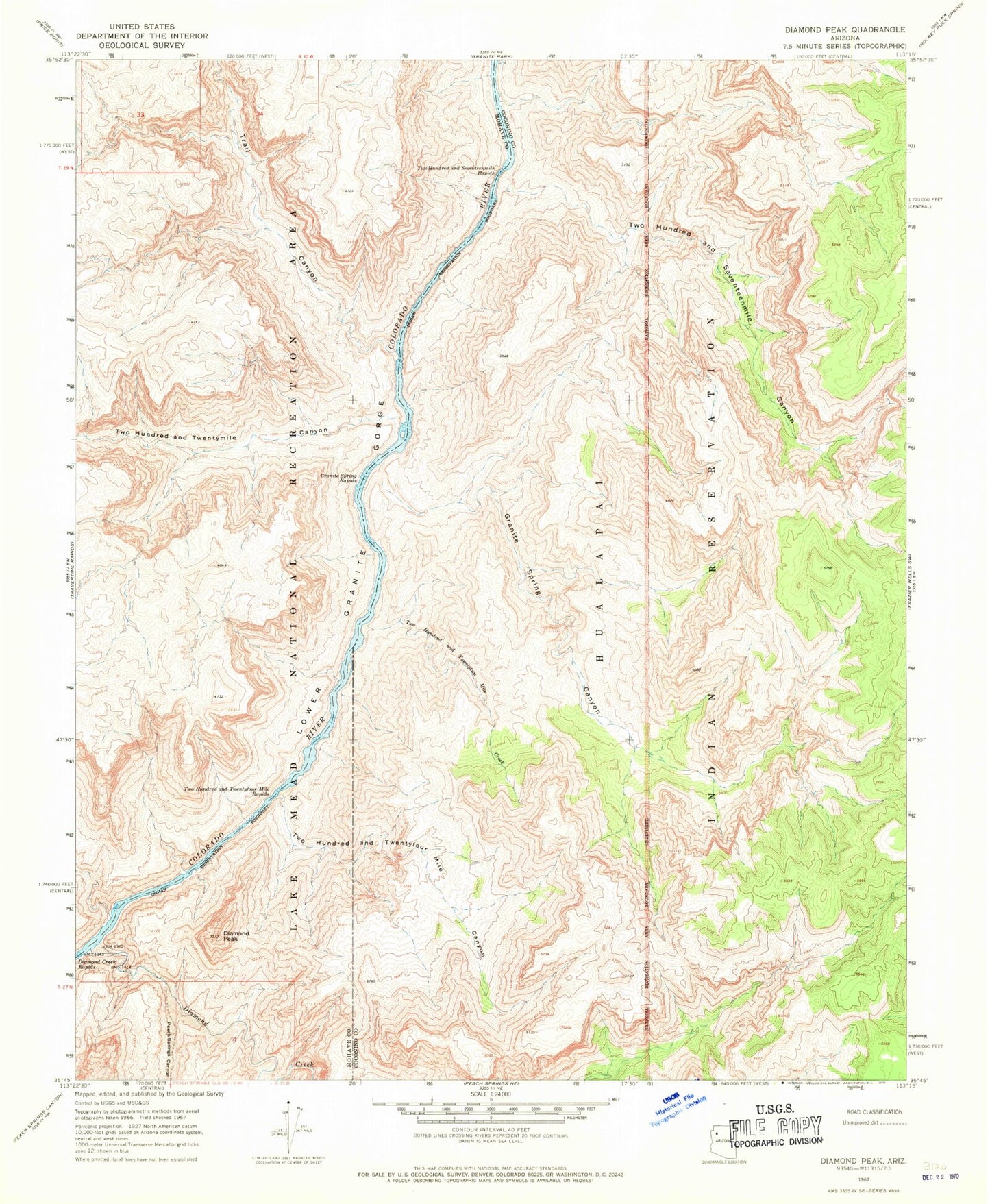
Classic USGS Diamond Peak Arizona 7.5'x7.5' Topo Map
Couldn't load pickup availability
Historical USGS topographic quad map of Diamond Peak in the state of Arizona. Map scale may vary for some years, but is generally around 1:24,000. Print size is approximately 24" x 27"
This quadrangle is in the following counties: Coconino, Mohave.
The map contains contour lines, roads, rivers, towns, and lakes. Printed on high-quality waterproof paper with UV fade-resistant inks, and shipped rolled.
Contains the following named places: Diamond Canyon, Diamond Creek, Diamond Peak, Granite Spring Canyon, Granite Spring Rapids, Peach Springs Canyon, Peach Springs Wash, Roadrunner Rapids, Trail Canyon, Two Hundred and Seventeen Mile Rapids, Two Hundred and Seventeenmile Canyon, Two Hundred and Twentyfour Mile Canyon, Two Hundred and Twentyfour Mile Rapids, Two Hundred and Twentymile Canyon, Two Hundred and Twentytwo Mile Creek