
MyTopo
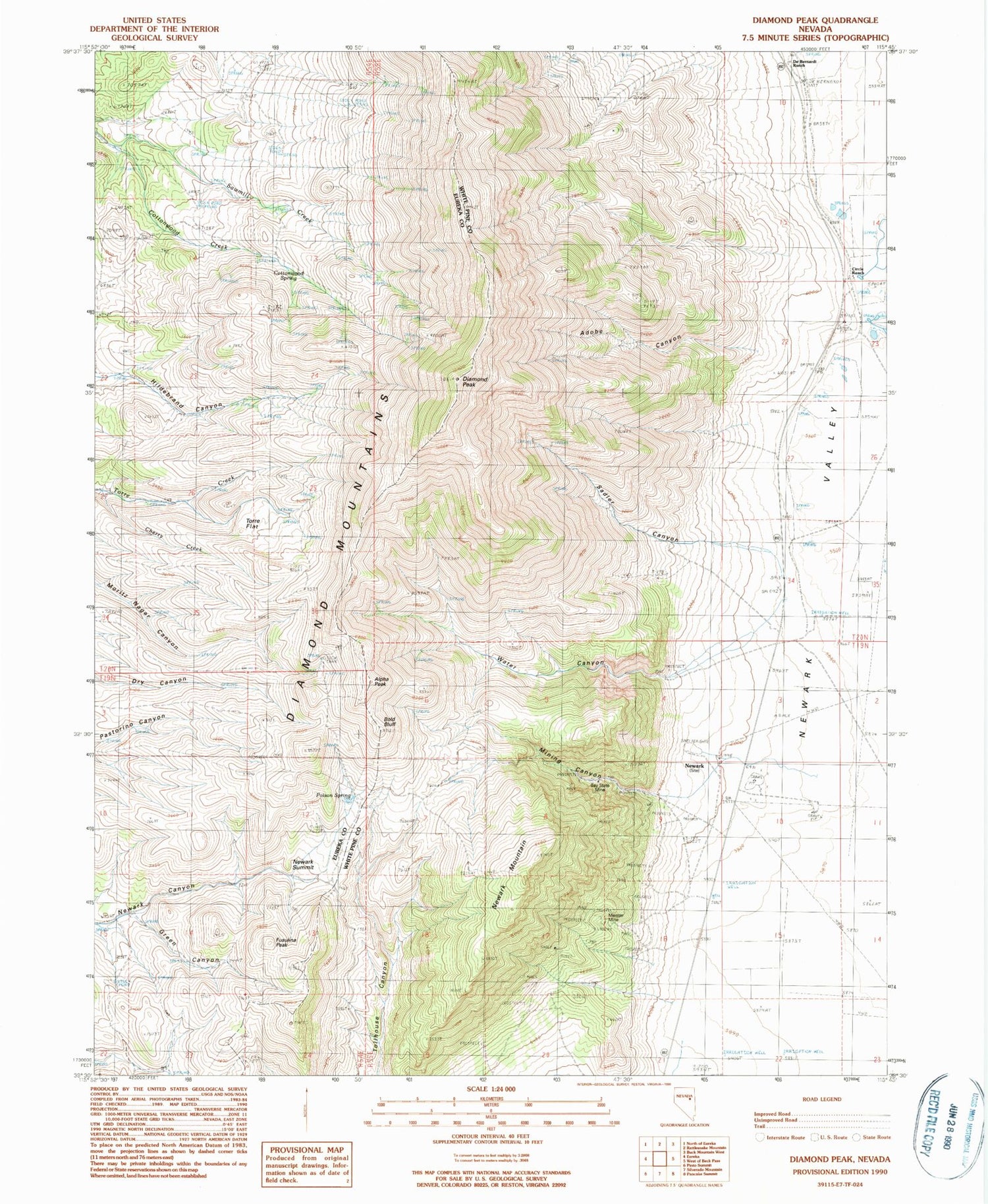
Classic USGS Diamond Peak Nevada 7.5'x7.5' Topo Map
Couldn't load pickup availability
Historical USGS topographic quad map of Diamond Peak in the state of Nevada. Map scale may vary for some years, but is generally around 1:24,000. Print size is approximately 24" x 27"
This quadrangle is in the following counties: Eureka, White Pine.
The map contains contour lines, roads, rivers, towns, and lakes. Printed on high-quality waterproof paper with UV fade-resistant inks, and shipped rolled.
Contains the following named places: Adobe Canyon, Alpha Peak, Battery Mine, Bay State Mine, Bold Bluff, Circle Ranch, Cottonwood Spring, De Bernardi Ranch, Diamond Peak, Fusulina Peak, Gimmie Mine, Green Canyon, Meister Mine, Mining Canyon, Newark, Newark Mill, Newark Mining District, Newark Mountain, Newark Summit, Newark Valley School, Poison Spring, Ratto Ranch, Sadler Canyon, Stinson Spring, Torre Flat, Water Canyon


