MyTopo
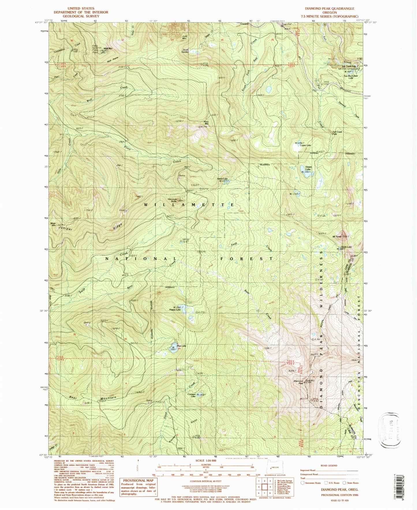
Classic USGS Diamond Peak Oregon 7.5'x7.5' Topo Map
Couldn't load pickup availability
Historical USGS topographic quad map of Diamond Peak in the state of Oregon. Typical map scale is 1:24,000, but may vary for certain years, if available. Print size: 24" x 27"
This quadrangle is in the following counties: Klamath, Lane.
The map contains contour lines, roads, rivers, towns, and lakes. Printed on high-quality waterproof paper with UV fade-resistant inks, and shipped rolled.
Contains the following named places: Bear Creek, Bear Mountain, Binghams Shelter, Blue Lake, Corrigan Lake, Devils Garden, Diamond Camp, Diamond Creek, Diamond Peak, Diamond Peak Trail, Fall Creek, Fall Creek Falls, Happy Lake, Hemlock Butte, Hills Creek Trail, Judd Mountain, Juniper Ridge, Moss Mountain, Notch Lake, Pinto Creek, Pinto Mountain, Pinto Mountain Way, Scout Creek, Too Much Bear Lake, Wolf Mountain, Wolf Mountain Trail, Wolf Prairie, Mount Yoran, Lopez Lake, Vivian Lake, Bect Creek, Salt Creek Falls Recreation Site, Wolf Mountain Recreation Site, Salt Creek Tunnel 2539, Diamond Creek Falls