MyTopo
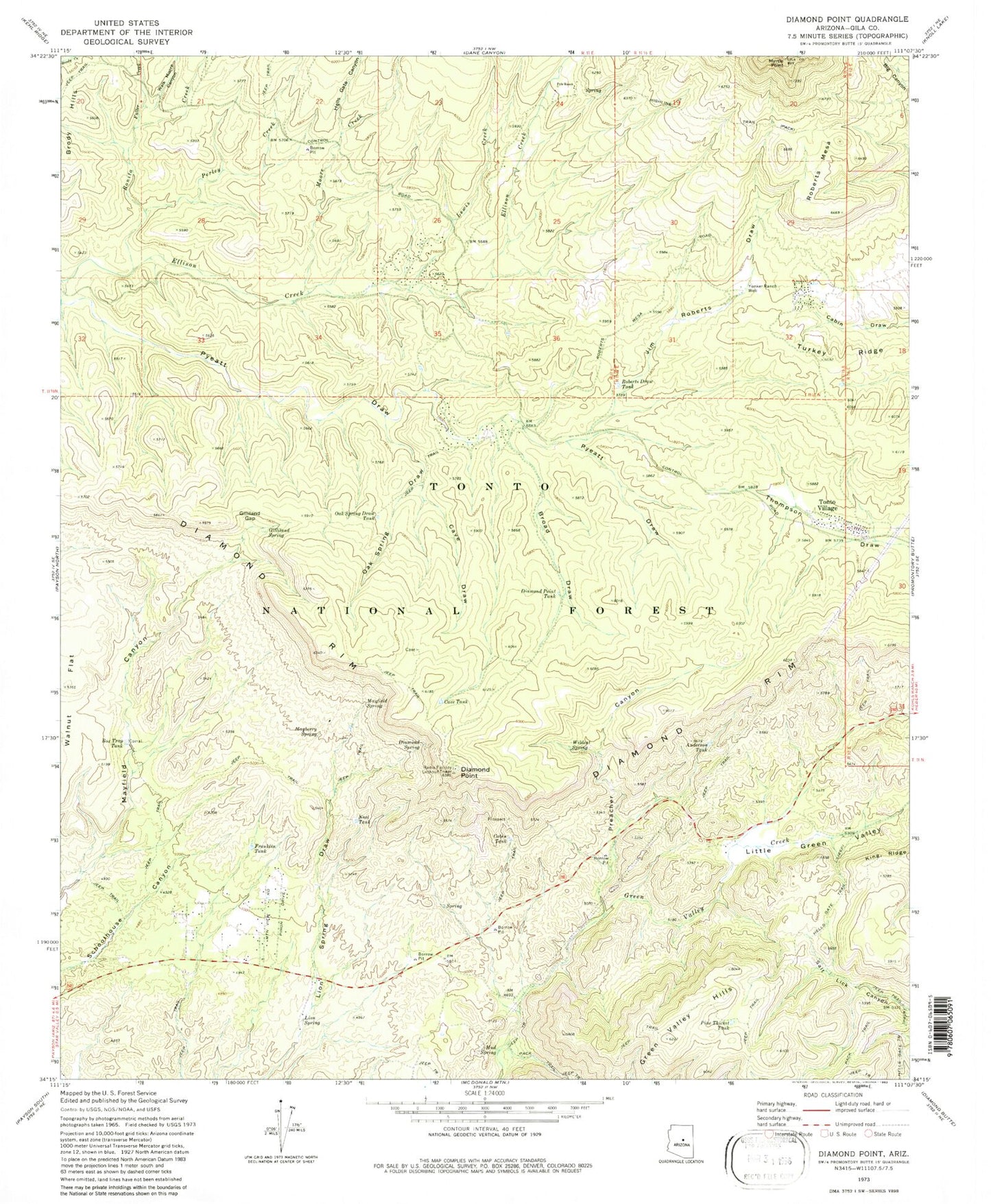
Classic USGS Diamond Point Arizona 7.5'x7.5' Topo Map
Couldn't load pickup availability
Historical USGS topographic quad map of Diamond Point in the state of Arizona. Typical map scale is 1:24,000, but may vary for certain years, if available. Print size: 24" x 27"
This quadrangle is in the following counties: Gila.
The map contains contour lines, roads, rivers, towns, and lakes. Printed on high-quality waterproof paper with UV fade-resistant inks, and shipped rolled.
Contains the following named places: Anderson Tank, Bonita Creek, Box Trap Tank, Broad Draw, Cabin Tank, Cave Draw, Cave Tank, Diamond Point, Diamond Point Tank, Diamond Rim, Diamond Spring, Franklin Tank, Fuller Creek, Gilliland Gap, Gilliland Spring, Green Valley Hills, Hells Gate Canyon, Hells Gate Trail, Highline National Recreation Trail, Jim Roberts Draw, Lewis Creek, Lion Spring, Little Green Valley, Mayberry Spring, Mayfield Spring, Moore Creek, Mud Spring, Myrtle Point, Neal Tank, Oak Spring Draw, Oak Spring Draw Tank, Perley Creek, Pine Thicket Tank, Preacher Canyon, Pyle Ranch, Roberts Draw Tank, Roberts Mesa, Tonto Village, Turkey Ridge, Walk Moore Canyon, Wildcat Spring, Yunker Ranch Well, Diamond Point Lookout Tower, Jackass Tank, Ellison Creek Estates, Diamond Point Shadows, Mead Ranch, La Cienega, Town of Star Valley, Mead Ranch Census Designated Place, Tonto Village Census Designated Place, Hellsgate Fire Department Station 22 Tonto Village, Hellsgate Fire Department Station 23