MyTopo
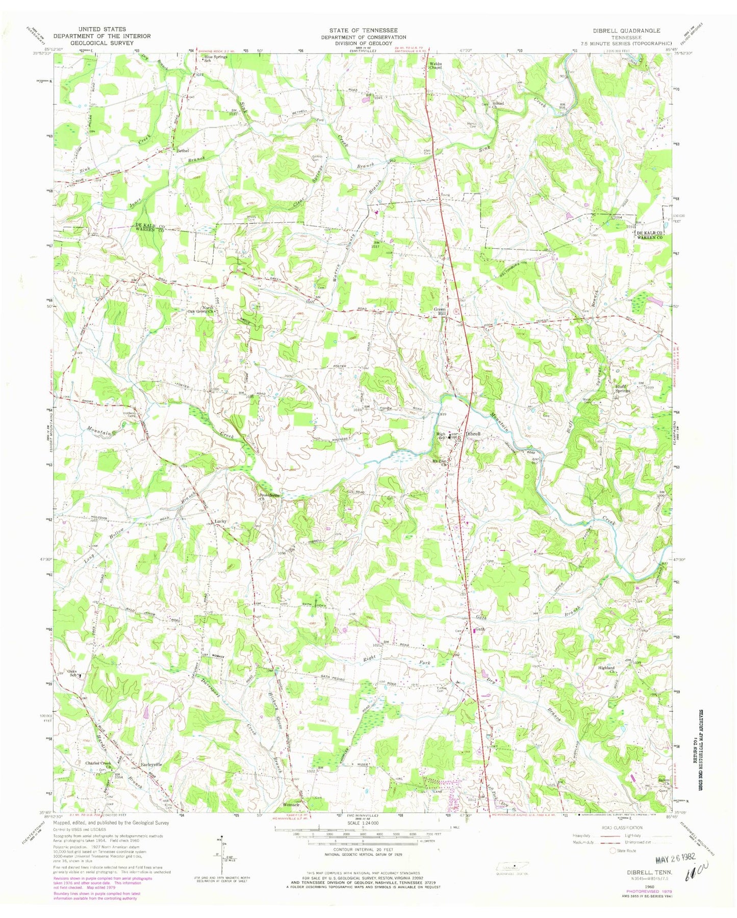
Classic USGS Dibrell Tennessee 7.5'x7.5' Topo Map
Couldn't load pickup availability
Historical USGS topographic quad map of Dibrell in the state of Tennessee. Map scale may vary for some years, but is generally around 1:24,000. Print size is approximately 24" x 27"
This quadrangle is in the following counties: DeKalb, Warren.
The map contains contour lines, roads, rivers, towns, and lakes. Printed on high-quality waterproof paper with UV fade-resistant inks, and shipped rolled.
Contains the following named places: Allen Cemetery, Bear Branch, Bethel, Bethel United Methodist Church, Blue Springs School, Bluff Springs, Bluff Springs Branch, Bluff Springs Church of Christ, Bluff Springs School, Bratcher Cemetery, Cantrell Cemetery, Charles Creek Church, Circle J Tree Farm, Clear Springs Branch, Commissioner District 12, Commissioner District 6, Cumberland School, Dekalb County Fire Department Station 69, Devenport Creek, Dibrell, Dibrell Division, Dibrell Elementary School, Dry Branch, Earleyville, Earleyville Church of Christ, Evanston, Ferrell Cemetery, Fuston Cemetery, Gath, Gath Baptist Church, Gath Branch, Green Hill, Griffith Cemetery, Highland Church, Highland School, Holders Cemetery, Jones Branch, Jones Mill, Kirby Cemetery, Long Hollow Branch, Lucky, Magnum, Martin Cemetery, Mizer Swamp, Mount Zion Church, Mountain View School, New Bildad Primitive Baptist Church, New Bildad Primitive Baptist Church Cemetery, North Oak Grove Church, North Warren Volunteer Fire Department Station 1, Oak Grove School, Oaks School, Providence Church, Salem Church, Ward Cemetery, Warren County Branch, Webb Cemetery, Webbs Chapel, Womack, Womacks Mill