MyTopo
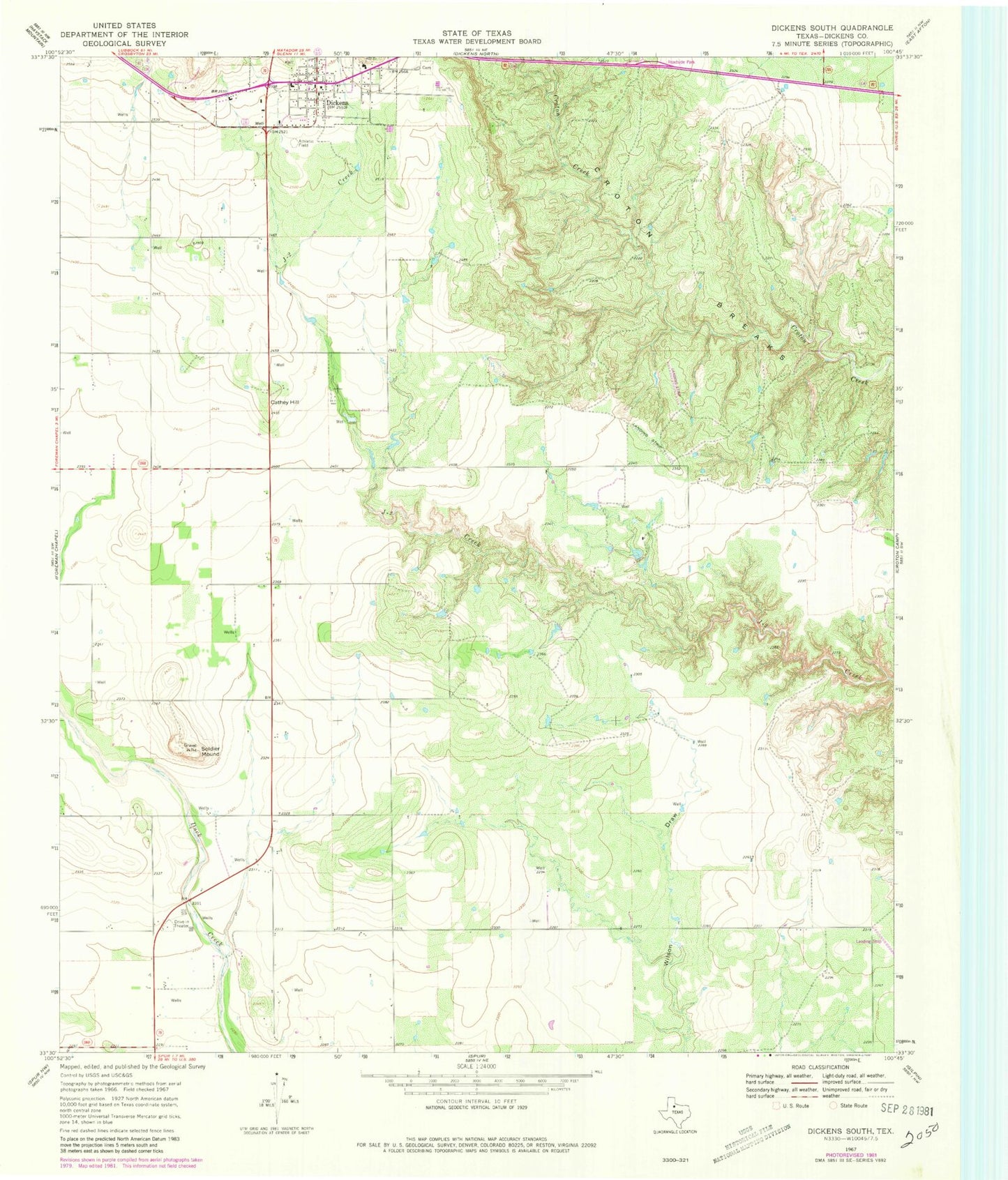
Classic USGS Dickens South Texas 7.5'x7.5' Topo Map
Couldn't load pickup availability
Historical USGS topographic quad map of Dickens South in the state of Texas. Map scale may vary for some years, but is generally around 1:24,000. Print size is approximately 24" x 27"
This quadrangle is in the following counties: Dickens.
The map contains contour lines, roads, rivers, towns, and lakes. Printed on high-quality waterproof paper with UV fade-resistant inks, and shipped rolled.
Contains the following named places: Cathey Hill, City of Dickens, Dickens, Dickens Cemetery, Dickens City Hall, Dickens County, Dickens County Ambulance Service, Dickens County Museum, Dickens County Sheriff's Office, Dickens Post Office, Dickens Volunteer Fire Department, Lehew Dam Number 1, Lehew Dam Number 2, Lehew Lake Number 1, Lehew Lake Number 2, Soldier Mound, Soldiers Mound