MyTopo
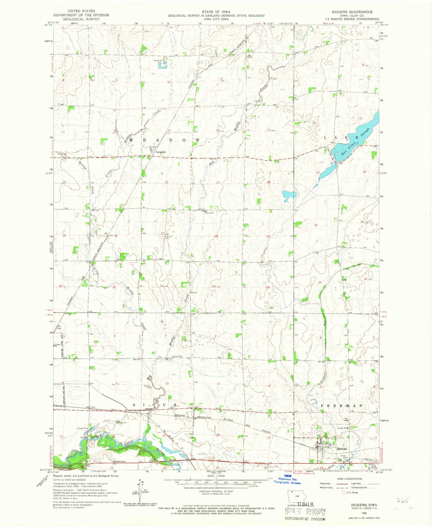
Classic USGS Dickens Iowa 7.5'x7.5' Topo Map
Couldn't load pickup availability
Historical USGS topographic quad map of Dickens in the state of Iowa. Map scale may vary for some years, but is generally around 1:24,000. Print size is approximately 24" x 27"
This quadrangle is in the following counties: Clay.
The map contains contour lines, roads, rivers, towns, and lakes. Printed on high-quality waterproof paper with UV fade-resistant inks, and shipped rolled.
Contains the following named places: A K Stock Farms, Big Muddy Creek, City of Dickens, Country Villa Mobile Home Park, Dan Green Slough, De Wolf Park, Dickens, Dickens Cemetery, Dickens Fire Department, Dickens Post Office, Dickens Public Library, Double D Farms, Fairview Cemetery, Freeman Post Office, Hamrick Farms, Hansen Farms, Hawk Valley Wildlife Management Area, Iowlea Farms, Kingdom Hall, KJJG-FM (Spencer), KRGS-FM (Spencer), Langdon, Langdon Post Office, Little Meadow Creek, Little Muddy Creek, McCune Farm, Oneota Little Sioux Access, Oneota Park, Pickerel Run, Plum Broke Ranch, Prospect, Prospect Post Office, Schmerse Wildlife Area, Stouffer Memorial Wildlife Preserve, Swart Farms, Township of Meadow, West Bend Elevator Company Elevator