MyTopo
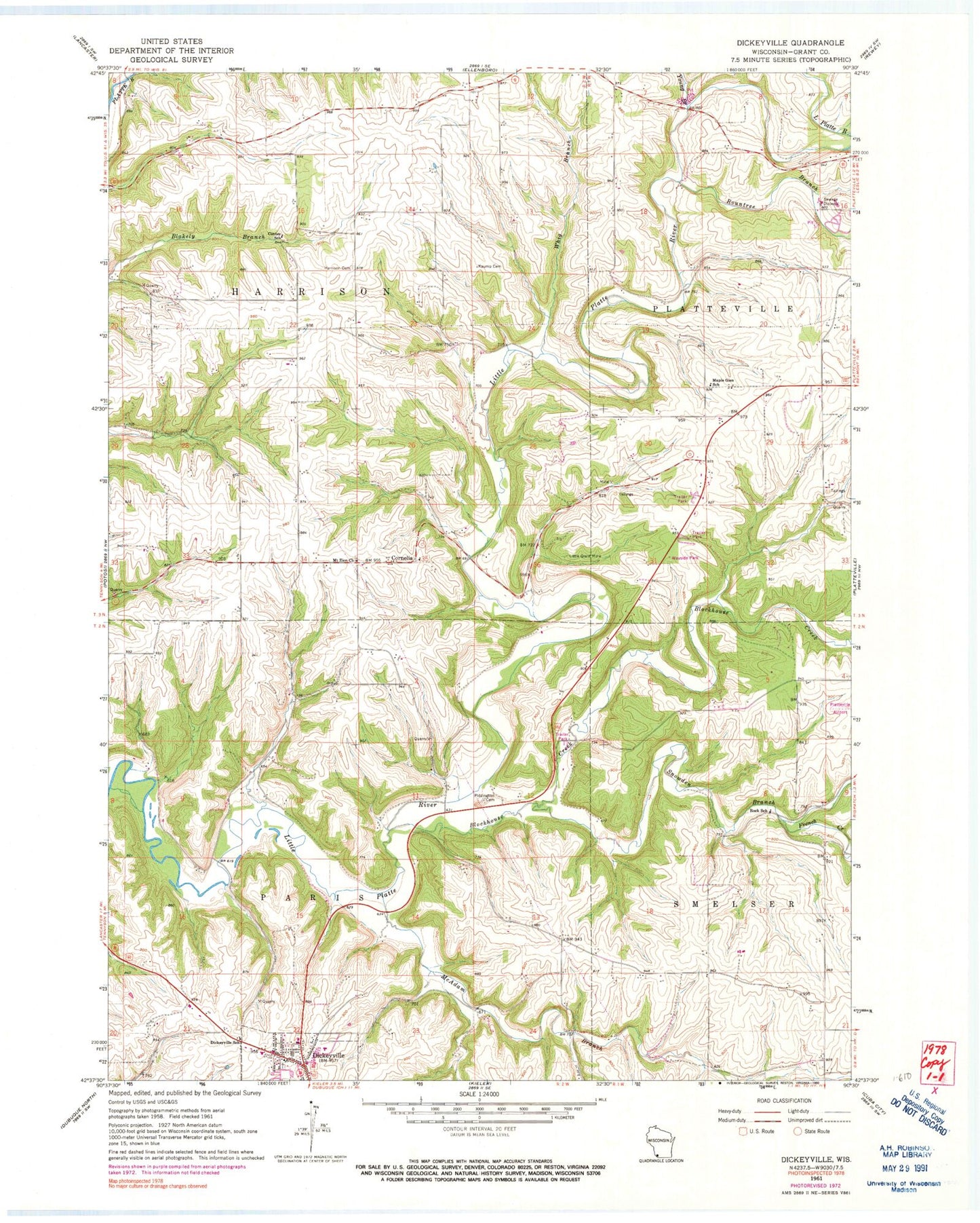
Classic USGS Dickeyville Wisconsin 7.5'x7.5' Topo Map
Couldn't load pickup availability
Historical USGS topographic quad map of Dickeyville in the state of Wisconsin. Map scale may vary for some years, but is generally around 1:24,000. Print size is approximately 24" x 27"
This quadrangle is in the following counties: Grant.
The map contains contour lines, roads, rivers, towns, and lakes. Printed on high-quality waterproof paper with UV fade-resistant inks, and shipped rolled.
Contains the following named places: Blockhouse Creek, Brogley Farms, Center School, Cornelia, Dickeyville, Dickeyville Elementary School, Dickeyville Police Department, Dickeyville Post Office, French Creek, Grimes Farm, Harrison Cemetery, Holy Ghost Immaculate Conception School, Kaump Cemetery, Little Grant Mine, Maple Glen School, McAdam Branch, Mount Zion Church, Piddington Cemetery, Platte Road Bridge, Platteville Wastewater Treatment Facility, R and R Farms, Rountree Branch, Saddleback Farms, Snowden Branch, Town of Harrison, Town of Paris, Vannatta Farms, Whig Branch, Young Branch, ZIP Code: 53808