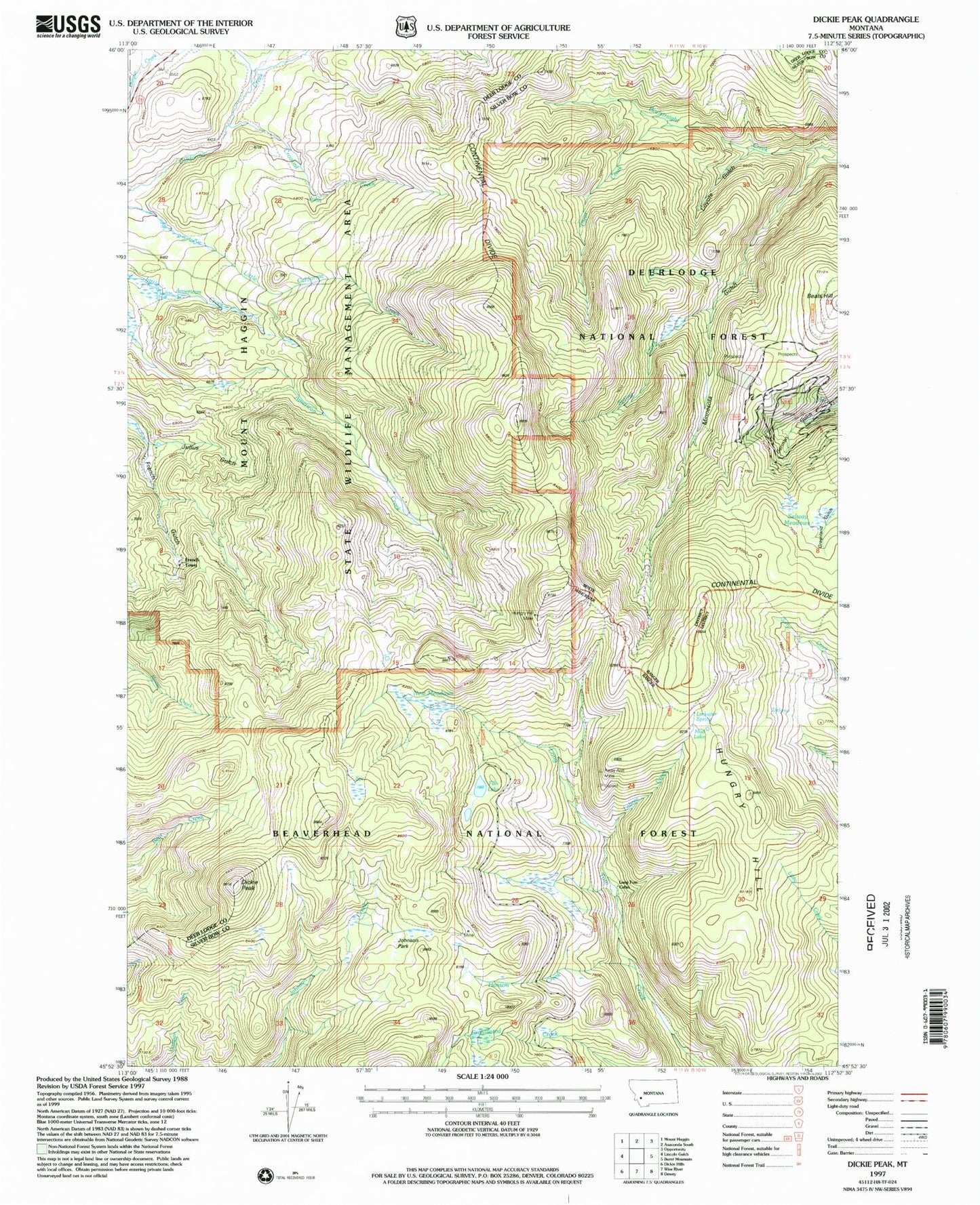
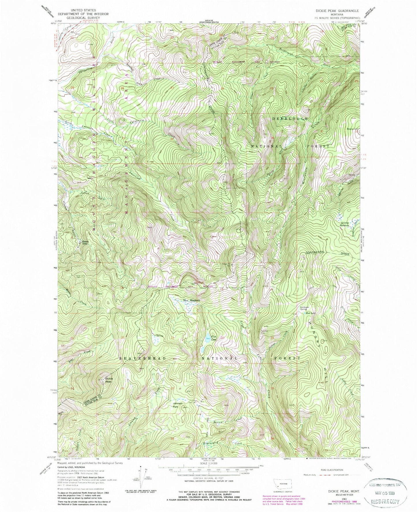
MyTopo
Classic USGS Dickie Peak Montana 7.5'x7.5' Topo Map
Couldn't load pickup availability
Historical USGS topographic quad map of Dickie Peak in the state of Montana. Typical map scale is 1:24,000, but may vary for certain years, if available. Print size: 24" x 27"
This quadrangle is in the following counties: Deer Lodge, Silver Bow.
The map contains contour lines, roads, rivers, towns, and lakes. Printed on high-quality waterproof paper with UV fade-resistant inks, and shipped rolled.
Contains the following named places: Clear Creek, Coyote Gulch, Crooked John Creek, Dickie Peak, Fish Lake, French Town, Hanson Creek, Hungry Hill, Hungry Hill Mine, Johnson Peak, Julius Gulch, Larkspur Spring, Minnesota Gulch, Mud Lake, New Meadows, Patsy Ann Mine, Pine Dale Cow Cabin, Selway Meadows, Spring Creek, Beals Hill, Pine Dale Mine, Patsy Ann Mine