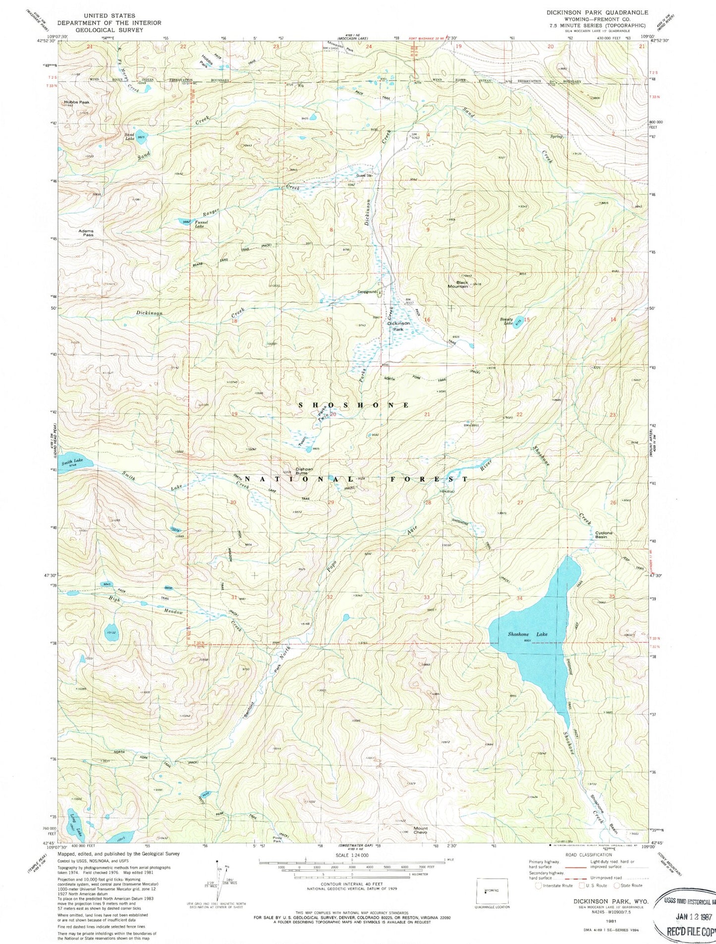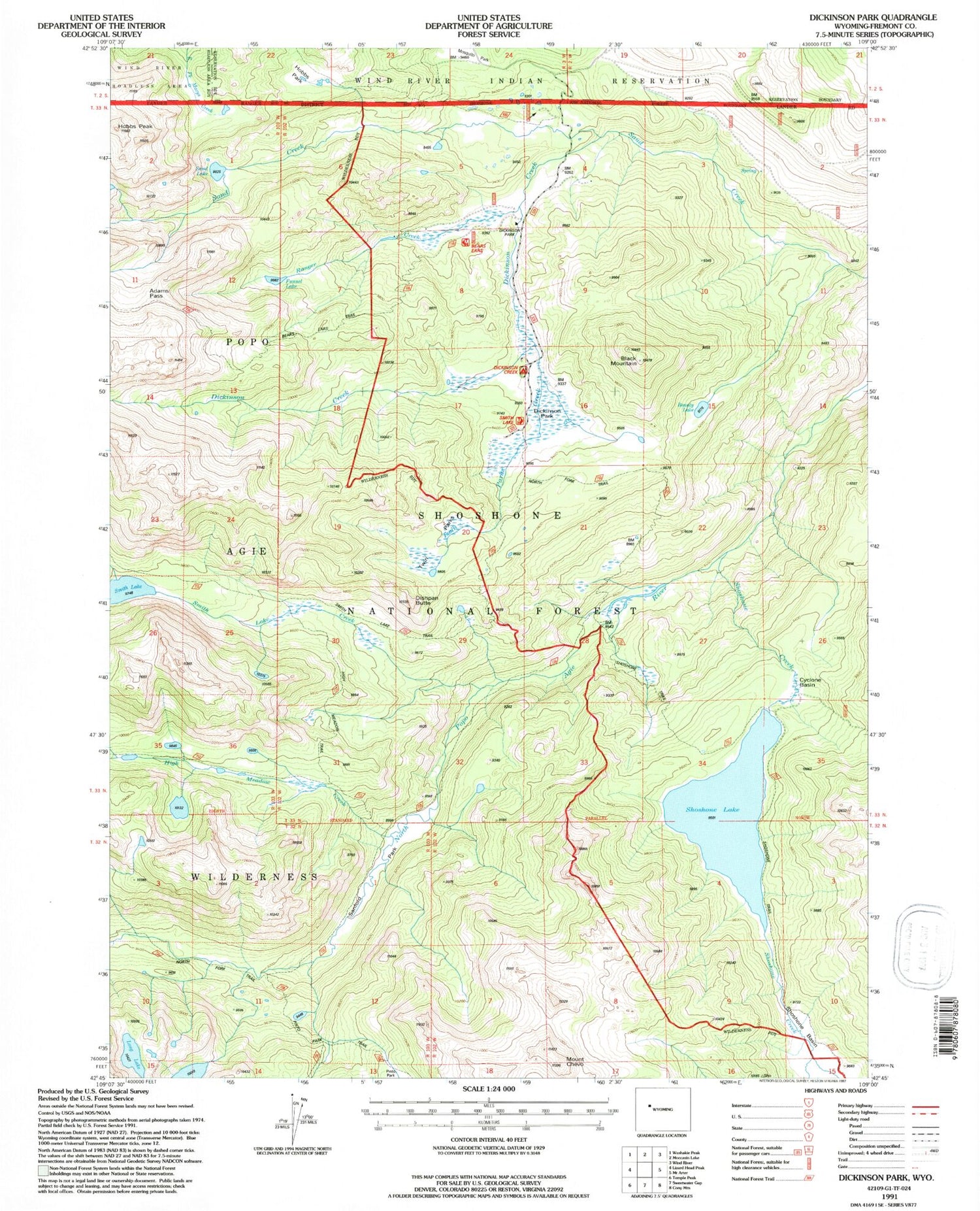
MyTopo
USGS Classic Dickinson Park Wyoming 7.5'x7.5' Topo Map
Couldn't load pickup availability
Historical USGS topographic quad map of Dickinson Park in the state of Wyoming. Scale: 1:24000. Print size: 24" x 27"
This quadrangle is in the following counties: Fremont.
The map contains contour lines, roads, rivers, towns, lakes, and grids including latitude / longitude and UTM / MGRS. Printed on high-quality waterproof paper with UV fade-resistant inks.
Contains the following named places: Adams Pass, Beauty Lake, Black Mountain, Mount Chevo, Cyclone Basin, Dickinson Creek Campground, Dickinson Park, Dickinson Park Guard Station, Dishpan Butte, Funnel Lake, High Meadow, Hobbs Park, Hobbs Peak, Ice Lakes Trail, Long Lake, Ranger Creek, Sand Lake, Sandord Park, Shoshone Lake, Smith Lake Creek, Smith Lake Trail, Twin Parks Creek, Dickinson Creek, High Meadow Creek, Shoshone Creek, Smith Lake, Twin Parks, Shoshone Lake Dam, High Meadow Trail, Bald Mountain Area Mine