MyTopo
Classic USGS Dierks Dam Arkansas 7.5'x7.5' Topo Map
Couldn't load pickup availability
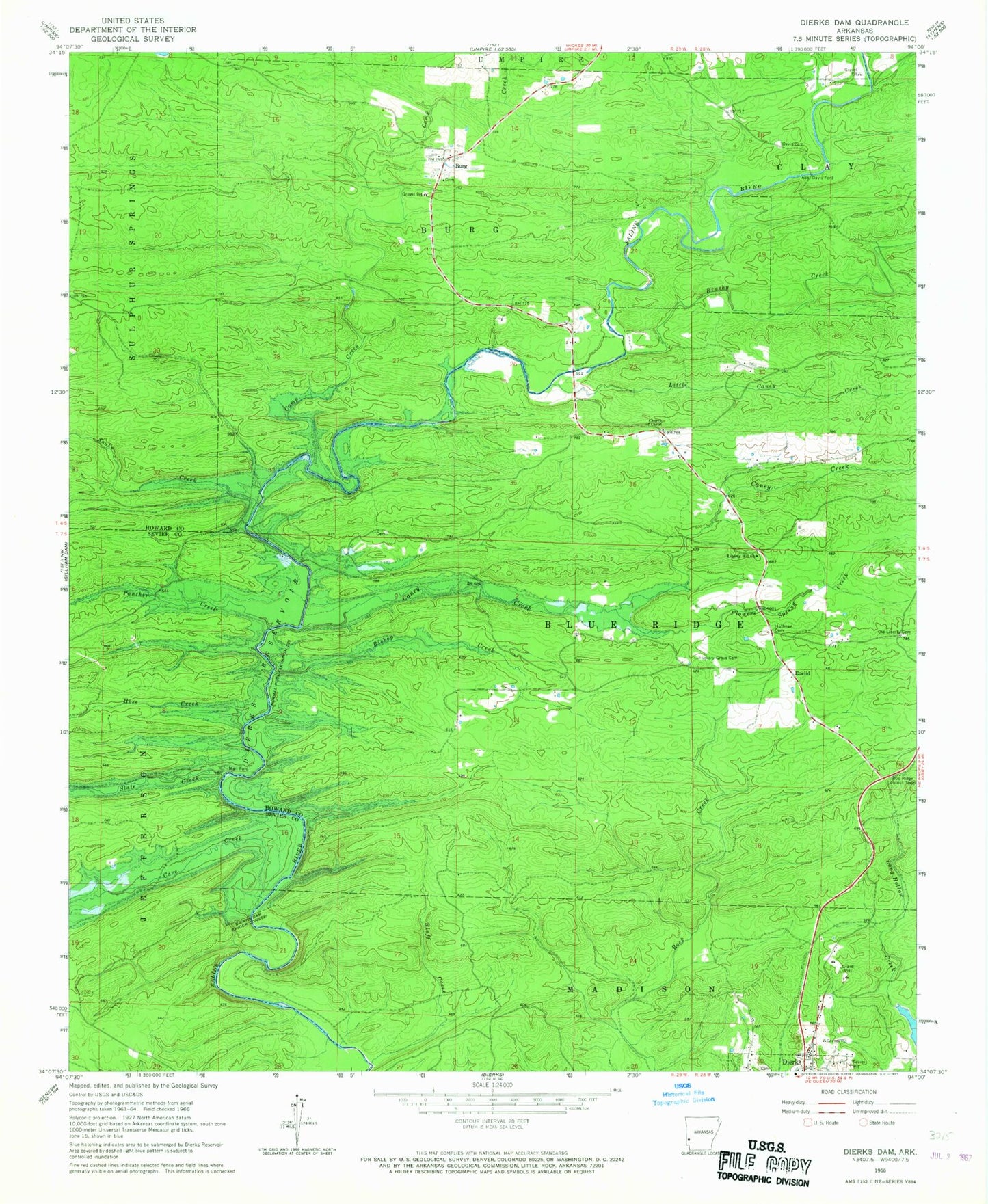
Historical USGS topographic quad map of Dierks Dam in the state of Arkansas. Map scale may vary for some years, but is generally around 1:24,000. Print size is approximately 24" x 27"
This quadrangle is in the following counties: Howard, Sevier.
The map contains contour lines, roads, rivers, towns, and lakes. Printed on high-quality waterproof paper with UV fade-resistant inks, and shipped rolled.
Contains the following named places: Amos Branch, Bishop Creek, Blue Ridge Use Area, Bluff Creek, Bolland School, Brushy Creek, Burg, Camp Creek, Caney Creek, Cave Creek, Davis Cemetery, Davis Ford, Dierks Dam, Euclid, Flowers Mill Crossing, Flowers Spring, Flowers Spring Creek, Hickory Grove Cemetery, Horseshoe Bend Use Area, Hose Creek, Huffman Cemetery, Liberty Hill Church, Little Caney Creek, Long Hollow Creek, Mail Ford, New Liberty School, Oak Hill Cemetery, Oak Hill Church, Oak Hill School, Old Euclid, Old Liberty Cemetery, Oreb, Panther Creek, Potts Ford, Rough Edge, Slate Creek, Snake Creek, Thompson Ford, Township of Blue Ridge, Township of Burg, Umpire Volunteer Fire Department, Utah School, ZIP Code: 71833