MyTopo
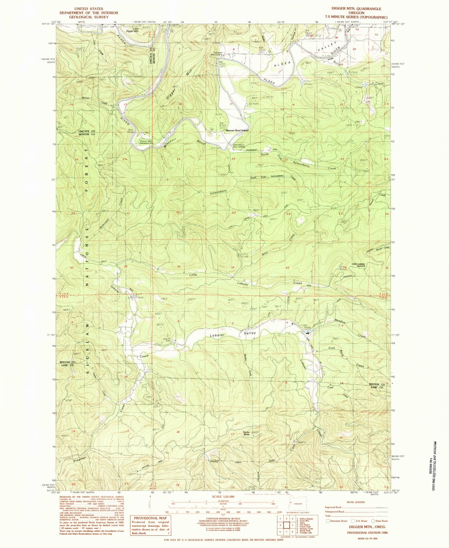
Classic USGS Digger Mountain Oregon 7.5'x7.5' Topo Map
Couldn't load pickup availability
Historical USGS topographic quad map of Digger Mountain in the state of Oregon. Map scale may vary for some years, but is generally around 1:24,000. Print size is approximately 24" x 27"
This quadrangle is in the following counties: Benton, Lane, Lincoln.
The map contains contour lines, roads, rivers, towns, and lakes. Printed on high-quality waterproof paper with UV fade-resistant inks, and shipped rolled.
Contains the following named places: Alsea Valley, Bear Creek, Benner Creek, Bovine Creek, Box, Box Post Office, Briar Creek, Burch Creek, Campbell Boat Landing, Campbell County Park, Coal Bank Creek, Cook Creek, Digger Mountain, Jasper Creek, Little Digger Mountain, Little Lobster Creek, Little Lobster Summit, Lobster Post Office, Lobster Valley, Lobster Valley Cemetery, Lone Fir Cemetery, Maltby Creek, Martha Creek, Meadow Creek, Missouri Bend, Missouri Bend Recreation Site, Missouri Bend School, Narrow Creek, North Fork Salmonberry Creek, Preacher Creek, Salmonberry Boat Landing, Salmonberry County Park & Campground, Salmonberry Creek, Schoolhouse Creek, Scoville Spring, South Fork Salmonberry Creek, Taylor Butte, Wilkinson Creek, Wilson Ridge, Yew Wood Camp