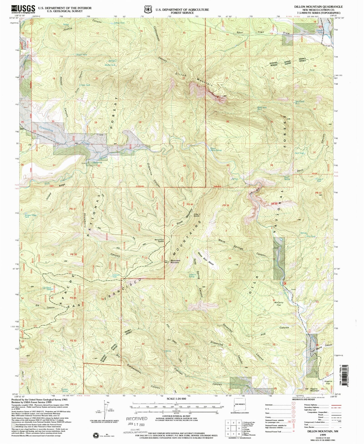
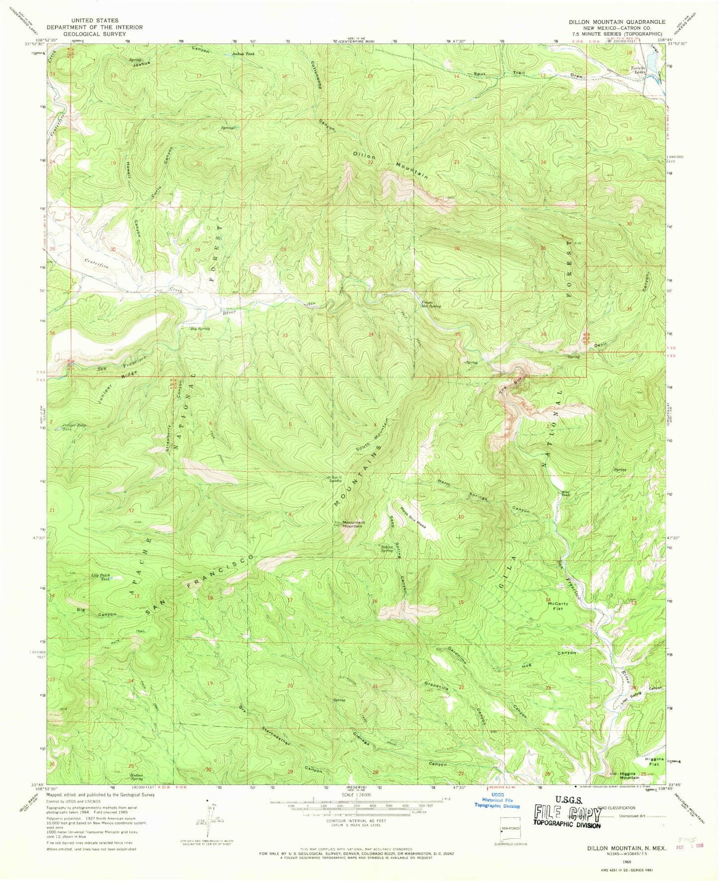
MyTopo
Classic USGS Dillon Mountain New Mexico 7.5'x7.5' Topo Map
Couldn't load pickup availability
Historical USGS topographic quad map of Dillon Mountain in the state of New Mexico. Typical map scale is 1:24,000, but may vary for certain years, if available. Print size: 24" x 27"
This quadrangle is in the following counties: Catron.
The map contains contour lines, roads, rivers, towns, and lakes. Printed on high-quality waterproof paper with UV fade-resistant inks, and shipped rolled.
Contains the following named places: Big Spring, Curio Canyon, Devil Canyon, Dillon Mountain, Frisco Hot Spring, Geronimo Canyon, Grapevine Canyon, H Bar V Saddle, Hog Canyon, Howell Canyon, Hudson Spring, Indian Spring, Joshua Canyon, Joshua Tank, Juniper Ridge, Juniper Ridge Tank, Lily Patch Tank, Lost Spring Canyon, McCarty Flat, Mess Box Mesa, Miller Ranch, Monument Mountain, Seep Spring Canyon, South Mountain, Spur Trail Draw, Strawberry Canyon, The Box, Toriette Lakes, Warm Springs Canyon, Lion Spring, Skunk Spring, Bill Lewis Spring, Pine Canyon, Mess Box Spring, Crass V Tank, Bill Lewis Mesa, Pine Tank, Devil Tank Number Two, Devil Tank, Devil Spring, Strawberry Tank, Curio Tank, Howell Tank, Shelby Tank, Lonnie Tank, Devil Tank Number One, Heifer Basin Tank, Liedman Tank, Centerfire Creek, Upper Frisco Hot Springs