MyTopo
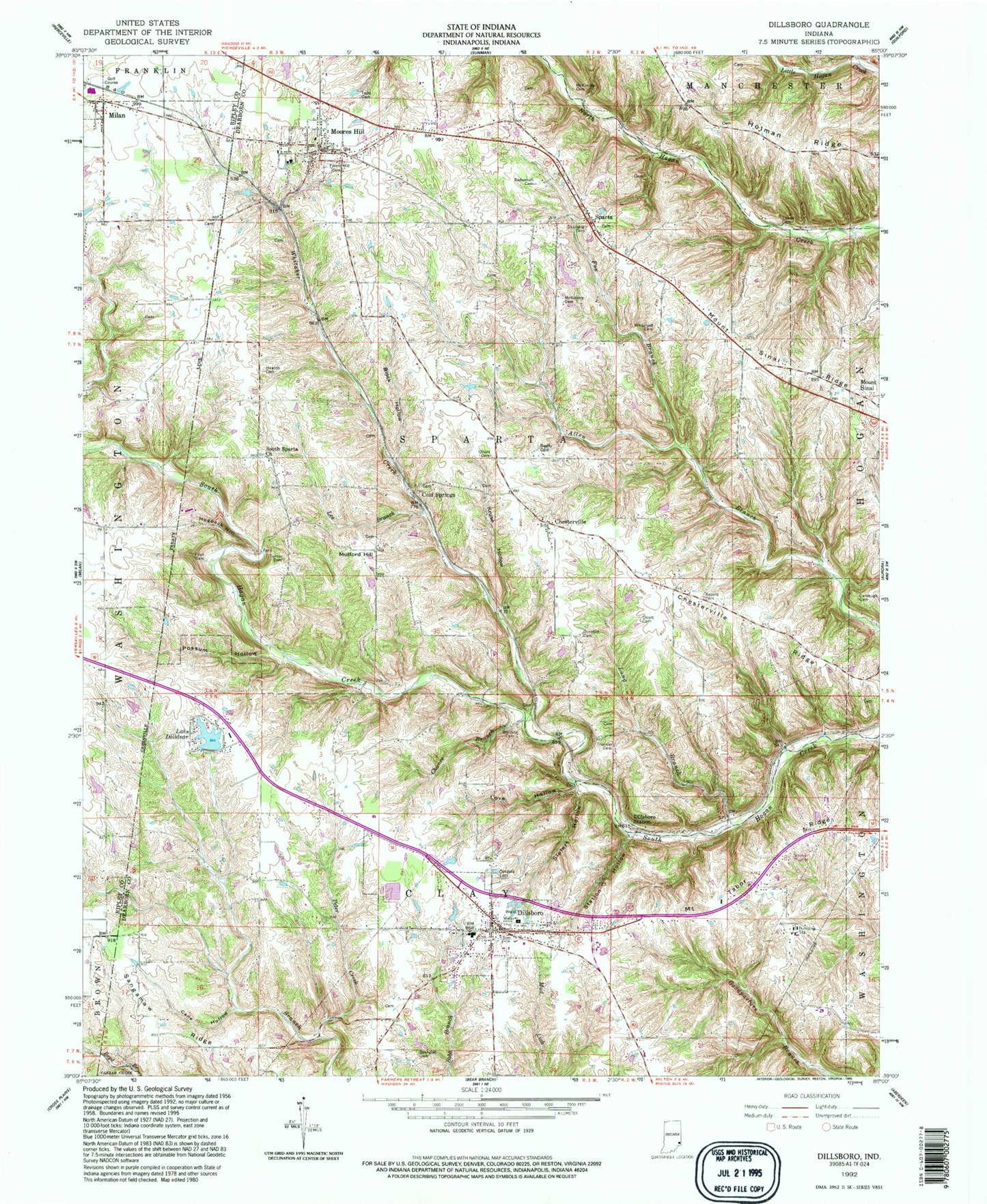
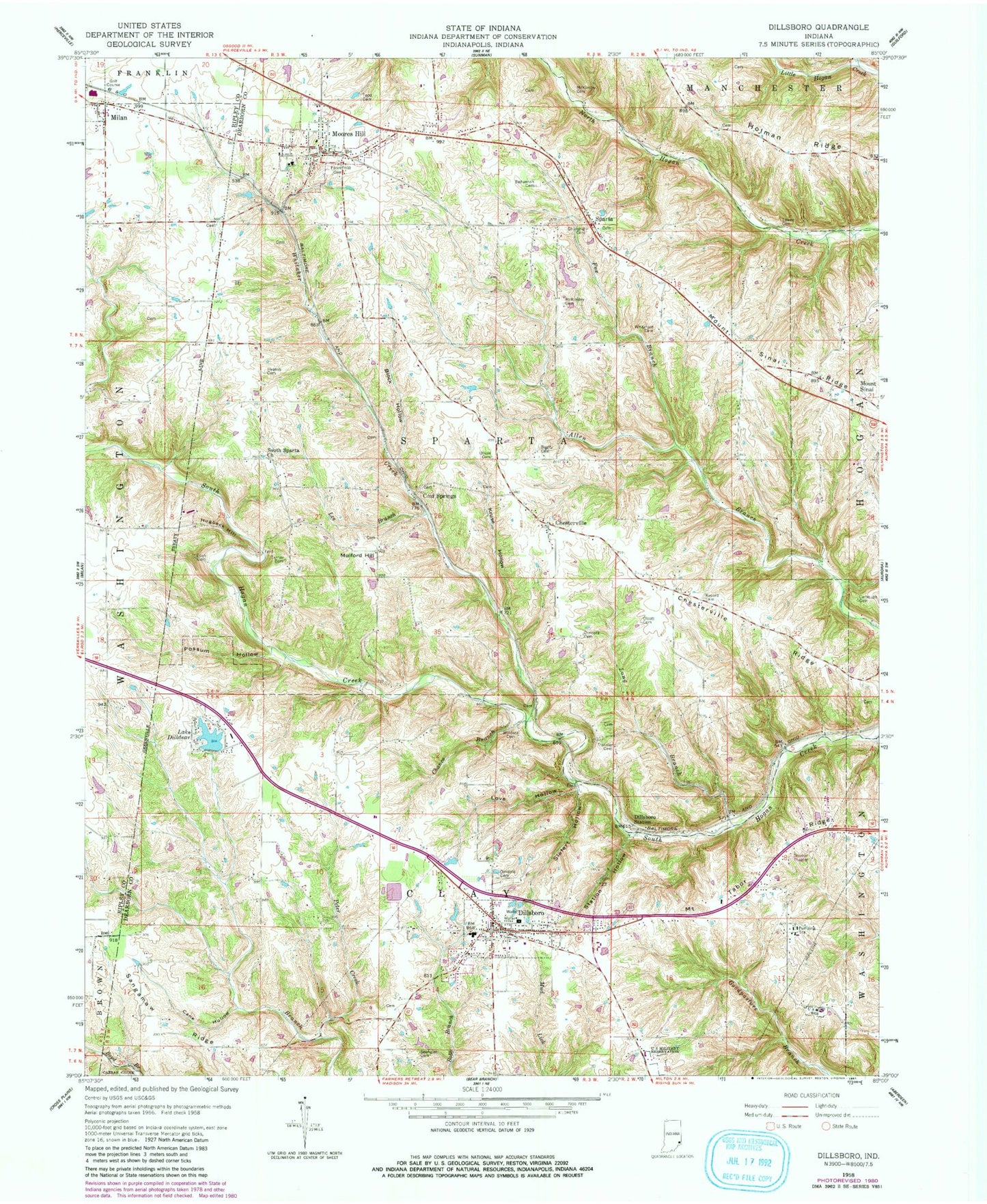
Classic USGS Dillsboro Indiana 7.5'x7.5' Topo Map
Couldn't load pickup availability
Historical USGS topographic quad map of Dillsboro in the state of Indiana. Typical map scale is 1:24,000, but may vary for certain years, if available. Print size: 24" x 27"
This quadrangle is in the following counties: Dearborn, Ripley.
The map contains contour lines, roads, rivers, towns, and lakes. Printed on high-quality waterproof paper with UV fade-resistant inks, and shipped rolled.
Contains the following named places: Beatty Cemetery, Bedunnah Cemetery, Burton Branch, Cane Hollow, Carbaugh Cemetery, Chance Branch, Chesterville, Chesterville Ridge, Churchill Cemetery, Concord Cemetery, Lake Dilldear, Dillsboro, Dillsboro Station, Eden Cemetery, Forest Hill Cemetery, Fox Branch, Heaton Cemetery, Kruse Hollow, Lee Branch, Long Branch, Love Hollow, Lowes Cemetery, McKinstry Cemetery, McKinstry Cemetery, Moores Hill, Mount Sinai Ridge, Mount Tabor Ridge, Oakdale Cemetery, Olcott Cemetery, Peter Creek, Possum Hollow, Record Cemetery, Sangamaw Ridge, Siefert Hollow, South Sparta Church, Spangler Cemetery, Sparta, Station Hollow, Todd Cemetery, Transier Cemetery, Turner Cemetery, Union Cemetery, Whitaker Creek, Whiteford Cemetery, Windsor Cemetery, Moores Hill Elementary School, Dillsboro Elementary School, Hogback Hill, Mulford Hill, Meyer Lake Dam, Lake Dilldear Dam, Hough Lake Dam, Hough Lake, Cold Springs, Township of Clay, Township of Sparta, Town of Dillsboro, Town of Moores Hill, Dillsboro Volunteer Fire Department, Moores Hill Sparta Township Fire and Emergency Services, Josephs Field, Dillsboro EMS, Dillsboro Police Department, Dillsboro Post Office, Moores Hill Post Office