
MyTopo
Classic USGS Dinner Island Florida 7.5'x7.5' Topo Map
Regular price
$16.95
Regular price
Sale price
$16.95
Unit price
per
Couldn't load pickup availability
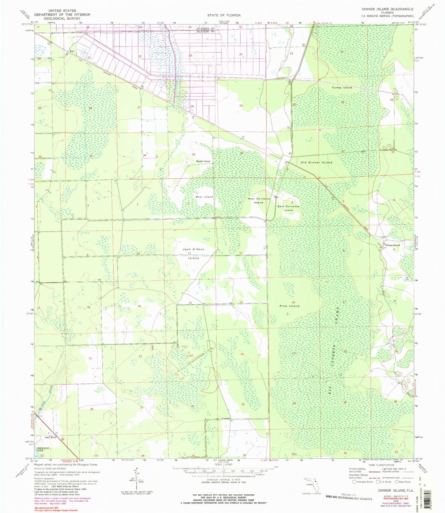
Historical USGS topographic quad map of Dinner Island in the state of Florida. Map scale may vary for some years, but is generally around 1:24,000. Print size is approximately 24" x 27"
This quadrangle is in the following counties: Flagler, St. Johns.
The map contains contour lines, roads, rivers, towns, and lakes. Printed on high-quality waterproof paper with UV fade-resistant inks, and shipped rolled.
Contains the following named places: Bear Island, Big Cypress Swamp, Dinner Island, East Durrance Island, Jack O'Neck Island, Myrtle Island, Old Dinner Island, Pine Island, Potatoville Railroad Station, Roy, Shell Bluff, Turkey Island, West Durrance Island


