MyTopo
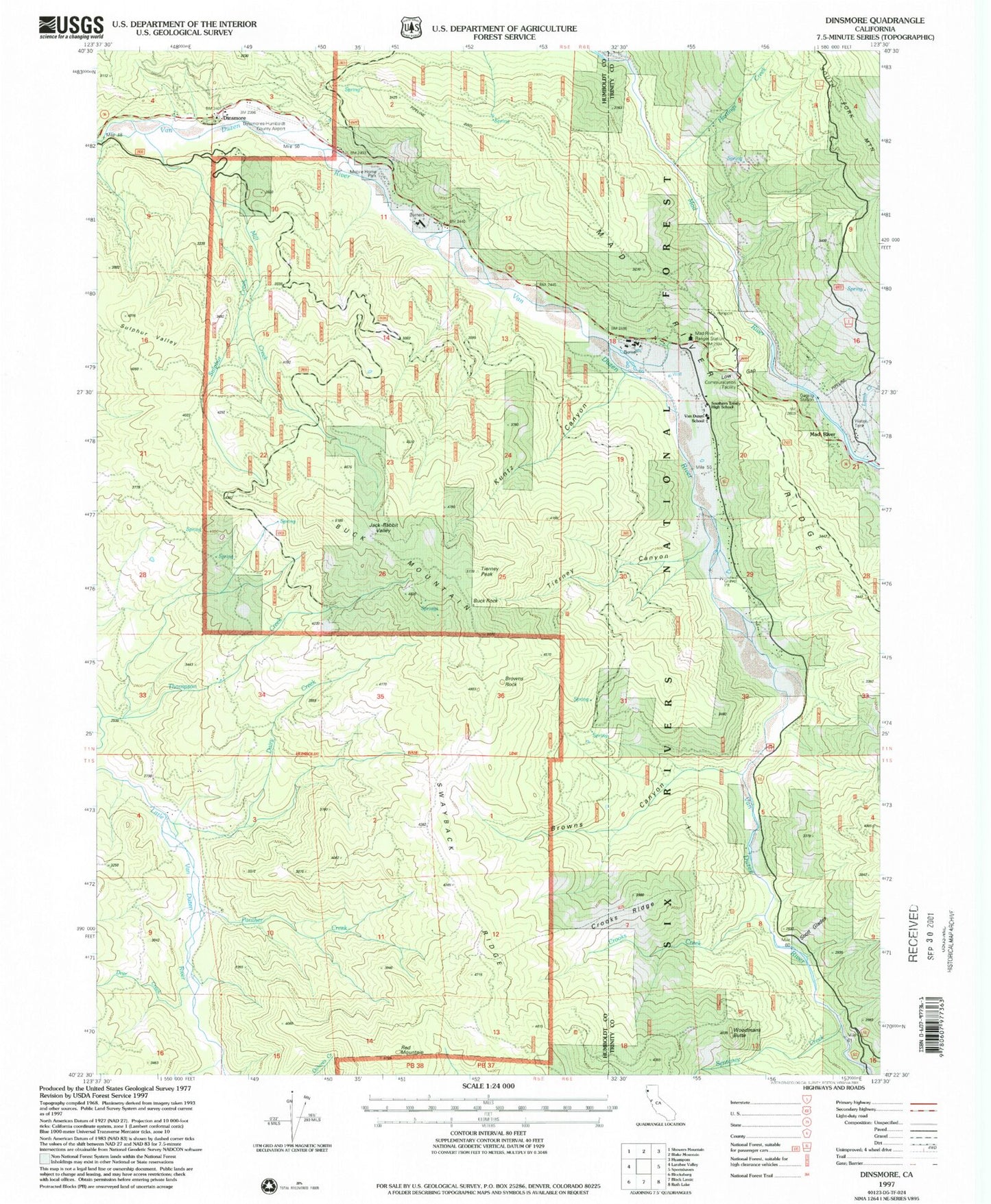
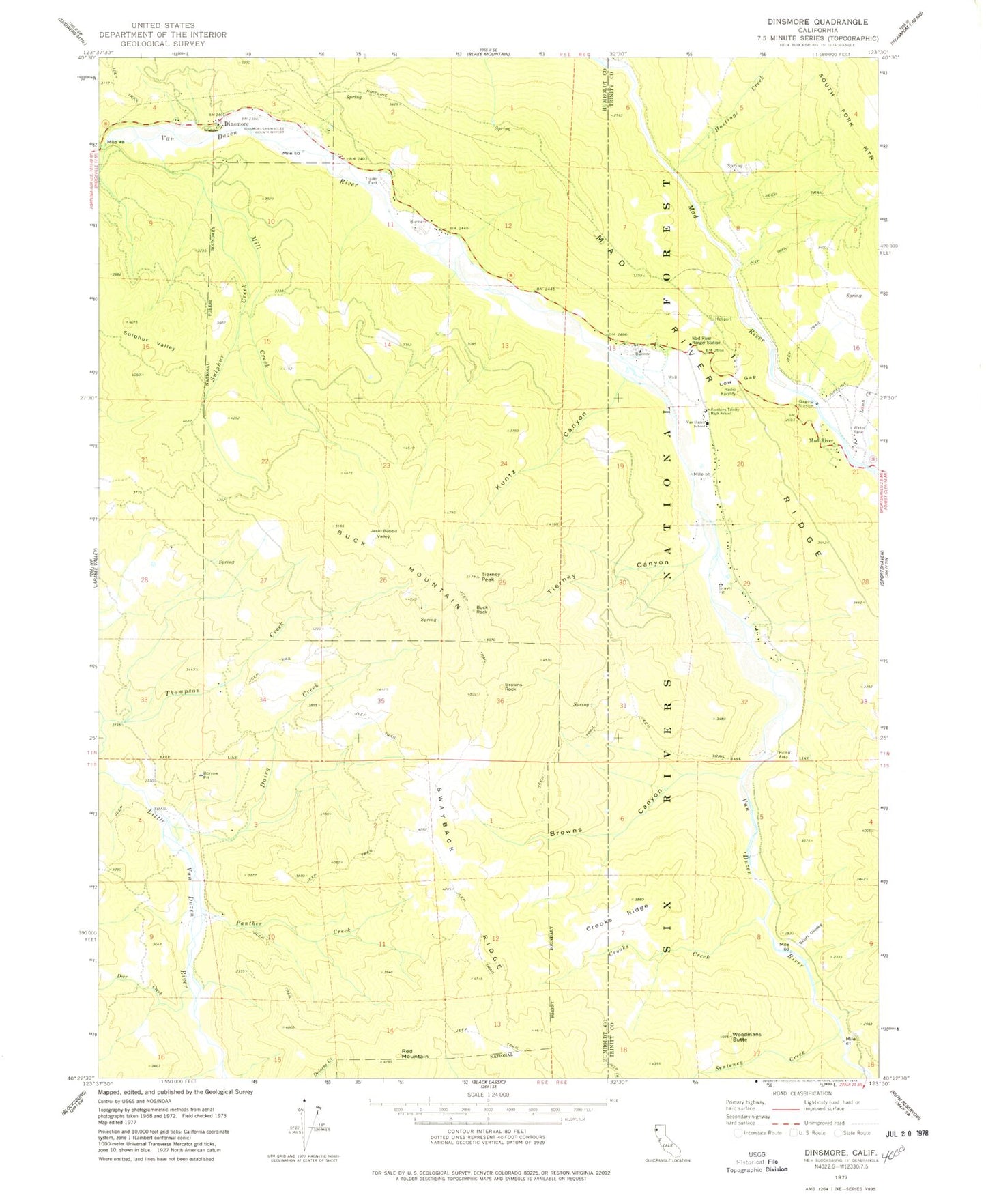
Classic USGS Dinsmore California 7.5'x7.5' Topo Map
Couldn't load pickup availability
Historical USGS topographic quad map of Dinsmore in the state of California. Map scale may vary for some years, but is generally around 1:24,000. Print size is approximately 24" x 27"
This quadrangle is in the following counties: Humboldt, Trinity.
The map contains contour lines, roads, rivers, towns, and lakes. Printed on high-quality waterproof paper with UV fade-resistant inks, and shipped rolled.
Contains the following named places: Browns Canyon, Browns Rock, Buck Mountain, Buck Rock, Cobb Ranch, County Line Creek, Crooks Creek, Crooks Ridge, Dairy Creek, Deer Creek, Dinsmore, Dinsmore Airport, Dinsmore Pit, Hastings Creek, Jack Rabbit Valley, Kuntz Canyon, Lamb Creek, Low Gap, Mad River, Mad River Post Office, Mad River Ranger Station, Mill Creek, Panther Creek, Red Mountain, Scott Glades, Senteney Creek, Simmons Camp, Southern Trinity Area Rescue, Southern Trinity High School, Sulphur Creek, Sulphur Valley, Tierney Canyon, Tierney Peak, Van Duzen Elementary School, Van Duzen Public Camp, Woodmans Butte