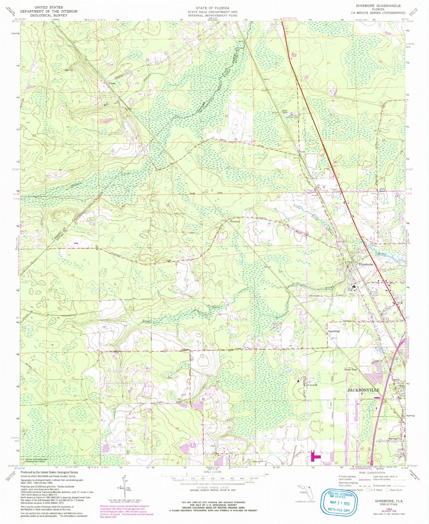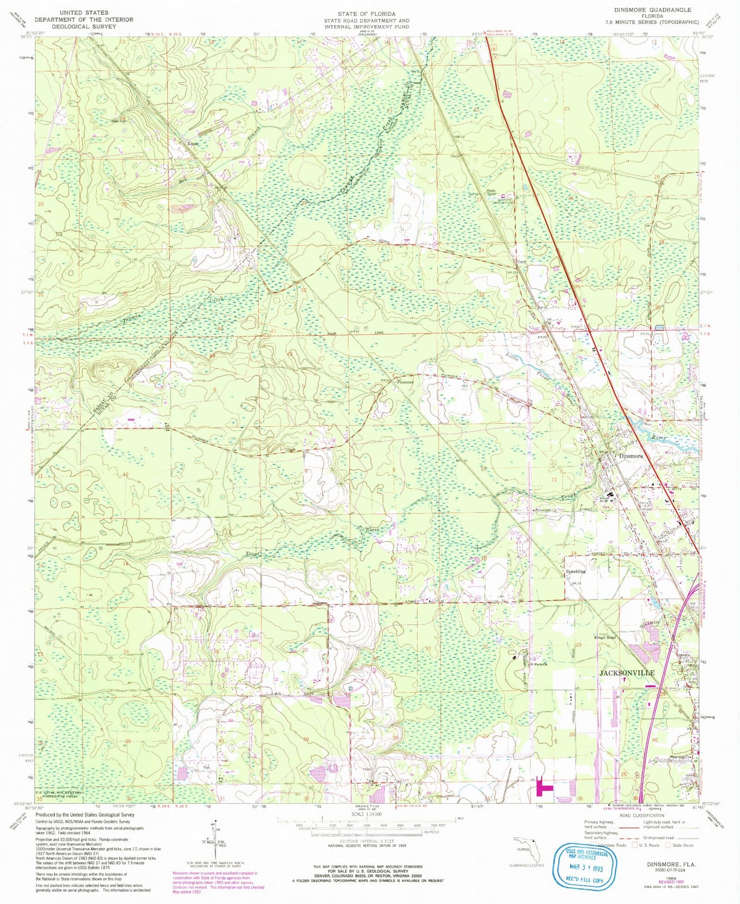
MyTopo
Classic USGS Dinsmore Florida 7.5'x7.5' Topo Map
Couldn't load pickup availability
Historical USGS topographic quad map of Dinsmore in the state of Florida. Map scale may vary for some years, but is generally around 1:24,000. Print size is approximately 24" x 27"
This quadrangle is in the following counties: Duval, Nassau.
The map contains contour lines, roads, rivers, towns, and lakes. Printed on high-quality waterproof paper with UV fade-resistant inks, and shipped rolled.
Contains the following named places: Ben Branch, Calvary Chapel Church of God, Cary, Cotton Rawles Grant, D Bloodworth Grant, Dinsmoore Church of God, Dinsmore Baptist Church, Dinsmore Elementary School, Dinsmore Lookout Tower, Dinsmore United Methodist Church, Jacksonville Fire and Rescue Department Station 33, Joseph Rain and William Bailey Grant, Keen Cemetery, Keene, Kings Road, Kings Road Baptist Church, Levi Sparkman Grant, Little Trout River, Nassau County Fire and Rescue Station 10, Plummer, Saint Pauls Church, School Number 45, Silver Dolphin Mobile Home Park, Spaulding, Study Estates Mobile Home Park, Wayside Assembly of God Church, West Side Church, ZIP Code: 32219