MyTopo
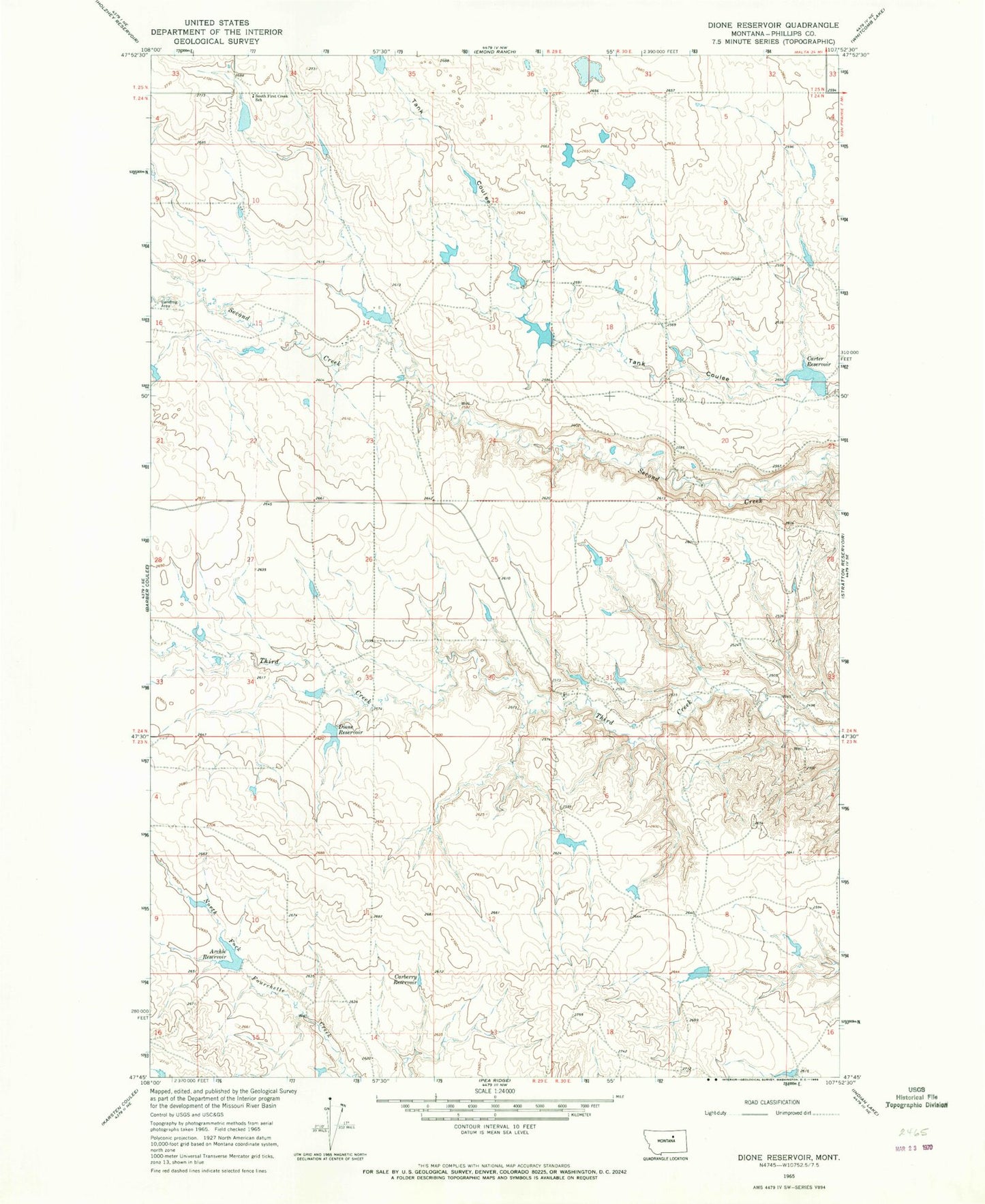
Classic USGS Dione Reservoir Montana 7.5'x7.5' Topo Map
Couldn't load pickup availability
Historical USGS topographic quad map of Dione Reservoir in the state of Montana. Map scale may vary for some years, but is generally around 1:24,000. Print size is approximately 24" x 27"
This quadrangle is in the following counties: Phillips.
The map contains contour lines, roads, rivers, towns, and lakes. Printed on high-quality waterproof paper with UV fade-resistant inks, and shipped rolled.
Contains the following named places: 23N29E15AD__01 Well, 24N29E14CBD_01 Well, 24N29E14DA__01 Well, 24N29E24BA__01 Well, 24N30E21BAC_01 Well, 24N30E32DADA01 Well, 25N29E33DDAD01 Well, Archie Reservoir, Blunt Ranch Number 3 Dam, Blunt RanchES Number 2 Dam, Carberry Dam, Carberry Reservoir, Carter Reservoir, Carters Reservoir Dam, Curly Q Dam, Dione Reservoir, Dione Reservoir Dam, Fifty Dam, First Creek, First Creek Post Office, Fourchette School, South First Creek School, Veseth and Veseth Number 1 Dam, Veseth and Veseth Number 2 Dam