MyTopo
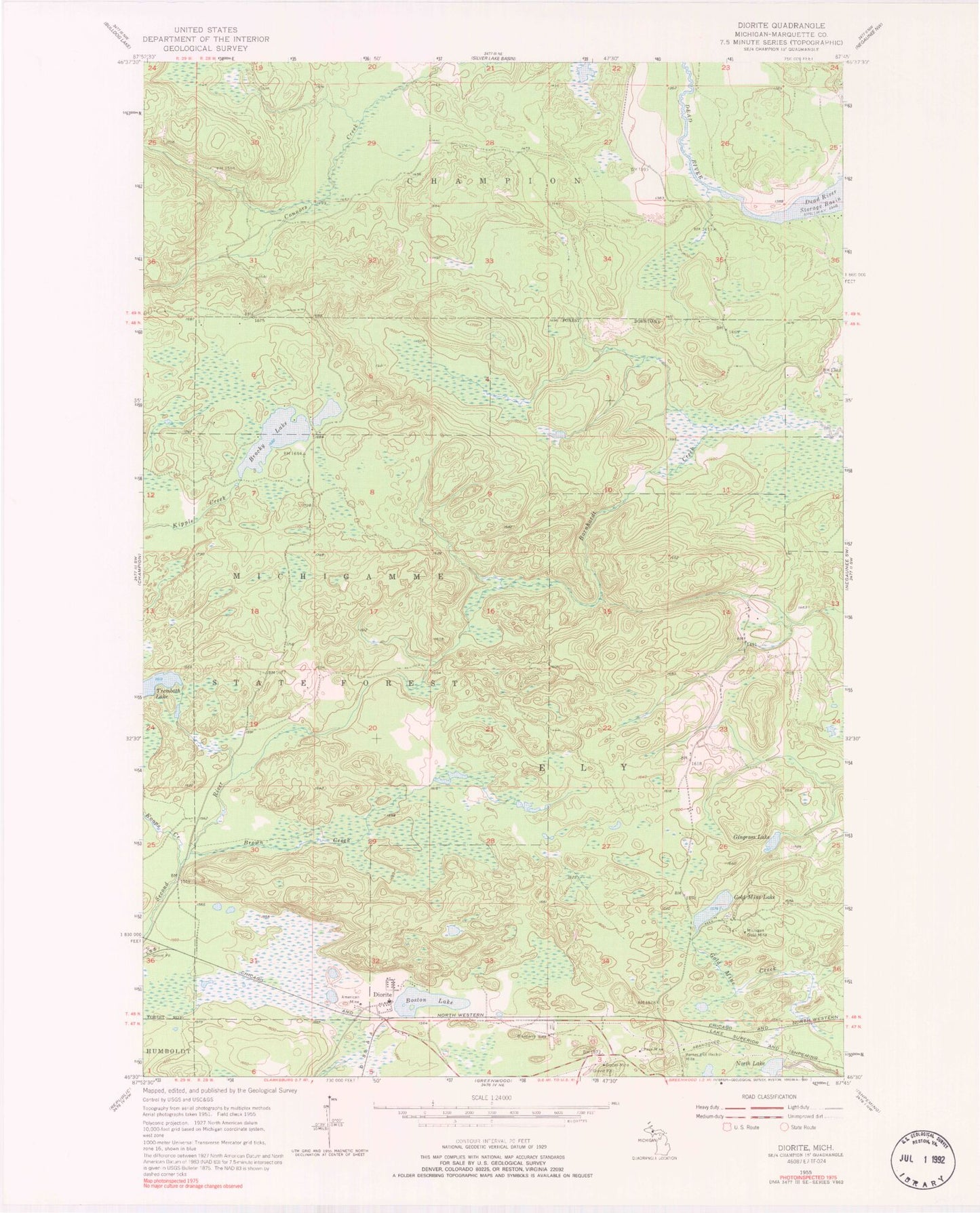
Classic USGS Diorite Michigan 7.5'x7.5' Topo Map
Regular price
$16.95
Regular price
Sale price
$16.95
Unit price
per
Couldn't load pickup availability
Historical USGS topographic quad map of Diorite in the state of Michigan. Map scale may vary for some years, but is generally around 1:24,000. Print size is approximately 24" x 27"
This quadrangle is in the following counties: Marquette.
The map contains contour lines, roads, rivers, towns, and lakes. Printed on high-quality waterproof paper with UV fade-resistant inks, and shipped rolled.
Contains the following named places: American Mine, Barnes and Hecker Mine, Blueberry Mine, Boston Lake, Brocky Lake, Brown Creek, Chase Mine, Dexter Mine, Diorite, Diorite Post Office, Diorite Station, Gingrass Lake, Gold Mine Lake, Koops Creek, Michigan Gold Mine, North Lake, Trembath Lake