
MyTopo
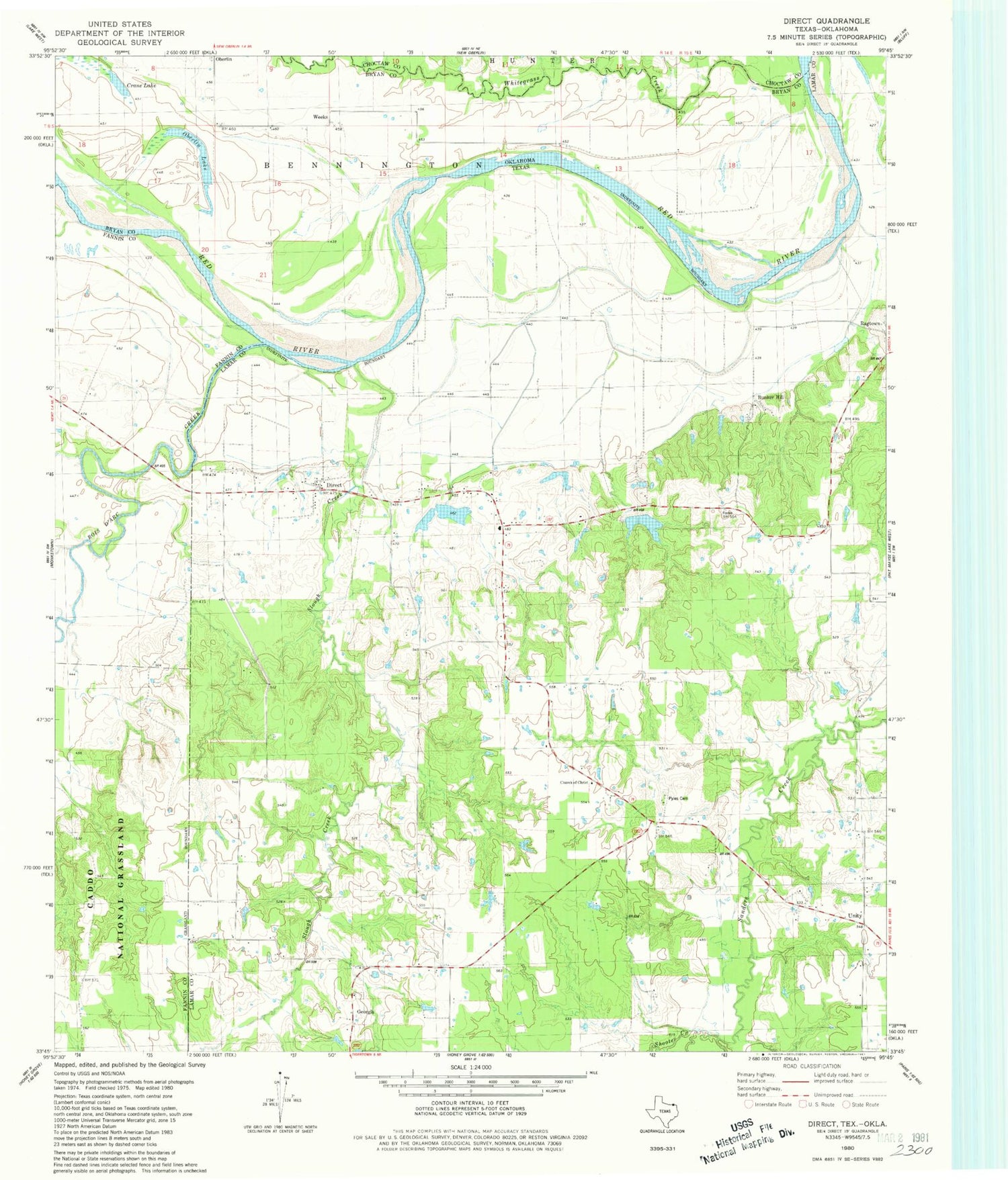
Classic USGS Direct Texas 7.5'x7.5' Topo Map
Couldn't load pickup availability
Historical USGS topographic quad map of Direct in the states of Texas, Oklahoma. Map scale may vary for some years, but is generally around 1:24,000. Print size is approximately 24" x 27"
This quadrangle is in the following counties: Bryan, Choctaw, Fannin, Lamar.
The map contains contour lines, roads, rivers, towns, and lakes. Printed on high-quality waterproof paper with UV fade-resistant inks, and shipped rolled.
Contains the following named places: Bois d'Arc Creek, Bunker Hill, Carson Branch, Church of Christ, Corinth Church, Crane Lake, Direct, Direct School, Direct Volunteer Fire Department, Dry Creek, East Direct, Georgia, Mays Prairie Church, Oberlin, Oberlin Ferry, Oberlin Lake, Pyles Cemetery, Q B Stephens Lower Lake, Q B Stephens Lower Lake Dam, Shooter Creek, Slough Creek, Soil Conservation Service Site 1 Dam, Soil Conservation Service Site 1 Reservoir, Soil Conservation Service Site 2 Dam, Soil Conservation Service Site 2 Reservoir, Soil Conservation Service Site 3 Dam, Soil Conservation Service Site 3 Reservoir, Unity, Weeks, Whitten Cemetery


