MyTopo
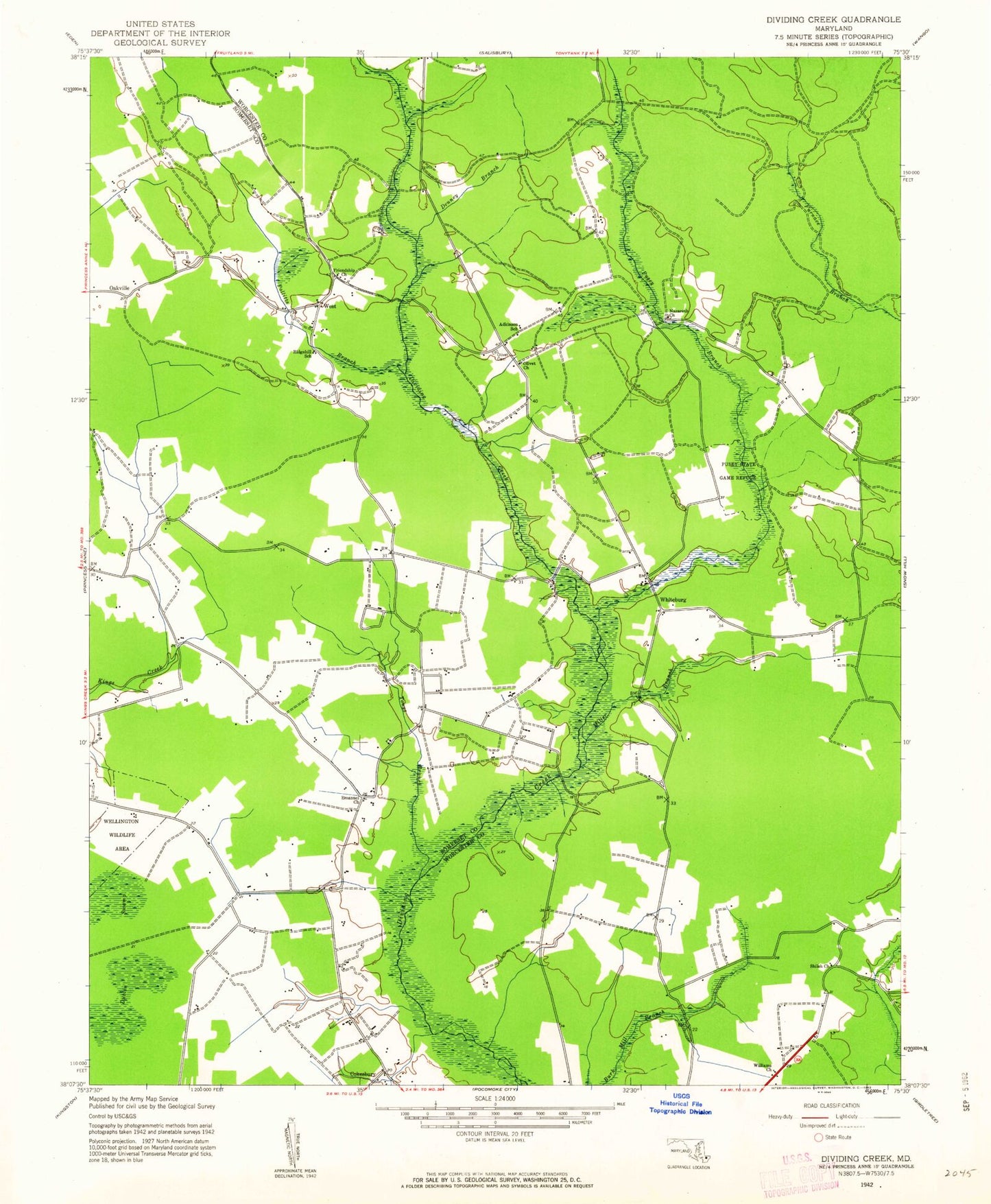
Classic USGS Dividing Creek Maryland 7.5'x7.5' Topo Map
Couldn't load pickup availability
Historical USGS topographic quad map of Dividing Creek in the state of Maryland. Map scale may vary for some years, but is generally around 1:24,000. Print size is approximately 24" x 27"
This quadrangle is in the following counties: Somerset, Worcester.
The map contains contour lines, roads, rivers, towns, and lakes. Printed on high-quality waterproof paper with UV fade-resistant inks, and shipped rolled.
Contains the following named places: Adkinson School, Blueberry Hill, Cokesbury, Denney Branch, Emanuel Cemetery, Emanuel Methodist Church, Flemming Mill, Friendship Church, Highlands Church, Miller Branch, Nazareth Church, Nazareth Church Cemetery, Oakville, Olivet Christian Cemetery, Olivet Church, Perryhawkin Church, Perryhawkin Church Cemetery, Pocomoke State Forest, Politts Branch, Pusey Branch, Pusey Cemetery, Pusey State Game Refuge, Ridgehill School, Saint Marys Church, Shiloh Church, Tonys Creek, Wellington, Wellington State Wildlife Management Area, West, Whiteburg, Wildwoods, Williams Church