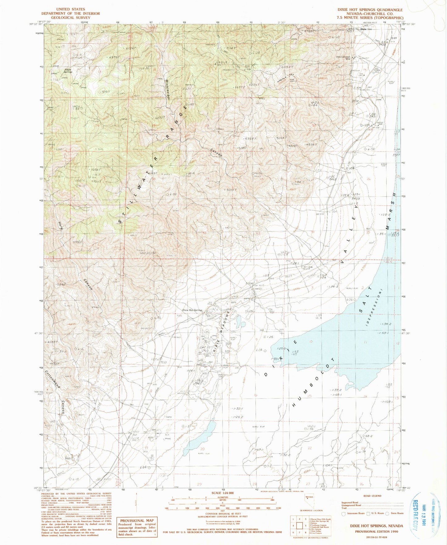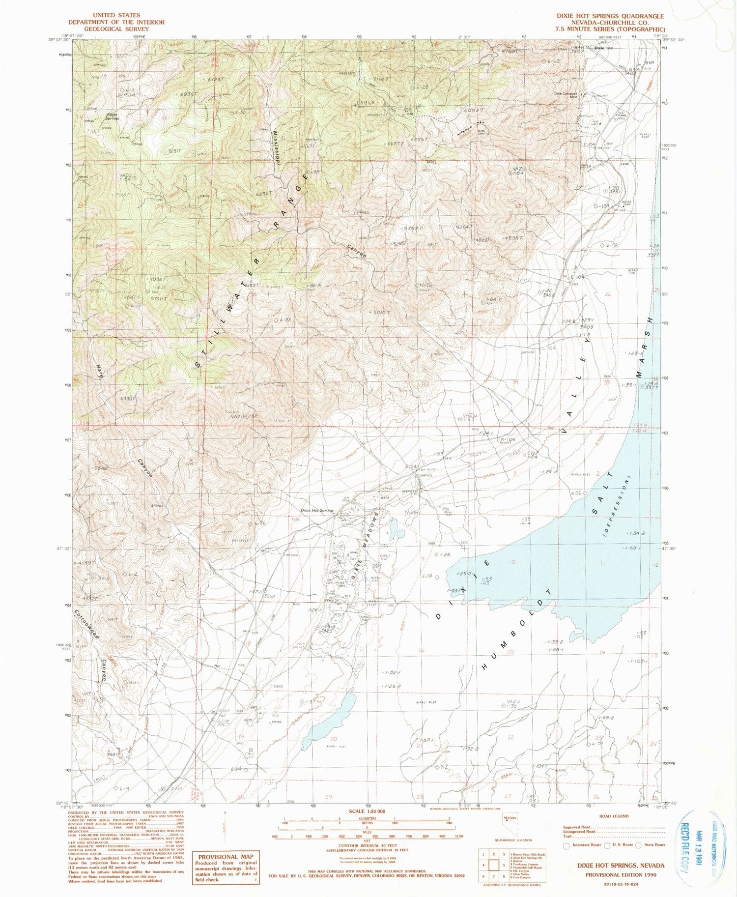
MyTopo
Classic USGS Dixie Hot Springs Nevada 7.5'x7.5' Topo Map
Regular price
$16.95
Regular price
Sale price
$16.95
Unit price
per
Couldn't load pickup availability
Historical USGS topographic quad map of Dixie Hot Springs in the state of Nevada. Map scale may vary for some years, but is generally around 1:24,000. Print size is approximately 24" x 27"
This quadrangle is in the following counties: Churchill.
The map contains contour lines, roads, rivers, towns, and lakes. Printed on high-quality waterproof paper with UV fade-resistant inks, and shipped rolled.
Contains the following named places: Cold Springs, Cottonwood Canyon, Dixie, Dixie Comstock Mine, Dixie Hot Springs, Dixie Valley Mining District, Eagle Springs, Fault Scarp of 1954, Fork Mississippi Canyon, Hare Canyon, Mississippi Canyon, North Fork Mississippi Canyon, Star Peak, Stillwater Range